2020s Maps of Chisago County, Minnesota
Explore 17 historic maps of Chisago County from the 2020s. These maps offer a rare glimpse into what life looked like during the 2020s — showing old roads, neighborhoods, homes, and landmarks that have changed or disappeared over time.
Whether you're researching your family's past, planning a metal detecting trip, or studying how Chisago County's landscape evolved across the 2020s, these high-resolution maps are a powerful tool for exploring the history of this region.
- Focus on a specific era: All maps on this page are from the 2020s, giving you a focused view of this time period.
- See what’s changed: Compare century-old streets, trails, and buildings to today's modern landscape using overlays and satellite layers.
- Research with precision: Use these maps for genealogy, historical research, land use analysis, or educational projects.
- View, download, or print: Maps are fully viewable online in high resolution, and can be downloaded or printed for your own records.
Start exploring Chisago County's history through authentic maps from the 2020s. This is your window into the past.
Chisago County, MN maps
(17)- 2022 Map of Randall, 2022 Print
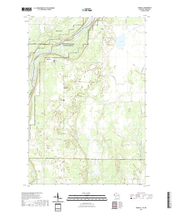 2022 Randall2022 Print · USGSBurnett County, Wisconsin, is captured here in the early 2020s, dominated by the protected corridor of the Saint Croix National Scenic Riverway. Researchers can trace rural lineages through local landmarks like Benson Cem, Pleasant Prairie Cem, and the settlement of Randall.
 - 2022 Map of Saint Croix Dalles, 2022 Print
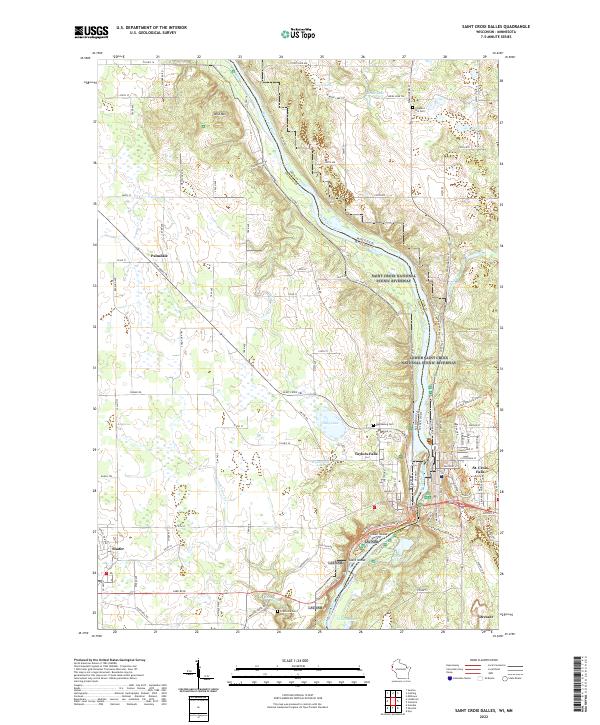 2022 Saint Croix Dalles2022 Print · USGSThe border between Minnesota and Wisconsin comes alive in the early twenty-first century at the dalles of the Saint Croix River. Local historians can trace the layouts of Taylors Falls and St. Croix Falls or locate family sites near Pleasant Hill Cem and Shafer.
 - 2022 Map of Osceola, 2022 Print
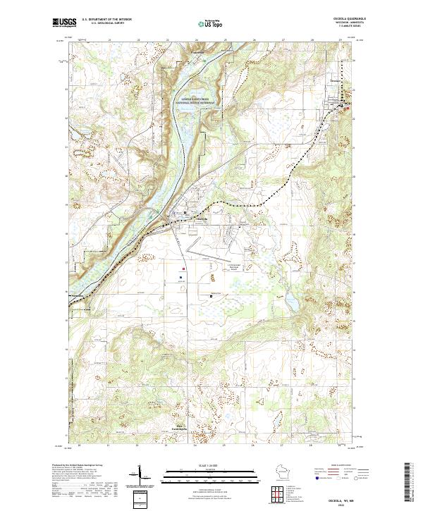 2022 Osceola2022 Print · USGSThe St. Croix River valley comes into sharp focus during the 2020s, revealing the modern layouts of Osceola, Dresser, and Franconia. Researchers can locate family sites at Mount Hope Cem or trace the protected wetlands of the Lower Saint Croix National Scenic Riverway.
 - 2022 Map of Cushing, 2022 Print
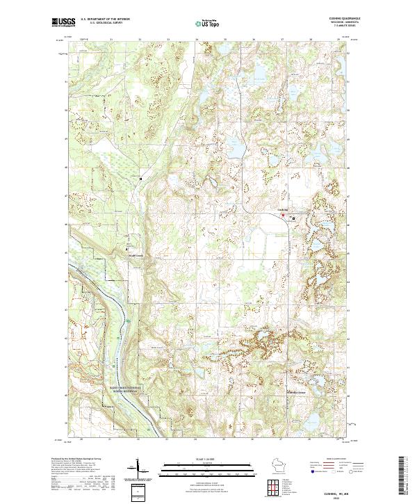 2022 Cushing2022 Print · USGSPolk County, Wisconsin, is shown here in the early twenty-first century as a landscape of glacial lakes and riverine timber. Researchers can locate established community centers like Cushing and Eureka Center alongside older burial grounds such as Pioneer Cem and Wolf Creek Cem.
 - 2022 Map of Stark, 2022 Print
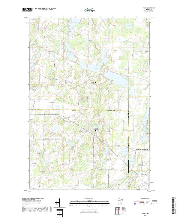 2022 Stark2022 Print · USGSThe lake country of Chisago and Isanti Counties was well-established by the early twenty-first century, centered on small crossroads and churchyards. Genealogists can locate family sites near the Fish Lake Lutheran Cem or trace the early plats around Stark and Spring Lake.
 - 2022 Map of Sunrise, 2022 Print
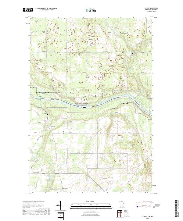 2022 Sunrise2022 Print · USGSThe river-bend settlement of Sunrise and the surrounding borderlands of the Saint Croix River are captured in this modern survey. Researchers can trace local pioneer roots at Old Settlers Cem or follow the historic route of the Sunrise Ferry Hiking Trl.
 - 2022 Map of Cambridge, 2022 Print
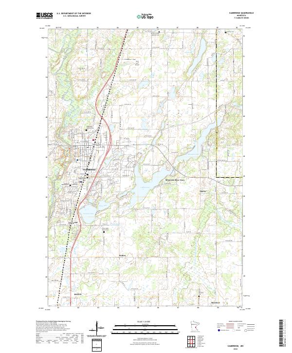 2022 Cambridge2022 Print · USGSThe Rum River corridor and the growing hubs of Isanti and Cambridge are documented in this contemporary survey of Isanti County. Researchers can locate numerous family and parish burial sites like Dalstorp Cem, Union Cem, and Big Meadows Cem.
 - 2022 Map of Lindstrom, 2022 Print
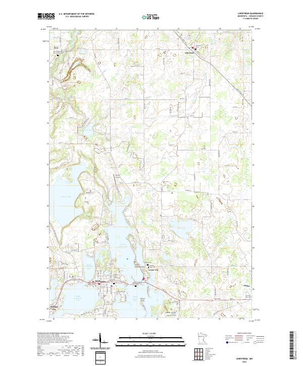 2022 Lindstrom2022 Print · USGSChisago County's lake district is shown in detail during the early 2020s, highlighting the unique peninsula settlements of the area. Genealogists and local researchers can trace family sites at Almelund Cem, Fairview Cem, and the Chisago County Government Center.
 - 2022 Map of Scandia, 2022 Print
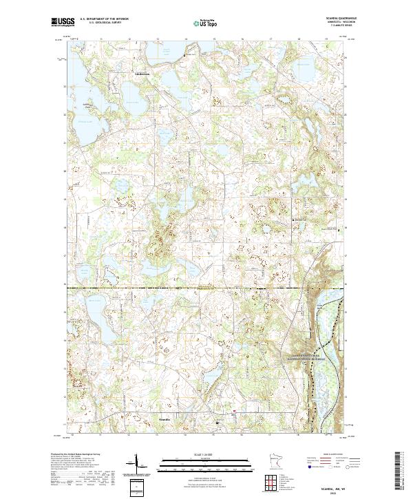 2022 Scandia2022 Print · USGSThe lake country of the Upper St. Croix Valley comes into focus in this contemporary survey of the Minnesota-Wisconsin border. Researchers can locate historic burial grounds like Glader Cem and Elim Cem alongside the protected Lower Saint Croix National Scenic Riverway.
 - 2022 Map of Braham, 2022 Print
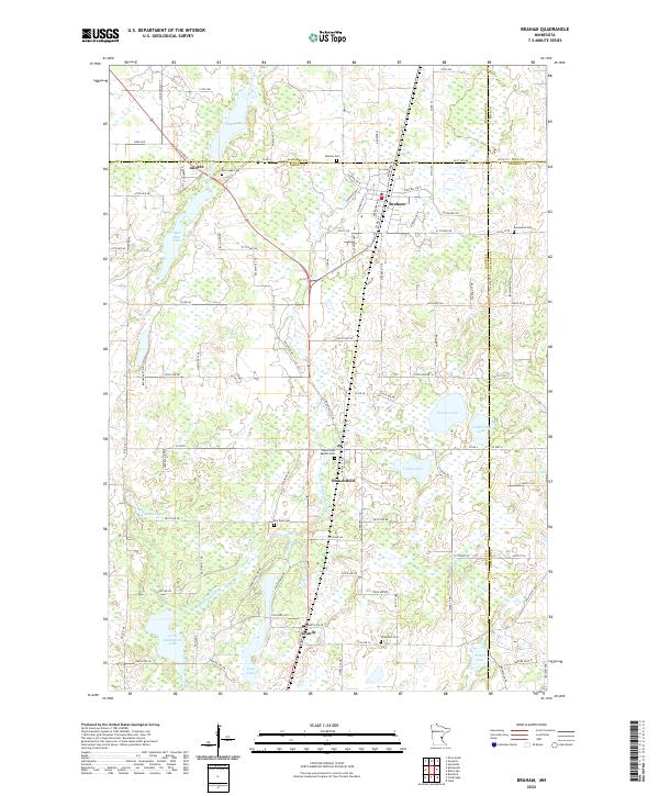 2022 Braham2022 Print · USGSThe borderlands of Isanti and Kanabec counties are captured in this recent survey of eastern Minnesota's lake country. Genealogists can trace family roots through numerous local burial grounds like Rice Lake Cem, Danewood Cem, and the Stanchfield Baptist Cem.
 - 2022 Map of North Branch, 2022 Print
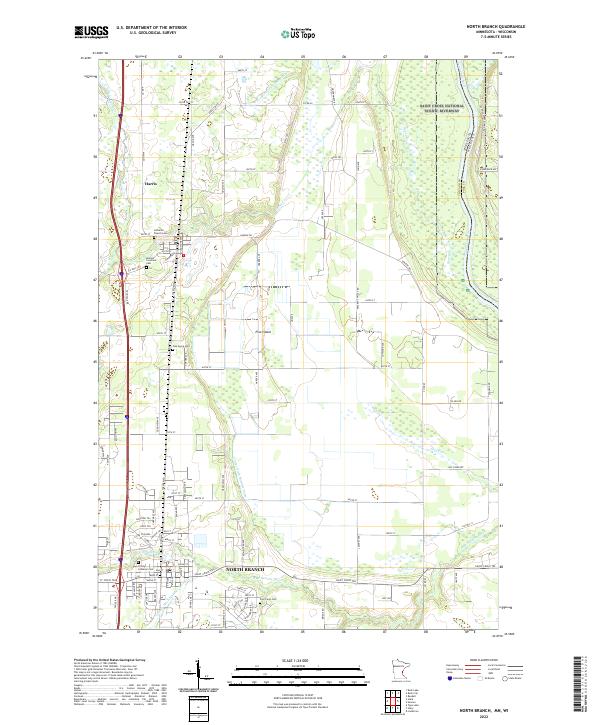 2022 North Branch2022 Print · USGSNorth Branch and Harris are depicted here in the early twenty-first century, anchored by the river corridors at the Minnesota-Wisconsin border. Researchers can trace local heritage through sites like the Poor Farm Cem, Oak Grove Cem, and Trinity Lutheran Ch.
 - 2022 Map of Stacy, 2022 Print
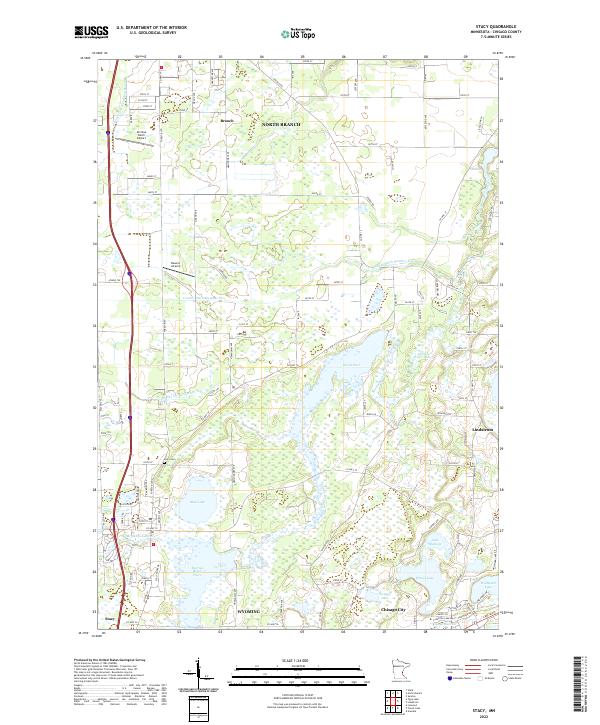 2022 Stacy2022 Print · USGSThe interconnected waters of the Sunrise River and the rural communities of Stacy and Wyoming define this portion of Chisago County in the early 2020s. Trace local landmarks like the Stacy Cem, Al's Due North Airport, and Wallmark Lake across a landscape of managed wetlands and historic ditch systems.
 - 2022 Map of Forest Lake, 2022 Print
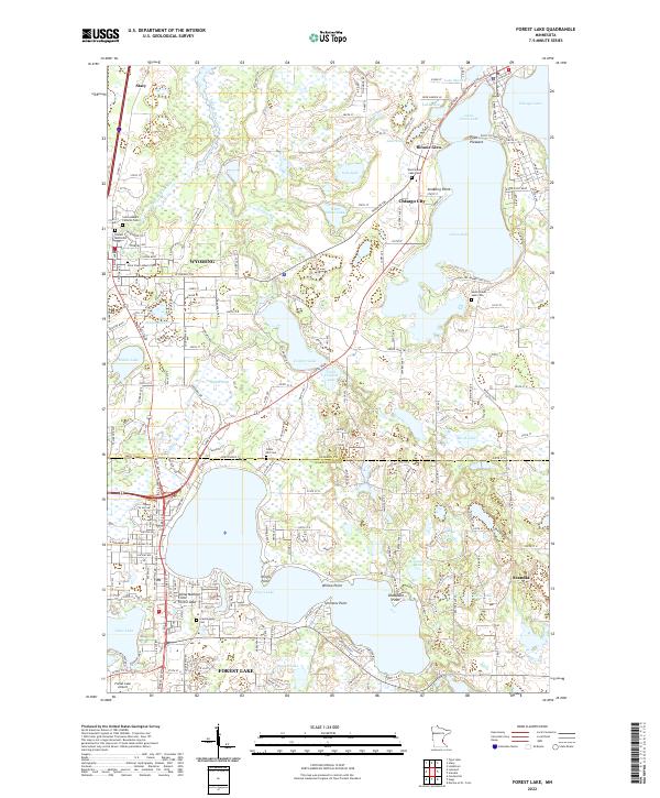 2022 Forest Lake2022 Print · USGSForest Lake and its surrounding chain of waters are captured here at a moment of modern residential growth north of the Twin Cities. Researchers can trace local heritage through numerous burial grounds like Scandinavian Cem and South Green Lake Cem, or locate family landmarks at Simmons Point and Bonnie Glen.
 - 2022 Map of Rush City, 2022 Print
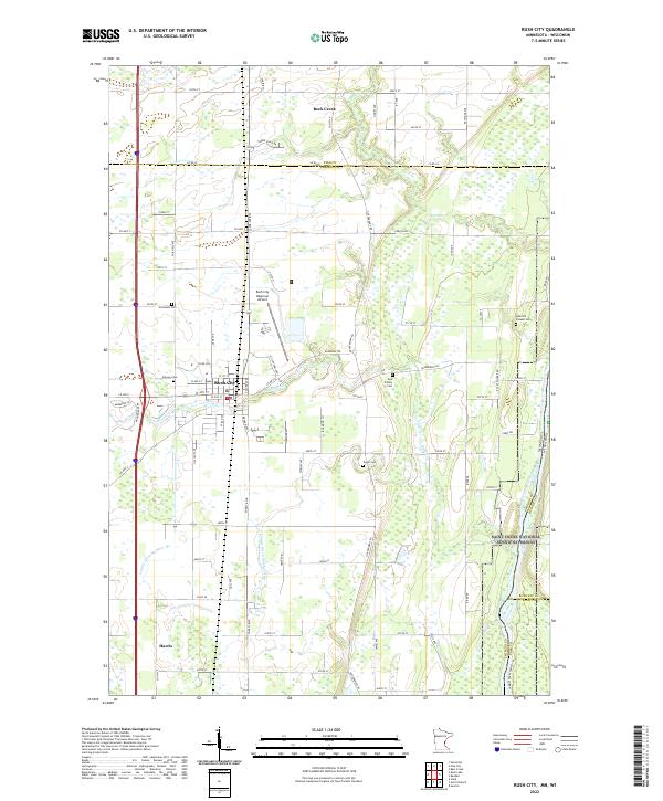 2022 Rush City2022 Print · USGSEastern Chisago County and the Saint Croix River valley are shown here in the early 2020s as modern transit routes meet historical river borders. Researchers can locate numerous local burial sites including Heinrich Pioneer Cem, Taylor Cem, and Gee Family Cem.
 - 2022 Map of Linwood, 2022 Print
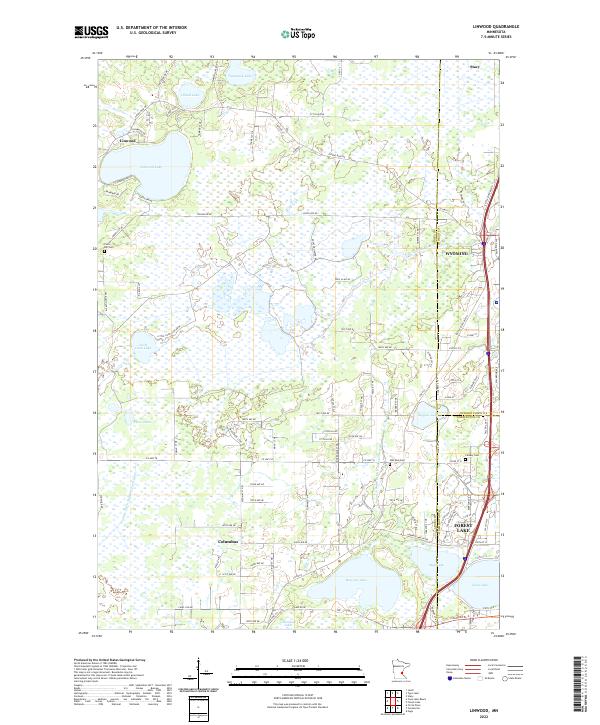 2022 Linwood2022 Print · USGSThe intersection of Anoka, Chisago, and Washington counties comes into focus in this early twenty-first-century survey. Genealogists and local historians can trace the developments of Forest Lake and Linwood, or locate family sites near Oak Park Cem and Victor Hill Cem.
 - 2022 Map of Rush Lake, 2022 Print
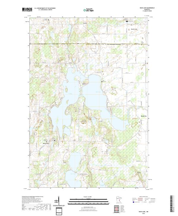 2022 Rush Lake2022 Print · USGSThe Chisago and Pine County borderlands are shown here in the 2020s, a landscape defined by the expansive Rush Lake and rural settlements. Researchers can locate numerous family burial grounds, including Saint Johns Cem and West Rock Cem, alongside local landmarks like Rush Point.
 - 2022 Map of Typo Lake, 2022 Print
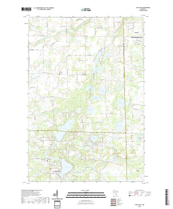 2022 Typo Lake2022 Print · USGSThe lake country of eastern Isanti County is captured here in the early 21st century, showing a landscape defined by the W Br Sunrise River. Genealogists and local historians can locate early burial sites like Oxford Union Cem and Linwood Township Cem.
End of results
Showing maps 1-17 of 17
Top cities of Chisago County
- North Branch historical maps
- Chisago City historical maps
- Lindström historical maps
- Wyoming historical maps
- Rush City historical maps
- Stacy historical maps
See more
Frequently asked questions
- What are the different types of historical maps available for Chisago County?
- What is the oldest map of Chisago County?
- Where can I purchase historical maps of Chisago County for my home or office?
- Where can I download high-res historical maps of Chisago County?
- Are there historical topographic maps available for Chisago County?
- Is there historical aerial imagery available for Chisago County?
- Where are historical maps of Chisago County sourced from?