Old Maps of Dodge County, Minnesota
Explore 107 old maps of Dodge County, spanning from 1953 to today. These high-resolution historic maps reveal how streets, neighborhoods, landmarks, and natural features evolved over time — perfect for genealogy, metal detecting, research, and local history exploration.
What you can do with these maps:
- See how Dodge County changed over time: Compare historical maps to modern-day views to trace roads, homesites, rail lines & more.
- View detailed metadata: Each map includes creators, publishers, year, scale, and archive source.
- Overlay maps with satellite & LiDAR: Visualize the past alongside modern tools to explore terrain & human change.
- Trusted historical sources: Maps sourced from the USGS, Library of Congress, and other archives.
- Access maps your way: View online, download high-res files, or order prints for personal or research use.
Start exploring old maps of Dodge County to uncover forgotten places, hidden landmarks, and the deep history beneath your feet.
Dodge County, MN maps
(107)- 1953 Map of Saint Paul, 1964 Print
 1953 Saint Paul1964 Print · USGSThe Twin Cities and the Mississippi River valley are captured here at a mid-century turning point. Trace the early growth of Minneapolis and Saint Paul alongside landmarks like Lake Minnetonka and the St Croix River.4 unique versions available
 - 1954 Map of Mason City, 1967 Print
 1954 Mason City1967 Print · USGSSouthern Minnesota and northern Iowa are shown here at the height of the mid-century rail era, centered on the regional hubs of Mason City and Rochester. Researchers can trace the vanished paths of the Chicago Great Western and find local landmarks like Pilot Knob and Bear Lake.2 unique versions available
 - 1955 Map of High Forest, 1957 Print
 1955 High Forest1957 Print · USGSSoutheast Minnesota's agricultural heartland is captured here in the mid-fifties, showing the rural township structure before modern highway expansion. Researchers can trace the legacy of early Norwegian and German settlers through sites like East St Olaf Ch, Shanty Town, and Folkestad Sch.
 - 1957 Map of Mason City
 1957 Mason City1957 Print · USGSThe Minnesota-Iowa border region comes alive in this mid-century survey, from the industrial plants of Mason City to the medical hub of Rochester. Researchers can trace the rail-and-river economy through the Chicago Great Western Railway and the Shell Rock River.
 - 1958 Map of Mason City
 1958 Mason City1958 Print · USGSSouthern Minnesota and northern Iowa are shown during the mid-fifties when railroads still anchored the regional economy. Genealogists and historians can trace the intricate rail networks of the Illinois Central and find local landmarks in Mason City, Albert Lea, and Austin.
 - 1959 Map of Saint Paul
 1959 Saint Paul1959 Print · USGSThe Twin Cities and southeastern Minnesota appear here in the late fifties, showing the peak of the rail era and post-war suburban growth. Genealogists can trace family footprints near Lake Minnetonka, the Univ Of Minn Rosemount Research Center, or the growing neighborhoods of Richfield.2 unique versions available
 - 1962 Map of Moland, 1964 Print
 1962 Moland1964 Print · USGSSteele and Rice counties are captured in the early sixties, showing a landscape of established farmsteads and rural social hubs. Genealogists can locate Richland Center, the Merton Cem, and the community surrounding Moland Ch.2 unique versions available
 - 1962 Map of Owatonna SE, 1964 Print
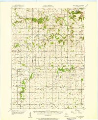
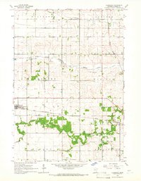
 1962 Owatonna SE1964 Print · USGSSteele and Dodge counties in the early sixties reveal a landscape of settled townships and agricultural progress. Genealogists can trace family footprints at Oasis Cem, St Johns Sch, and the rail-side community of Claremont.
 - 1965 Map of Dodge Center, 1966 Print
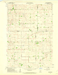
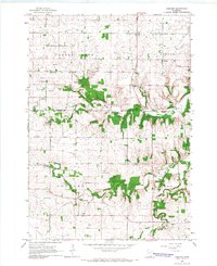
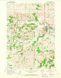
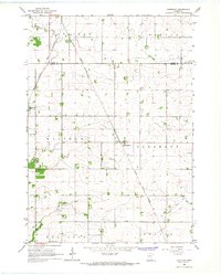
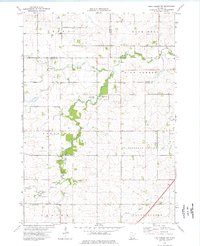
 1965 Dodge Center1966 Print · USGSDodge County's central townships were defined by the intersection of major rail lines and the Zumbro River during the mid-1960s. Researchers can locate family landmarks like Riverside Cem, Pleasant Corners Ch, and the streets of Wasioja.2 unique versions available
 - 1965 Map of Concord, 1966 Print
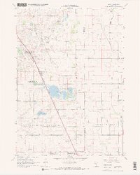
 1965 Concord1966 Print · USGSThe rural countryside of Dodge and Goodhue counties comes into focus in the mid-1960s, showing a landscape defined by the Zumbro River. Trace old homesteads near Berne, Roscoe, and the rural St Rose Ch or Riverside Cem.2 unique versions available
 - 1965 Map of Claremont, 1966 Print
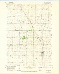
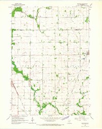
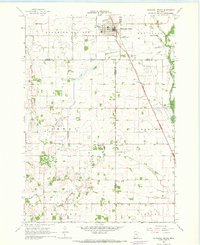
 1965 Claremont1966 Print · USGSDodge County's agricultural heartland is documented here in the mid-sixties, showing the established rail and river patterns of the era. Genealogists and historians can trace the paths of the Chicago and North Western railroad or locate family plots at Claremont Street Cem.2 unique versions available
 - 1965 Map of West Concord, 1966 Print
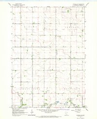
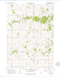
 1965 West Concord1966 Print · USGSDodge County farmland was defined by its rails and rivers in the mid-sixties, with the Chicago Great Western railroad serving as a vital corridor. Genealogists can locate family landmarks like Hegre Ch Cem and the small settlement of Skyberg near the Goodhue County line.
 - 1965 Map of Byron, 1967 Print
 1965 Byron1967 Print · USGSThe railroad towns of Kasson and Byron are captured in the mid-sixties, showing the transition from traditional farming to modern growth. Researchers can trace the Chicago and North Western rail line and locate landmarks like the Fairground and Othello Cem.2 unique versions available
 - 1965 Map of Pine Island, 1967 Print
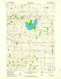
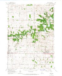
 1965 Pine Island1967 Print · USGSPine Island and the surrounding agricultural townships are seen here in the mid-1960s as the rail and river networks shaped the region. Genealogists and local historians can locate early burial sites like St Michael Cem and follow the Chicago Great Western tracks.2 unique versions available
 - 1966 Map of Waltham, 1967 Print
 1966 Waltham1967 Print · USGSSouthern Minnesota's agricultural heartland is documented here during the mid-1960s, showing the vital rail links and small townships of Mower and Dodge Counties. Researchers can trace local genealogy and land use through landmarks like St Michaels Ch, the village of Waltham, and the Chicago Great Western tracks.
 - 1966 Map of Hayfield NW, 1967 Print
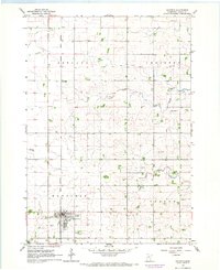
 1966 Hayfield NW1967 Print · USGSDodge County's agricultural heartland is captured here in the mid-sixties, showing a landscape defined by prairie rivers and drainage works. Genealogists and local historians can trace family farmsteads near Graves Landing Field, Townhall, and the Little Cedar River.
 - 1966 Map of Hayfield, 1967 Print
 1966 Hayfield1967 Print · USGSDodge County's agricultural heartland is captured here in the mid-1960s, showing the intersection of rail and river life. Researchers can trace family sites near Vlasaty, locate the Fairview Cem, or follow the Chicago Great Western rail line.
 - 1966 Map of Sargeant, 1967 Print
 1966 Sargeant1967 Print · USGSSoutheastern Minnesota farmland near the Dodge and Mower county line is captured here in the mid-sixties. Genealogists and local historians can trace the Chicago Great Western rail line and locate community landmarks like St Johns Ch and the Waltham Cem.
 - 1967 Map of Bixby, 1968 Print
 1967 Bixby1968 Print · USGSSteele County farmland and rail-side hamlets are documented here in the late sixties. Genealogists and historians can trace the foundations of local life at Bixby, Trinity Ch, and rural landmarks like Westfield Ch Cem.2 unique versions available
 - 1967 Map of Blooming Prairie, 1968 Print
 1967 Blooming Prairie1968 Print · USGSThe fertile farmlands surrounding Blooming Prairie were captured in the late sixties, showing the vital link between the Chicago Milwaukee St Paul and Pacific rail line and the prairie economy. Local historians can trace family-named landmarks and rural hubs like Red Oak Grove Ch and Selstad Landing Field.
 - 1974 Map of Rock Dell, 1976 Print
 1974 Rock Dell1976 Print · USGSDodge and Olmsted Counties come into focus during the mid-1970s as agricultural patterns and small rural settlements define the landscape. Researchers can trace local history through sites like East St Olaf Ch, the South Zumbro Ch, and the hamlet of Shanty Town.
 - 1974 Map of High Forest SW, 1976 Print
 1974 High Forest SW1976 Print · USGSMower County and the surrounding townships are captured in the mid-seventies, showing a landscape defined by the winding Root River. Researchers can trace rural community life through landmarks like Evanger Ch, Zion Ch, and the local Townhall.
 - 1985 Map of Rochester
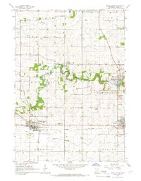
 1985 Rochester1985 Print · USGSSoutheastern Minnesota in the mid-eighties centers on the growth of Rochester and its surrounding river valleys. Trace family roots and old rail lines through Mantorville, Pine Island, and along the Mississippi River near Lake Pepin.
 - 1985 Map of Albert Lea
 1985 Albert Lea1985 Print · USGSSouthern Minnesota's agricultural heartland is documented here in the mid-1980s, showing a landscape defined by industrial rail lines and managed waterways. Trace the historic routes of the Chicago and North Western and explore settlements like Hollandale, New Richland, and Bricelyn.2 unique versions available
 - 1985 Map of Austin
 1985 Austin1985 Print · USGSSoutheast Minnesota in the mid-1980s reveals a land of river valleys and agricultural hubs along the Iowa border. Researchers can trace the legacy of regional transport through the Chicago and North Western line and landmarks like Niagara Cave or the Rochester Municipal Airport.2 unique versions available
Showing maps 1-25 of 107
Top cities of Dodge County
- Kasson historical maps
- Dodge Center historical maps
- Hayfield historical maps
- Mantorville historical maps
- West Concord historical maps
- Concord historical maps
See more
Frequently asked questions
- What are the different types of historical maps available for Dodge County?
- What is the oldest map of Dodge County?
- Where can I purchase historical maps of Dodge County for my home or office?
- Where can I download high-res historical maps of Dodge County?
- Are there historical topographic maps available for Dodge County?
- Is there historical aerial imagery available for Dodge County?
- Where are historical maps of Dodge County sourced from?