Old Maps of Golden Valley, Minnesota for Metal Detecting
Plan your next treasure hunt with 43 historic maps of Golden Valley. Find old homesites, ghost towns, trails, and gathering spots that may be lost to time — perfect for identifying promising metal detecting locations.
- Locate forgotten sites: Uncover places like long-lost settlements, abandoned rail lines, or gathering spots.
- Plan better hunts: Use map overlays combined with LiDAR or satellite views to narrow in on historically rich areas.
- Made for detectorists: Thousands of hobbyists use these maps to discover relics, coins, and hidden history.
Use these historic maps to boost your research and find new opportunities beneath the surface of Golden Valley.
Golden Valley, MN maps
(43)- 1896 Map of Minneapolis
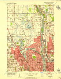
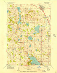
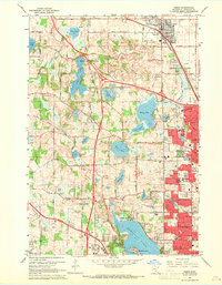
 1896 Minneapolis1896 Print · USGSHennepin County and the Minnesota River valley appear here in the mid-1890s, when the region was a mix of lakeside retreats and rail-side settlements. Genealogists and local historians can locate early landmarks like Edina Mills, the Washburn Home, and the Bloomington Ferry crossing.
 - 1901 Map of Minneapolis
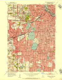
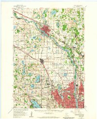
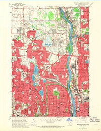
 1901 Minneapolis1901 Print · USGSThe Twin Cities suburbs begin to take shape in the late nineteenth century as rail lines weave through lake-studded prairies. Trace the origins of local industry and transit at Edina Mills, the Bloomington Ferry, and the St. Louis Park rail junction.8 unique versions available
 - 1902 Map of Anoka
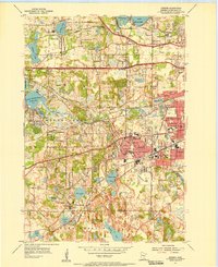
 1902 Anoka1902 Print · USGSNorth of Minneapolis at the turn of the century, this area shows a landscape of glacial lakes and growing rail towns. Genealogists can trace family roots in early settlements like Osseo, Champlin, and Robbinsdale or locate long-standing landmarks near Medicine Lake.4 unique versions available
 - 1952 Map of Minneapolis North, 1954 Print
 1952 Minneapolis North1954 Print · USGSPost-war suburban expansion and industrial growth define the northern outskirts of Minneapolis in the early fifties. Genealogists and local historians can trace the development of Robbinsdale and Brooklyn Center alongside landmarks like Crystal Lake Cemetery and the Northern Ordnance Plant.2 unique versions available
 - 1952 Map of Minneapolis South, 1954 Print
 1952 Minneapolis South1954 Print · USGSMid-century Minneapolis and its growing western suburbs are documented here during a period of significant post-war expansion. Genealogists and local historians can trace the development of Edina and St Louis Park or locate family sites near Lakewood Cemetery and St Marys Cemetery.2 unique versions available
 - 1953 Map of Saint Paul, 1964 Print
 1953 Saint Paul1964 Print · USGSThe Twin Cities and the Mississippi River valley are captured here at a mid-century turning point. Trace the early growth of Minneapolis and Saint Paul alongside landmarks like Lake Minnetonka and the St Croix River.4 unique versions available
 - 1953 Map of Stillwater, 1980 Print
 1953 Stillwater1980 Print · USGSThe Twin Cities and the St. Croix Valley are captured in this mid-century survey as the interstate era began to transform the Upper Midwest. Genealogists and historians can trace the rail-and-river geography of Stillwater, locate landmarks in Anoka, or explore the sprawling St Croix State Park.
 - 1954 Map of Hopkins, 1956 Print
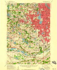
 1954 Hopkins1956 Print · USGSThe Western Minneapolis suburbs are shown here in the mid-1950s as they transitioned from rural outposts to established communities. Genealogists and historians can trace institutional sites like the Glen Lake Sanatorium, the Minneapolis Penal Institution, and the Shady Oak Sch (Abandoned).2 unique versions available
 - 1954 Map of Minneapolis, 1959 Print
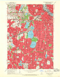
 1954 Minneapolis1959 Print · USGSThe Twin Cities suburbs were in the midst of a post-war transformation during the early fifties as the urban grid expanded into the surrounding lake country. Researchers can find many lost local landmarks, from the Glen Lake Sanatorium and Flying Cloud Airport to the rural Eden Prairie Ch and Bloomington Cem.
 - 1955 Map of Osseo, 1956 Print
 1955 Osseo1956 Print · USGSHennepin County during the mid-fifties shows the early suburban transformation of Osseo and Plymouth among their many lakes. Genealogists and local historians can trace rural roots through the St Marys Cem, Mission Farms, and the Hennessy Hill Sch.2 unique versions available
 - 1955 Map of Anoka, 1959 Print
 1955 Anoka1959 Print · USGSNorth of Minneapolis in the mid-fifties, the suburban frontier was rapidly advancing through the lake-dotted landscapes of Hennepin and Anoka counties. Local historians can trace the early development of Coon Rapids, Brooklyn Park, and New Hope alongside legacy sites like the State Hospital and St Vincent Cem.
 - 1955 Map of Stillwater, 1965 Print
 1955 Stillwater1965 Print · USGSThe Upper St. Croix Valley and the growing Twin Cities area are shown here during the mid-fifties, before the interstate era transformed the regional commute. You can trace the lines of the Northern Pacific RR through towns like Rush City or locate the Saint Croix Indian Reservation.
 - 1958 Map of Stillwater
 1958 Stillwater1958 Print · USGSThe Upper Mississippi and St. Croix River valleys appear in the mid-fifties as the Twin Cities expanded north. Genealogists can locate family landmarks like Oak Park Cem, Saint Michael Church, and the Soo Line RR rail corridors.2 unique versions available
 - 1959 Map of Saint Paul
 1959 Saint Paul1959 Print · USGSThe Twin Cities and southeastern Minnesota appear here in the late fifties, showing the peak of the rail era and post-war suburban growth. Genealogists can trace family footprints near Lake Minnetonka, the Univ Of Minn Rosemount Research Center, or the growing neighborhoods of Richfield.2 unique versions available
 - 1965 Map of Stillwater
 1965 Stillwater1965 Print · USGSThe Twin Cities and the St. Croix Valley are mapped here during a period of significant post-war growth and industrial transit. Genealogists and historians can trace rail lines like the Northern Pacific RR through towns such as Rush City, Amery, and Balsam Lake.
 - 1967 Map of Minneapolis South, 1969 Print
 1967 Minneapolis South1969 Print · USGSThe Twin Cities suburbs and urban core are seen here during the late sixties, as the region's lakefronts and parkways matured. Researchers can trace the development of Southdale, locate family plots in Lakewood Cemetery, or study the rail corridors of the Great Northern.6 unique versions available
 - 1967 Map of Hopkins, 1969 Print
 1967 Hopkins1969 Print · USGSSuburban expansion and civic institutions define this Hennepin County landscape during the late sixties. Genealogists and local historians can trace legacy sites like the Glen Lake State Sanatorium, Minnetonka Mills, and the Grand View Park Cemetery.5 unique versions available
 - 1967 Map of Osseo, 1969 Print
 1967 Osseo1969 Print · USGSHennepin County suburbs were rapidly transforming in the late sixties as residential developments met industrial expansion. Researchers can trace family sites and local landmarks like Gethsemane Cemetery, Mission Farms, and North Hennepin State College.5 unique versions available
 - 1967 Map of Minneapolis North, 1969 Print
 1967 Minneapolis North1969 Print · USGSNorth Minneapolis and its growing suburbs are captured here during the late sixties, a period of massive residential and highway expansion. Researchers can locate family sites near Crystal Lake Cemetery, trace the old Soo Line tracks, or explore the grounds of the Northern Ordnance Plant.5 unique versions available
 - 1975 Map of Stillwater
 1975 Stillwater1975 Print · USGSThe Twin Cities and the St. Croix Valley are captured in the mid-seventies, showing the urban growth of Minneapolis and St Paul. Researchers can trace old rail corridors of the Northern Pacific RR and locate tribal lands at the Mille Lacs Indian Reservation.2 unique versions available
 - 1985 Map of Saint Paul
 1985 Saint Paul1985 Print · USGSThe Twin Cities metropolitan area and its southern suburbs are captured here in the mid-eighties as the urban landscape expanded toward the Minnesota River. Researchers can trace the layout of the Fort Snelling Military Reservation, find local landmarks like St Benedict Church, and study the rail routes of the Soo Line.2 unique versions available
 - 1985 Map of Anoka
 1985 Anoka1985 Print · USGSThe northern Twin Cities suburbs and the Mississippi River valley are captured here in the mid-eighties as suburban growth began to meet rural conservation lands. Trace the expansion of Anoka and Blaine, or locate family landmarks near the Rum River and Buffalo Lake.
 - 1991 Map of Anoka, 1992 Print
 1991 Anoka1992 Print · USGSThe northern Twin Cities suburbs and the upper Mississippi River valley are captured here in the early nineties during a period of rapid suburban expansion. Trace the rail corridors of the Burlington Northern Railroad or explore the boundaries of the Sherburne National Wildlife Refuge and Lake Maria State Park.
 - 2010 Map of Minneapolis North, 2010 Print
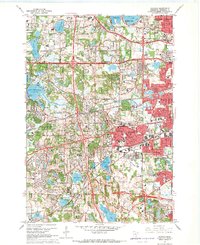
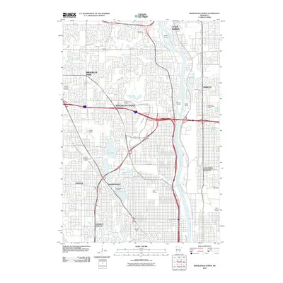 2010 Minneapolis North2010 Print · USGSCovers Golden Valley, including Minneapolis, Brooklyn Park, and other nearby areas
 - 2010 Map of Hopkins, 2010 Print
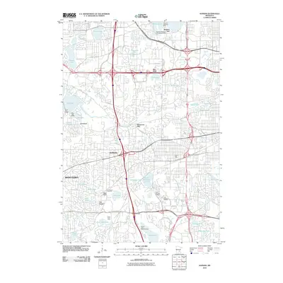 2010 Hopkins2010 Print · USGSCovers Golden Valley, including Plymouth, Eden Prairie, and other nearby areas
Showing maps 1-25 of 43
Top cities near Golden Valley
- Minneapolis historical maps
- Saint Paul historical maps
- Bloomington historical maps
- Brooklyn Park historical maps
- Plymouth historical maps
- Eagan historical maps
See more
Top neighborhoods of Golden Valley
Frequently asked questions
- What are the different types of historical maps available for Golden Valley?
- What is the oldest map of Golden Valley?
- Where can I purchase historical maps of Golden Valley for my home or office?
- Where can I download high-res historical maps of Golden Valley?
- Are there historical topographic maps available for Golden Valley?
- Is there historical aerial imagery available for Golden Valley?
- Where are historical maps of Golden Valley sourced from?