2020s Maps of Houston, Minnesota
Explore 2 historic maps of Houston from the 2020s. These maps offer a rare glimpse into what life looked like during the 2020s — showing old roads, neighborhoods, homes, and landmarks that have changed or disappeared over time.
Whether you're researching your family's past, planning a metal detecting trip, or studying how Houston's landscape evolved across the 2020s, these high-resolution maps are a powerful tool for exploring the history of this region.
- Focus on a specific era: All maps on this page are from the 2020s, giving you a focused view of this time period.
- See what’s changed: Compare century-old streets, trails, and buildings to today's modern landscape using overlays and satellite layers.
- Research with precision: Use these maps for genealogy, historical research, land use analysis, or educational projects.
- View, download, or print: Maps are fully viewable online in high resolution, and can be downloaded or printed for your own records.
Start exploring Houston's history through authentic maps from the 2020s. This is your window into the past.
Houston, MN maps
(2)- 2022 Map of Sheldon, 2022 Print
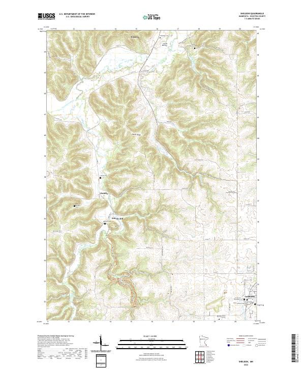 2022 Sheldon2022 Print · USGSSoutheast Minnesota in the early twenty-first century reveals a landscape of high ridges and deep river valleys. Genealogists can trace family names through several historic sites like Schechs Mill, Messerall Cem, and the Old Ridge Cem.
 - 2022 Map of Houston, 2022 Print
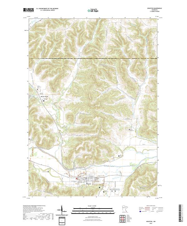 2022 Houston2022 Print · USGSThe Root River valley in southeastern Minnesota remains a landscape of deep hollows and high ridges. Researchers can trace numerous historic burial sites and family landmarks, from the First Swedish Baptist Cem to the Omodt Family Cem and the quiet reaches of Looney Valley.
End of results
Showing maps 1-2 of 2
Top cities near Houston
- Winona historical maps
- Caledonia historical maps
- Rushford historical maps
- Spring Grove historical maps
- Wilson historical maps
- New Hartford historical maps
See more
Frequently asked questions
- What are the different types of historical maps available for Houston?
- What is the oldest map of Houston?
- Where can I purchase historical maps of Houston for my home or office?
- Where can I download high-res historical maps of Houston?
- Are there historical topographic maps available for Houston?
- Is there historical aerial imagery available for Houston?
- Where are historical maps of Houston sourced from?