Old Maps of Grand Rapids, Minnesota for Academic Research
Study the evolution of Grand Rapids with 30 high-resolution historic maps. Whether you're teaching, researching, or modeling changes in land use, these maps provide essential visual documentation of urban, environmental, and geographic change.
- Analyze long-term change: Track patterns in development, transportation, and natural features.
- Ideal for environmental or urban studies: Support academic projects with primary historical map data.
- Use in the classroom or lab: Educators and researchers rely on these maps to bring historical context to life.
These maps are a powerful tool for teaching, research, and visualizing how Grand Rapids has changed over the decades.
Grand Rapids, MN maps
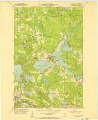
(30)- 1920 Map of Trout Lake
 1920 Trout Lake1920 Print · USGSItasca County's industrial heartland is documented here just as the mining boom transformed the landscape. Trace the early streets and rail spurs of Coleraine, Bovey, and Taconite, or locate lost sites like the U.S.B.M. Dam and Arcturus.
 - 1952 Map of Bovey, 1954 Print
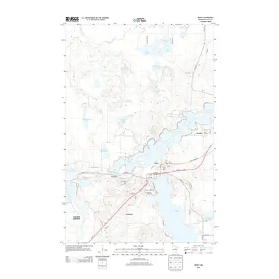
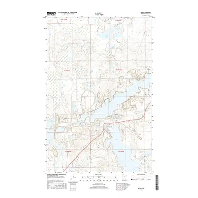
 1952 Bovey1954 Print · USGSThe Mesabi Iron Range is in full production in the 1950s, showing a landscape defined by massive open-pit mines and rail spurs. Genealogists and industrial historians can trace the foundations of Coleraine and Bovey alongside active sites like the Canisteo Mine and Lakeview Cem.4 unique versions available
 - 1953 Map of Cohasset East, 1955 Print
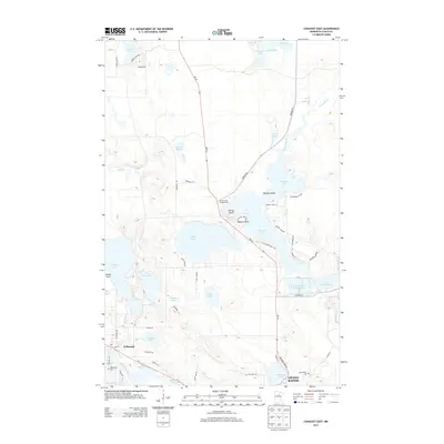
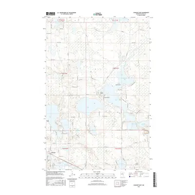
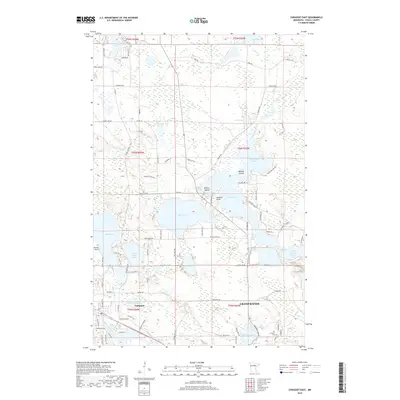
 1953 Cohasset East1955 Print · USGSItasca County’s Iron Range comes into focus during the early fifties, showing the interplay of rail and water around the settlement of Cohasset. Genealogists and historians can locate Old Soldiers Cem, the Great Northern rail line, and the industrial footprint of Greenway Mine.3 unique versions available
 - 1953 Map of Grand Rapids, 1955 Print
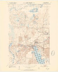
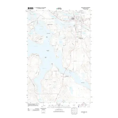
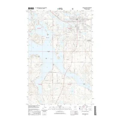
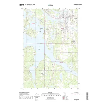
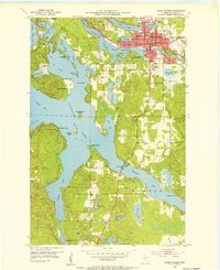 1953 Grand Rapids1955 Print · USGSGrand Rapids and the surrounding lake country are shown here in the early fifties during a period of steady growth. Researchers can find neighborhood schools like Murphy Sch, local landmarks such as the Courthouse, and the intricate shoreline of Pokegama Lake.4 unique versions available
 - 1954 Map of Hibbing, 1966 Print
 1954 Hibbing1966 Print · USGSNorthern Minnesota's Iron Range thrives during the mid-1960s, showing the industrial landscape between the Mesabi Range and the Mississippi River. Genealogists and historians can trace the rail lines of the Great Northern RR through mining hubs like Hibbing and Virginia.3 unique versions available
 - 1957 Map of Hibbing
 1957 Hibbing1957 Print · USGSNorthern Minnesota's Iron Range is shown at its industrial peak in the mid-fifties, dominated by the massive iron pits and rail corridors of the Mesabi Range. Researchers can trace the rail networks of the Duluth Missabe and Iron Range and locate mining hubs like Hibbing, Virginia, and Bovey.
 - 1958 Map of Hibbing
 1958 Hibbing1958 Print · USGSThe Mesabi Iron Range reached its mid-century height during this era, defining the landscape between Grand Rapids and Virginia. Genealogists and historians can trace the mining-town networks of Hibbing and Chisholm or locate numerous iron mines and rail spurs.
 - 1964 Map of Hibbing
 1964 Hibbing1964 Print · USGSNorthern Minnesota’s iron-rich corridor is captured here during a peak era of mid-century industrial activity. Researchers can trace the rail-to-mine connections through Mesabi Range towns like Hibbing and Virginia or locate lakefront settlements near Pokegama Lake.
 - 1969 Map of La Prairie, 1972 Print
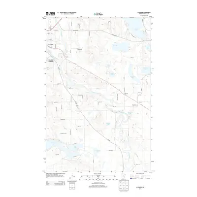
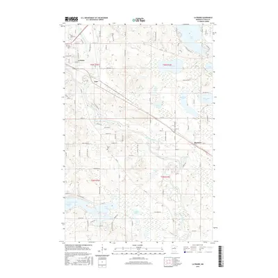
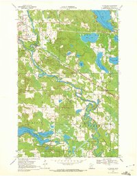 1969 La Prairie1972 Print · USGSItasca County near the end of the sixties is defined by its winding river systems and nascent rail corridors. Genealogists and historians can trace local ties at Blackberry Cem or Harris Cem and explore the industrial footprint of Gunn and La Prairie.2 unique versions available
 - 1992 Map of Pokegama Lake
 1992 Pokegama Lake1992 Print · USGSItasca County in the early nineties showcases the industrial pulse of the Iron Range and the vast waters of the north woods. Trace the rail lines of the Duluth Missabe and Iron Range Railway or locate old settlements like Wawina and Calumet.
 - 2010 Map of La Prairie, 2010 Print
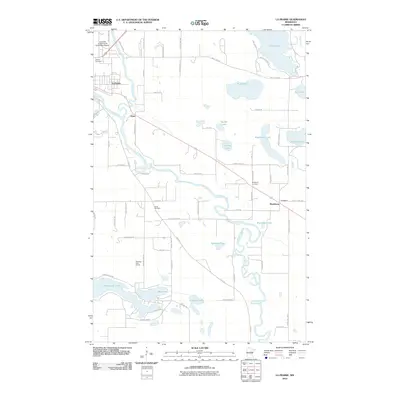 2010 La Prairie2010 Print · USGSCovers Grand Rapids, including Coleraine, Blackberry, and other nearby areas
 - 2010 Map of Bovey, 2010 Print
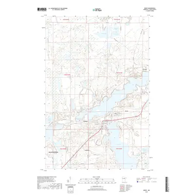
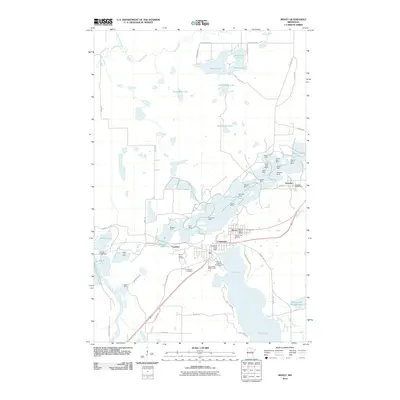 2010 Bovey2010 Print · USGSCovers Grand Rapids, including Coleraine, Bovey, and other nearby areas
 - 2010 Map of Grand Rapids, 2010 Print
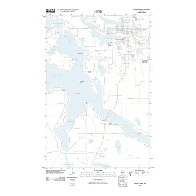 2010 Grand Rapids2010 Print · USGSCovers Grand Rapids, including Cohasset, La Prairie, and other nearby areas
 - 2010 Map of Cohasset East, 2010 Print
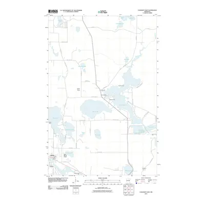 2010 Cohasset East2010 Print · USGSCovers Grand Rapids, including Cohasset, Bass Brook Court, and other nearby areas
 - 2013 Map of La Prairie, 2013 Print
 2013 La Prairie2013 Print · USGSCovers Grand Rapids, including Coleraine, Blackberry, and other nearby areas
 - 2013 Map of Bovey, 2013 Print
 2013 Bovey2013 Print · USGSCovers Grand Rapids, including Coleraine, Bovey, and other nearby areas
 - 2013 Map of Grand Rapids, 2013 Print
 2013 Grand Rapids2013 Print · USGSCovers Grand Rapids, including Cohasset, La Prairie, and other nearby areas
 - 2013 Map of Cohasset East, 2013 Print
 2013 Cohasset East2013 Print · USGSCovers Grand Rapids, including Cohasset, Bass Brook Court, and other nearby areas
 - 2016 Map of Grand Rapids, 2016 Print
 2016 Grand Rapids2016 Print · USGSCovers Grand Rapids, including Cohasset, La Prairie, and other nearby areas
 - 2016 Map of Cohasset East, 2016 Print
 2016 Cohasset East2016 Print · USGSCovers Grand Rapids, including Cohasset, Bass Brook Court, and other nearby areas
 - 2016 Map of Bovey, 2016 Print
 2016 Bovey2016 Print · USGSCovers Grand Rapids, including Coleraine, Bovey, and other nearby areas
 - 2016 Map of La Prairie, 2016 Print
 2016 La Prairie2016 Print · USGSCovers Grand Rapids, including Coleraine, Blackberry, and other nearby areas
 - 2019 Map of Bovey, 2019 Print
 2019 Bovey2019 Print · USGSCovers Grand Rapids, including Coleraine, Bovey, and other nearby areas
 - 2019 Map of Grand Rapids, 2019 Print
 2019 Grand Rapids2019 Print · USGSCovers Grand Rapids, including Cohasset, La Prairie, and other nearby areas
 - 2019 Map of Cohasset East, 2019 Print
 2019 Cohasset East2019 Print · USGSCovers Grand Rapids, including Cohasset, Bass Brook Court, and other nearby areas
Showing maps 1-25 of 30
Top cities near Grand Rapids
- Cohasset historical maps
- Coleraine historical maps
- Blackberry historical maps
- Marble historical maps
- Bovey historical maps
- La Prairie historical maps
See more
Top neighborhoods of Grand Rapids
- Country Acres Mobile Home Park historical maps
- Wagon Wheel Mobile Home Park historical maps
- Huhn Addition Mobile Home Court historical maps
- North Star Moblie Home Park historical maps
Frequently asked questions
- What are the different types of historical maps available for Grand Rapids?
- What is the oldest map of Grand Rapids?
- Where can I purchase historical maps of Grand Rapids for my home or office?
- Where can I download high-res historical maps of Grand Rapids?
- Are there historical topographic maps available for Grand Rapids?
- Is there historical aerial imagery available for Grand Rapids?
- Where are historical maps of Grand Rapids sourced from?