Old Maps of Nassau, Minnesota for Hiking & Exploration
Hike through history with 10 historic maps of Nassau. Explore old trails, ghost towns, and forgotten backroads — perfect for outdoor adventurers and local explorers.
- Rediscover forgotten places: Map out old mining camps, roads, and footpaths that no longer exist on modern maps.
- Layer with modern tools: Combine with LiDAR or satellite views to plan hikes through historical terrain.
- Made for exploration: Popular among hikers, overlanders, and local history lovers.
Use these maps to find adventure and explore the hidden past of Nassau.
Nassau, MN maps
(10)- 1953 Map of Bellingham, 1955 Print
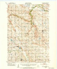 1953 Bellingham1955 Print · USGSThe borderlands of western Minnesota and South Dakota are shown here in the mid-fifties as a landscape of rail-connected prairie towns and a dense network of country school districts. Genealogists can trace family footprints near Bellingham and Marietta, or locate rural sites like Immanuel Ch and the Swedish Mission Cem.
 - 1953 Map of Milbank, 1958 Print
 1953 Milbank1958 Print · USGSThe tri-state border region of South Dakota, North Dakota, and Minnesota is shown here during the early fifties, a landscape defined by glacial lakes and the Sisseton Indian Reservation. Researchers can trace the legacy of the western railroads, locating old stops along the Great Northern and settlements like Milbank, Webster, and Sisseton.3 unique versions available
 - 1958 Map of Milbank
 1958 Milbank1958 Print · USGSThe northern Great Plains in the late fifties show a landscape of glacial lakes and reservation lands shaped by the Great Northern railroad. Genealogists and local historians can trace the grid of settlements from Britton to Milbank and locate landmarks like Enemy Swim Lake and the Sisseton Indian Reservation.
 - 1971 Map of Marietta, 1974 Print
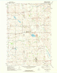 1971 Marietta1974 Print · USGSThe prairie borderlands of western Minnesota and eastern South Dakota come into focus during the early 1970s. Trace local history through the streets of Marietta and Nassau or locate rural sites like the Swedish Mission Ch and Pegg Lake.2 unique versions available
 - 1985 Map of Milbank
 1985 Milbank1985 Print · USGSThe South Dakota and Minnesota border region comes into focus during the mid-eighties as a hub of prairie lakes and rail transport. Genealogists and researchers can trace the lakeside settlements of Hiawatha Beach, the streets of Milbank, and legacy rail lines like the Burlington Northern.
 - 2010 Map of Marietta, 2010 Print
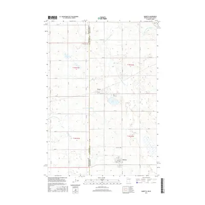
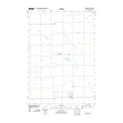 2010 Marietta2010 Print · USGSCovers Nassau, including Marietta, Lac qui Parle County, and other nearby areas
 - 2013 Map of Marietta, 2013 Print
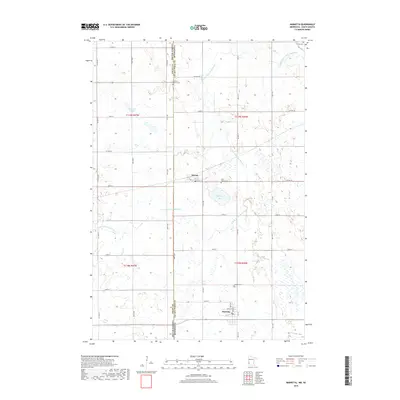
 2013 Marietta2013 Print · USGSCovers Nassau, including Marietta, Lac qui Parle County, and other nearby areas
 - 2016 Map of Marietta, 2016 Print
 2016 Marietta2016 Print · USGSCovers Nassau, including Marietta, Lac qui Parle County, and other nearby areas
 - 2019 Map of Marietta, 2019 Print
 2019 Marietta2019 Print · USGSCovers Nassau, including Marietta, Lac qui Parle County, and other nearby areas
 - 2022 Map of Marietta, 2022 Print
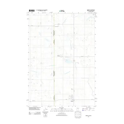
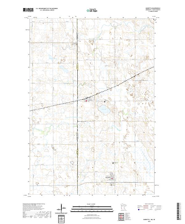 2022 Marietta2022 Print · USGSThe Minnesota-South Dakota borderlands come into focus in this recent survey of Lac qui Parle County. Genealogists and local historians can trace the rural landscape between Marietta and Nassau, locating family sites near Swedish Mission Cem and Pegg Lake.
End of results
Showing maps 1-10 of 10
Top cities near Nassau
- Milbank historical maps
- Ortonville historical maps
- Big Stone City historical maps
- Bellingham historical maps
- Marietta historical maps
- Revillo historical maps
See more
Frequently asked questions
- What are the different types of historical maps available for Nassau?
- What is the oldest map of Nassau?
- Where can I purchase historical maps of Nassau for my home or office?
- Where can I download high-res historical maps of Nassau?
- Are there historical topographic maps available for Nassau?
- Is there historical aerial imagery available for Nassau?
- Where are historical maps of Nassau sourced from?