Old Maps of Austin, Minnesota
Explore 19 old maps of Austin, spanning from 1954 to today. These high-resolution historic maps reveal how streets, neighborhoods, landmarks, and natural features evolved over time — perfect for genealogy, metal detecting, research, and local history exploration.
What you can do with these maps:
- See how Austin changed over time: Compare historical maps to modern-day views to trace roads, homesites, rail lines & more.
- View detailed metadata: Each map includes creators, publishers, year, scale, and archive source.
- Overlay maps with satellite & LiDAR: Visualize the past alongside modern tools to explore terrain & human change.
- Trusted historical sources: Maps sourced from the USGS, Library of Congress, and other archives.
- Access maps your way: View online, download high-res files, or order prints for personal or research use.
Start exploring old maps of Austin to uncover forgotten places, hidden landmarks, and the deep history beneath your feet.
Austin, MN maps
(19)- 1954 Map of Hayward, 1956 Print
 1954 Hayward1956 Print · USGSSouthern Freeborn County and the Iowa borderlands thrive in the mid-1950s as a landscape of railroads and rural parishes. Genealogists can trace family footprints at Trondhjem Ch, Danish Cem, and dozens of district schools like Benesh Sch.2 unique versions available
 - 1954 Map of Austin, 1956 Print
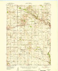
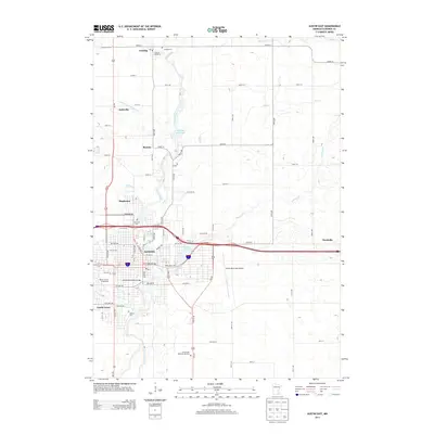
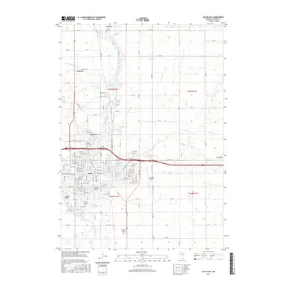
 1954 Austin1956 Print · USGSPost-war Mower County thrives as a rail and agricultural center during the mid-fifties. Researchers can locate numerous country schools and churches, from School No 101 to Hoffanda Ch, and trace the rail lines serving Austin and Rose Creek.2 unique versions available
 - 1954 Map of Mason City, 1967 Print
 1954 Mason City1967 Print · USGSSouthern Minnesota and northern Iowa are shown here at the height of the mid-century rail era, centered on the regional hubs of Mason City and Rochester. Researchers can trace the vanished paths of the Chicago Great Western and find local landmarks like Pilot Knob and Bear Lake.2 unique versions available
 - 1957 Map of Mason City
 1957 Mason City1957 Print · USGSThe Minnesota-Iowa border region comes alive in this mid-century survey, from the industrial plants of Mason City to the medical hub of Rochester. Researchers can trace the rail-and-river economy through the Chicago Great Western Railway and the Shell Rock River.
 - 1958 Map of Mason City
 1958 Mason City1958 Print · USGSSouthern Minnesota and northern Iowa are shown during the mid-fifties when railroads still anchored the regional economy. Genealogists and historians can trace the intricate rail networks of the Illinois Central and find local landmarks in Mason City, Albert Lea, and Austin.
 - 1982 Map of Austin East, 1983 Print
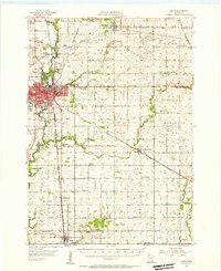
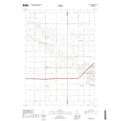
 1982 Austin East1983 Print · USGSAustin and its surrounding Mower County townships are captured here in the early 1980s, centered on the busy Cedar River corridor. Researchers can trace local landmarks like Oakwood Cem, the Drive-in Theater, and the Austin Municipal Airport.
 - 1982 Map of Austin West, 1983 Print
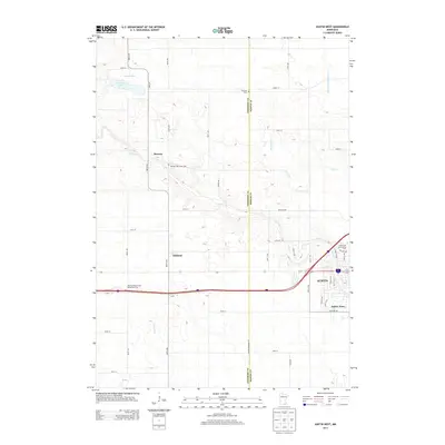
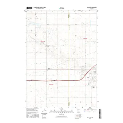
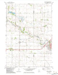 1982 Austin West1983 Print · USGSThe western outskirts of Austin and the small rail stops of Freeborn County are captured here in the early 1980s. Researchers can trace family history at Fairview Cem or locate the site of the Vo-Tech Sch and the neighborhood of Austin Acres.
 - 1985 Map of Albert Lea
 1985 Albert Lea1985 Print · USGSSouthern Minnesota's agricultural heartland is documented here in the mid-1980s, showing a landscape defined by industrial rail lines and managed waterways. Trace the historic routes of the Chicago and North Western and explore settlements like Hollandale, New Richland, and Bricelyn.2 unique versions available
 - 1985 Map of Austin
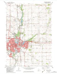
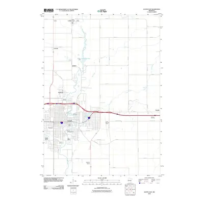
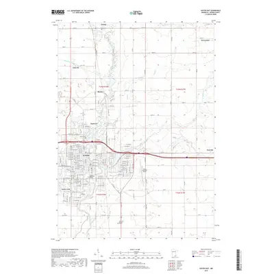
 1985 Austin1985 Print · USGSSoutheast Minnesota in the mid-1980s reveals a land of river valleys and agricultural hubs along the Iowa border. Researchers can trace the legacy of regional transport through the Chicago and North Western line and landmarks like Niagara Cave or the Rochester Municipal Airport.2 unique versions available
 - 2010 Map of Austin West, 2010 Print
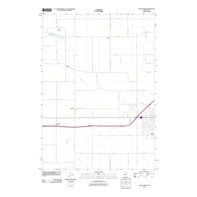 2010 Austin West2010 Print · USGSCovers Austin, including Moscow, Oakland, and other nearby areas
 - 2010 Map of Austin East, 2010 Print
 2010 Austin East2010 Print · USGSCovers Austin, including Lansing, Brownsdale, and other nearby areas
 - 2013 Map of Austin West, 2013 Print
 2013 Austin West2013 Print · USGSCovers Austin, including Moscow, Oakland, and other nearby areas
 - 2013 Map of Austin East, 2013 Print
 2013 Austin East2013 Print · USGSCovers Austin, including Lansing, Brownsdale, and other nearby areas
 - 2016 Map of Austin East, 2016 Print
 2016 Austin East2016 Print · USGSCovers Austin, including Lansing, Brownsdale, and other nearby areas
 - 2016 Map of Austin West, 2016 Print
 2016 Austin West2016 Print · USGSCovers Austin, including Moscow, Oakland, and other nearby areas
 - 2019 Map of Austin West, 2019 Print
 2019 Austin West2019 Print · USGSCovers Austin, including Moscow, Oakland, and other nearby areas
 - 2019 Map of Austin East, 2019 Print
 2019 Austin East2019 Print · USGSCovers Austin, including Lansing, Brownsdale, and other nearby areas
 - 2022 Map of Austin East, 2022 Print
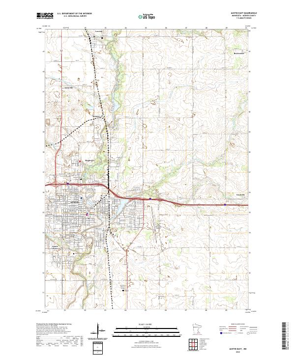 2022 Austin East2022 Print · USGSIn the early 2020s, the eastern outskirts of Austin, Minnesota, show a complex network of suburban expansion and historical burial grounds. Genealogists can trace family records across Oakwood Cem, Lansing Cem, and the Grand View Memorial Gardens.
 - 2022 Map of Austin West, 2022 Print
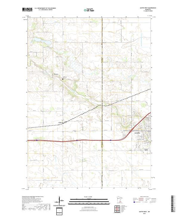 2022 Austin West2022 Print · USGSThe western outskirts of Austin and the surrounding Freeborn County prairie are captured here in the early twenty-first century. Genealogists and local historians can pinpoint Old Red Oak Grove Cem, trace the path of Turtle Cr, or locate the rural crossroads of Moscow.
End of results
Showing maps 1-19 of 19
Top cities near Austin
- Northwood historical maps
- Blooming Prairie historical maps
- Hayfield historical maps
- Lansing historical maps
- Brownsdale historical maps
- Moscow historical maps
See more
Top neighborhoods of Austin
Frequently asked questions
- What are the different types of historical maps available for Austin?
- What is the oldest map of Austin?
- Where can I purchase historical maps of Austin for my home or office?
- Where can I download high-res historical maps of Austin?
- Are there historical topographic maps available for Austin?
- Is there historical aerial imagery available for Austin?
- Where are historical maps of Austin sourced from?