1900s (20th Century) Maps of Emmet Township, Minnesota
Explore 10 historic maps of Emmet Township from the 1900s (20th Century). These maps offer a rare glimpse into what life looked like during the 1900s — showing old roads, neighborhoods, homes, and landmarks that have changed or disappeared over time.
Whether you're researching your family's past, planning a metal detecting trip, or studying how Emmet Township's landscape evolved across the 1900s, these high-resolution maps are a powerful tool for exploring the history of this region.
- Focus on a specific era: All maps on this page are from the 1900s, giving you a focused view of this time period.
- See what’s changed: Compare century-old streets, trails, and buildings to today's modern landscape using overlays and satellite layers.
- Research with precision: Use these maps for genealogy, historical research, land use analysis, or educational projects.
- View, download, or print: Maps are fully viewable online in high resolution, and can be downloaded or printed for your own records.
Start exploring Emmet Township's history through authentic maps from the 1900s. This is your window into the past.
Emmet Township, MN maps
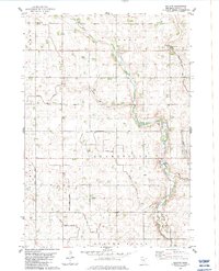
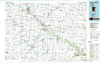
(10)- 1952 Map of Redwood Falls, 1954 Print
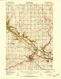 1952 Redwood Falls1954 Print · USGSRedwood Falls and the Minnesota River valley are captured in detail during the early fifties, showing the area's deep agricultural and river-town roots. Researchers can trace rural school districts, the Chicago and North Western rail line, and the Lower Sioux Indian Community.2 unique versions available
 - 1953 Map of New Ulm, 1968 Print
 1953 New Ulm1968 Print · USGSSouthern Minnesota in the mid-1950s is defined by its deep river valleys and the expanding reach of the Great Northern and Chicago and North Western railroads. Researchers can trace rural lineages through landmarks like the Milford State Monument, St. John's Ch, and the Upper Sioux Indian Res.3 unique versions available
 - 1957 Map of New Ulm
 1957 New Ulm1957 Print · USGSCentral Minnesota in the mid-fifties remains a landscape of river-valley commerce and prairie agriculture defined by its historic mission sites and rail towns. Genealogists and local historians can trace the development of New Ulm and Montevideo, or locate specific landmarks like the Milford State Monument and Minnesota Falls.
 - 1958 Map of New Ulm
 1958 New Ulm1958 Print · USGSSouth-central Minnesota’s river valleys and prairie towns are captured here in the mid-fifties, during the height of the region's rail-and-river economy. Genealogists and historians can trace the legacy of the Upper Sioux Indian Mission or locate early rail stops along the Chicago and North Western Ry in towns like Redwood Falls and Glencoe.
 - 1965 Map of Danube, 1966 Print
 1965 Danube1966 Print · USGSRenville County farmland is captured here in the mid-1960s, showing the vital intersection of rail and road through Danube. Researchers can trace old family sites near the United Brethren Cem or follow the path of the Chicago Milwaukee St Paul and Pacific railroad.
 - 1965 Map of Renville, 1967 Print
 1965 Renville1967 Print · USGSRenville was a bustling prairie rail hub in the mid-1960s, defined by its connection to the Chicago Milwaukee St Paul and Pacific line. Genealogists and historians can trace local landmarks like Ebenezer Ch, Emden Cem, and the old city Townhall.
 - 1967 Map of New Ulm
 1967 New Ulm1967 Print · USGSSouthern Minnesota in the mid-fifties is captured here as a landscape of river-valley missions and busy prairie rail towns. Researchers can trace the Yellow Medicine Trail and locate historic sites like the Morton Indian Mission and Milford State Monument.
 - 1982 Map of Vicksburg, 1983 Print
 1982 Vicksburg1983 Print · USGSThe Minnesota River valley meets the agricultural heartland of Renville County in the early eighties. Genealogists and local historians can trace rural roots at St Matthew Ch, Zion Cem, and the Old Indian Treaty Boundary.
 - 1983 Map of Bechyn
 1983 Bechyn1983 Print · USGSRenville County farmland and prairie drainage are frozen in time during the early eighties, centered on the small settlement of Bechyn. Genealogists and researchers can trace township lines through Henryville and Flora or follow the paths of Beaver Creek and West Fork.
 - 1986 Map of Montevideo
 1986 Montevideo1986 Print · USGSWestern Minnesota’s river valleys and prairie townships are captured here in the mid-eighties, showing the region's agricultural and rail network. Trace family roots and local history through Montevideo, Granite Falls, and the Upper Sioux Agency State Park.2 unique versions available
End of results
Showing maps 1-10 of 10
Top cities near Emmet Township
- Redwood Falls historical maps
- Olivia historical maps
- Clara City historical maps
- Renville historical maps
- Sacred Heart historical maps
- Roseland historical maps
See more
Top neighborhoods of Emmet Township
Frequently asked questions
- What are the different types of historical maps available for Emmet Township?
- What is the oldest map of Emmet Township?
- Where can I purchase historical maps of Emmet Township for my home or office?
- Where can I download high-res historical maps of Emmet Township?
- Are there historical topographic maps available for Emmet Township?
- Is there historical aerial imagery available for Emmet Township?
- Where are historical maps of Emmet Township sourced from?