Old Maps of Babbitt, Minnesota for Genealogy
Trace your family roots with 19 historic maps of Babbitt. These high-res maps reveal old neighborhoods, homesites, landmarks, and streets — helping you uncover where your ancestors lived and how the area evolved over time.
- Explore historic neighborhoods: Identify where your relatives may have lived in the 1800s or 1900s.
- Compare maps over time: Trace the changes in streets, buildings, and landmarks for multi-generational research.
- Perfect for genealogy & ancestry research: Used by family historians and researchers to map out lineage and migration.
These maps are an incredible resource for exploring your personal connection to Babbitt's past.
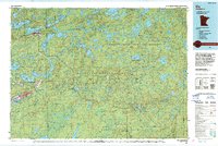
Babbitt, MN maps
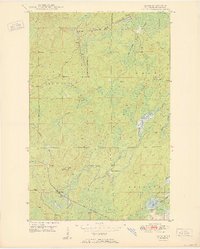
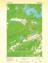
(19)- 1949 Map of Isaac Lake, 1958 Print
 1949 Isaac Lake1958 Print · USGSCovers Babbitt, including Hoyt Lakes, Bear Head Lake, and other nearby areas4 unique versions available
 - 1949 Map of Allen, 1958 Print
 1949 Allen1958 Print · USGSCovers Babbitt, including Hoyt Lakes, Bassett Township, and other nearby areas
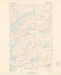
 - 1950 Map of Isaac Lake
 1950 Isaac Lake1950 Print · USGSCovers Babbitt, including Hoyt Lakes, Bear Head Lake, and other nearby areas2 unique versions available
 - 1950 Map of Allen
 1950 Allen1950 Print · USGSCovers Babbitt, including Hoyt Lakes, Bassett Township, and other nearby areas2 unique versions available
 - 1951 Map of Babbitt SW, 1952 Print
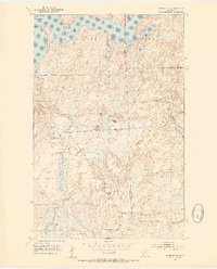
 1951 Babbitt SW1952 Print · USGSCovers Babbitt, including Bassett Township, Saint Louis County, and other nearby areas6 unique versions available
 - 1951 Map of Babbitt, 1953 Print
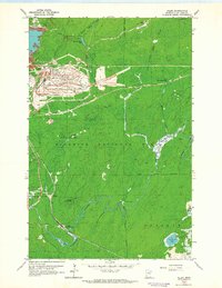
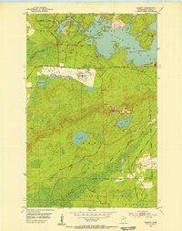 1951 Babbitt1953 Print · USGSCovers Babbitt, including Bassett Township, Birch Lake (Unorganized Territory), and other nearby areas2 unique versions available
 - 1952 Map of Babbitt NE, 1954 Print
 1952 Babbitt NE1954 Print · USGSCovers Babbitt, including Stony River Township, Bassett Township, and other nearby areas6 unique versions available
 - 1954 Map of Two Harbors, 1964 Print
 1954 Two Harbors1964 Print · USGSCovers Babbitt, including Two Harbors, Ely, and other nearby areas2 unique versions available
 - 1954 Map of Hibbing, 1966 Print
 1954 Hibbing1966 Print · USGSCovers Babbitt, including Hibbing, Virginia, and other nearby areas3 unique versions available
 - 1957 Map of Two Harbors
 1957 Two Harbors1957 Print · USGSCovers Babbitt, including Two Harbors, Ely, and other nearby areas
 - 1957 Map of Hibbing
 1957 Hibbing1957 Print · USGSCovers Babbitt, including Hibbing, Virginia, and other nearby areas
 - 1958 Map of Hibbing
 1958 Hibbing1958 Print · USGSCovers Babbitt, including Hibbing, Virginia, and other nearby areas
 - 1958 Map of Two Harbors
 1958 Two Harbors1958 Print · USGSCovers Babbitt, including Two Harbors, Ely, and other nearby areas
 - 1962 Map of Babbitt, 1963 Print
 1962 Babbitt1963 Print · USGSCovers Babbitt, including Bassett Township, Birch Lake (Unorganized Territory), and other nearby areas3 unique versions available
 - 1962 Map of Allen, 1964 Print
 1962 Allen1964 Print · USGSCovers Babbitt, including Hoyt Lakes, Bassett Township, and other nearby areas4 unique versions available
 - 1964 Map of Hibbing
 1964 Hibbing1964 Print · USGSCovers Babbitt, including Hibbing, Virginia, and other nearby areas
 - 1964 Map of Two Harbors
 1964 Two Harbors1964 Print · USGSCovers Babbitt, including Two Harbors, Ely, and other nearby areas
 - 1994 Map of Ely
 1994 Ely1994 Print · USGSCovers Babbitt, including Ely, Winton, and other nearby areas
 - 1994 Map of Vermillion Lake
 1994 Vermillion Lake1994 Print · USGSCovers Babbitt, including Hibbing, Virginia, and other nearby areas
End of results
Showing maps 1-19 of 19
Top cities near Babbitt
Top neighborhoods of Babbitt
Frequently asked questions
- What are the different types of historical maps available for Babbitt?
- What is the oldest map of Babbitt?
- Where can I purchase historical maps of Babbitt for my home or office?
- Where can I download high-res historical maps of Babbitt?
- Are there historical topographic maps available for Babbitt?
- Is there historical aerial imagery available for Babbitt?
- Where are historical maps of Babbitt sourced from?