Old Maps of Saint Louis County, Minnesota
Explore 1,013 old maps of Saint Louis County, spanning from 1895 to today. These high-resolution historic maps reveal how streets, neighborhoods, landmarks, and natural features evolved over time — perfect for genealogy, metal detecting, research, and local history exploration.
What you can do with these maps:
- See how Saint Louis County changed over time: Compare historical maps to modern-day views to trace roads, homesites, rail lines & more.
- View detailed metadata: Each map includes creators, publishers, year, scale, and archive source.
- Overlay maps with satellite & LiDAR: Visualize the past alongside modern tools to explore terrain & human change.
- Trusted historical sources: Maps sourced from the USGS, Library of Congress, and other archives.
- Access maps your way: View online, download high-res files, or order prints for personal or research use.
Start exploring old maps of Saint Louis County to uncover forgotten places, hidden landmarks, and the deep history beneath your feet.
Saint Louis County, MN maps
(1,013)- 1895 Map of Duluth
 1895 Duluth1895 Print · USGSDuluth in the mid-1890s shows a rapidly expanding port city before the turn of the century. Genealogists and historians can trace the early street grids of Woodland Park and Lester Park or explore the original shoreline of Duluth Harbor.5 unique versions available
 - 1915 Map of Superior
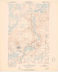
 1915 Superior1915 Print · USGSThe Twin Ports region at the peak of the industrial era shows a landscape defined by massive rail yards and shoreline development. Genealogists and historians can locate early neighborhoods like Morgan Park, find rural landmarks like Saunders Cem, and trace the numerous lines of the Northern Pacific railroad.2 unique versions available
 - 1917 Map of Superior
 1917 Superior1917 Print · USGSThe Twin Ports region at the height of its industrial boom reveals a landscape of massive rail yards and shipping docks. Trace the development of South Superior and Steelton, or locate early rural landmarks like Selden School and Manitou Falls.3 unique versions available
 - 1933 Map of Ely, 1961 Print
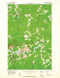
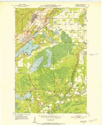
 1933 Ely1961 Print · USGSThe iron-rich Vermilion Range comes alive in the early 1930s, showing the intersection of heavy industry and the Northwoods wilderness. Genealogists and historians can trace the foundations of Ely and Winton, including the Pioneer Mines and the Halfway CCC Camp.
 - 1939 Map of Ely
 1939 Ely1939 Print · USGSEly and the surrounding Iron Range were dominated by heavy industry and woodland conservation in the years before the war. Genealogists and historians can locate specific sites like Pioneer Mines, the Halfway CCC Camp, and the White Iron Sch.3 unique versions available
 - 1949 Map of Aurora, 1956 Print
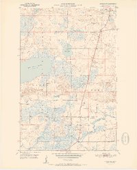
 1949 Aurora1956 Print · USGSThe Iron Range of northern Minnesota comes alive in this post-war survey of the mining landscape around Aurora. Researchers can trace the industrial footprint of the St James Pit, the community of Mesaba, and family landmarks near Colby Lake.
 - 1949 Map of Isaac Lake, 1958 Print
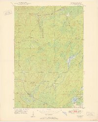
 1949 Isaac Lake1958 Print · USGSSt. Louis County timber and iron lands are documented here during the late 1940s as industry pushed into the northern woods. Researchers can locate the Arvo Cem, trace the Duluth Missabe and Iron Range rail line, and find Armanda Camp.4 unique versions available
 - 1949 Map of Allen, 1958 Print
 1949 Allen1958 Print · USGSThe Mesaba Range and the Iron Range railroad system are in full operation during this post-war era in northern Minnesota. Genealogists and historians can trace the early industrial footprint at Allen, Wyman, and remote outposts like Niemi Camp.
 - 1949 Map of Embarrass, 1959 Print
 1949 Embarrass1959 Print · USGSThe Embarrass River valley in the late 1940s shows a landscape of glacial lakes and northern timber. Genealogists can locate School No 70 and the village of Embarrass along the Duluth Missabe and Iron Range railroad.4 unique versions available
 - 1950 Map of Isaac Lake
 1950 Isaac Lake1950 Print · USGSSt. Louis County is captured at mid-century as the timber and iron economies shaped this north woods landscape. You can trace early cemetery locations like Armanda Cem, find the local Town Hall, and follow the Duluth Missabe and Iron Range railroad.2 unique versions available
 - 1950 Map of Embarrass
 1950 Embarrass1950 Print · USGSSt. Louis County in the post-war era reveals a landscape of Iron Range rail lines and northern forests. Genealogists and local historians can trace the early layout of Embarrass, the location of School No 70, and dozens of named water bodies like Heikkilla Lake.
 - 1950 Map of Allen
 1950 Allen1950 Print · USGSThe Mesaba Range comes into focus during the mid-century as an active corridor of mining and rail transport. Genealogists and historians can trace the Duluth Missabe and Iron Range railroad through the forest to Allen and Niemi Camp.2 unique versions available
 - 1950 Map of Aurora
 1950 Aurora1950 Print · USGSThe Mesaba Iron Range was at a peak of industrial activity in the mid-twentieth century when this survey was conducted. Historians can trace the massive excavations of the St James Pit and Miller Pit alongside the rail-dependent settlements of Aurora and Old Mesaba.2 unique versions available
 - 1950 Map of Biwabik, 1959 Print
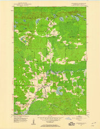
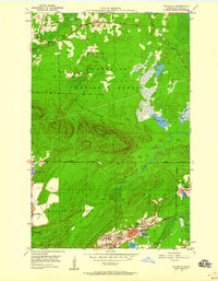
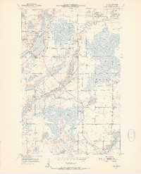
 1950 Biwabik1959 Print · USGSIn the heart of the Mesabi Range during the mid-century mining boom, this map shows a landscape transformed by massive pits and rail lines. Genealogists and industrial historians can locate old company towns like Pineville and Belgrade or trace the early operations of the Canton Mine and Erie Mine.5 unique versions available
 - 1950 Map of Mc Kinley, 1960 Print
 1950 Mc Kinley1960 Print · USGSIron mining communities and the Duluth Missabe and Iron Range railroad define this mid-century survey of the Mesabi Range. Local historians can trace the industrial footprint of the Corsica Mine and the early layouts of McKinley and Elcor.4 unique versions available
 - 1950 Map of Biwabik NW, 1963 Print
 1950 Biwabik NW1963 Print · USGSSt. Louis County's wooded lake country is captured here in the early fifties at the meeting of two great forests. Genealogists and local historians can locate the Florenton P O, School No 14, and old burial grounds like West Pike Cem along the Pike River.5 unique versions available
 - 1950 Map of Biwabik NE, 1963 Print
 1950 Biwabik NE1963 Print · USGSSt. Louis County's Iron Range is captured here in the early postwar era as the region's rail and river networks supported a mix of forest industry and rural life. Researchers can trace the paths of the Duluth Missabe and Iron Range and locate landmarks like Wahlsten, Salo Corner, and the Pike River Ch.4 unique versions available
 - 1951 Map of Biwabik
 1951 Biwabik1951 Print · USGSMid-century mining on the Mesabi Range is captured here during a period of intense industrial activity and growth. Local historians can trace the footprints of the Biwabik Mine, the Duluth Missabe and Iron Range rail lines, and the Erie Mine works.2 unique versions available
 - 1951 Map of Mc Kinley
 1951 Mc Kinley1951 Print · USGSThe Mesabi Range’s industrial landscape comes into focus during the early fifties, showing a network of iron mines and company towns. Genealogists and historians can trace the foundations of McKinley, Elcor, and the Corsica Mine alongside the Duluth Missabe and Iron Range railroad.2 unique versions available
 - 1951 Map of Biwabik NE
 1951 Biwabik NE1951 Print · USGSSt. Louis County was a landscape of winding rivers and timbered iron country in the early fifties. Genealogists and historians can trace pioneer roots through family-named landmarks and local sites like Salo Corner, Pike River Ch, and the Old Vermilion Lake Cem.2 unique versions available
 - 1951 Map of Biwabik NW
 1951 Biwabik NW1951 Print · USGSSt. Louis County is captured here in the early 1950s, showing a landscape of dense forests and river systems before modern expansion. Genealogists can locate the Florenton P O and community landmarks like School No 14, Pike Ch, and Sandy Cem.2 unique versions available
 - 1951 Map of Palo, 1952 Print
 1951 Palo1952 Print · USGSMid-century St. Louis County is captured here as a landscape of iron-related industry and lakeside retreats. Genealogists and researchers can trace local family landmarks like Palo, Rauha Cem, and the old Loon Lake Sch.6 unique versions available
 - 1951 Map of Gilbert, 1952 Print
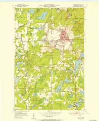
 1951 Gilbert1952 Print · USGSThe Mesabi Range iron industry is in full production during the early fifties, centering on the rail hubs and open pits of Gilbert and Sparta. Genealogists and historians can trace the footprints of the Gilbert Mine, Gilbert Cem, and the D M & I R railroad.4 unique versions available
 - 1951 Map of Eveleth, 1952 Print
 1951 Eveleth1952 Print · USGSThe Mesabi Iron Range hums with industrial activity in the early fifties, showing the massive pits and rail lines that drove the regional economy. Genealogists and historians can locate family homes near Leonidas, trace the Duluth Missabe and Iron Range tracks, or find old landmarks like Fayal Sch and the Virginia Mine.5 unique versions available
 - 1951 Map of Virginia, 1952 Print
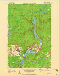
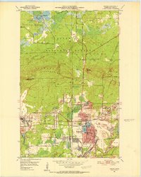 1951 Virginia1952 Print · USGSThe Mesabi Range's industrial peak is on full display in the early fifties, showing a landscape defined by massive iron mines and railroad junctions. Genealogists and researchers can trace the neighborhoods of Mountain Iron and Parkville or locate specific sites like Greenwood Cemetery and Rainy Junction.9 unique versions available
Showing maps 1-25 of 1,013
Top cities of Saint Louis County
- Duluth historical maps
- Hibbing historical maps
- Hermantown historical maps
- Virginia historical maps
- Chisholm historical maps
- Eveleth historical maps
See more
Frequently asked questions
- What are the different types of historical maps available for Saint Louis County?
- What is the oldest map of Saint Louis County?
- Where can I purchase historical maps of Saint Louis County for my home or office?
- Where can I download high-res historical maps of Saint Louis County?
- Are there historical topographic maps available for Saint Louis County?
- Is there historical aerial imagery available for Saint Louis County?
- Where are historical maps of Saint Louis County sourced from?