1950s Maps of Scott County, Minnesota
Explore 10 historic maps of Scott County from the 1950s. These maps offer a rare glimpse into what life looked like during the 1950s — showing old roads, neighborhoods, homes, and landmarks that have changed or disappeared over time.
Whether you're researching your family's past, planning a metal detecting trip, or studying how Scott County's landscape evolved across the 1950s, these high-resolution maps are a powerful tool for exploring the history of this region.
- Focus on a specific era: All maps on this page are from the 1950s, giving you a focused view of this time period.
- See what’s changed: Compare century-old streets, trails, and buildings to today's modern landscape using overlays and satellite layers.
- Research with precision: Use these maps for genealogy, historical research, land use analysis, or educational projects.
- View, download, or print: Maps are fully viewable online in high resolution, and can be downloaded or printed for your own records.
Start exploring Scott County's history through authentic maps from the 1950s. This is your window into the past.
Scott County, MN maps
(10)- 1953 Map of Saint Paul, 1964 Print
 1953 Saint Paul1964 Print · USGSThe Twin Cities and the Mississippi River valley are captured here at a mid-century turning point. Trace the early growth of Minneapolis and Saint Paul alongside landmarks like Lake Minnetonka and the St Croix River.4 unique versions available
 - 1954 Map of Bloomington, 1956 Print
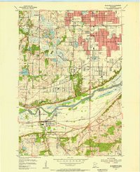 1954 Bloomington1956 Print · USGSThe Minnesota River valley in the mid-fifties is captured at the moment of its suburban expansion south of the Twin Cities. Genealogists and local historians can trace family sites from Savage to Oxboro, locating landmarks like Port Cargill and the Bloomington Ferry Ch.2 unique versions available
 - 1954 Map of Eden Prairie, 1956 Print
 1954 Eden Prairie1956 Print · USGSEden Prairie and Bloomington are captured here in the mid-fifties, just as the river valley's rail-and-water economy met the early jet age. Genealogists can trace family sites near Bloomington Ferry, Eden Prairie Cem, and several abandoned schoolhouses.2 unique versions available
 - 1954 Map of Minneapolis, 1959 Print
 1954 Minneapolis1959 Print · USGSThe Twin Cities suburbs were in the midst of a post-war transformation during the early fifties as the urban grid expanded into the surrounding lake country. Researchers can find many lost local landmarks, from the Glen Lake Sanatorium and Flying Cloud Airport to the rural Eden Prairie Ch and Bloomington Cem.
 - 1957 Map of Belle Plaine, 1958 Print
 1957 Belle Plaine1958 Print · USGSThe Minnesota River valley serves as a bustling corridor for four counties during the late fifties, defined by its intersecting rail lines and riverside towns. Genealogists can locate family landmarks like West Union Ch, Zion Cem, and the Jessenland Fish Hatchery.2 unique versions available
 - 1957 Map of Prior Lake, 1958 Print
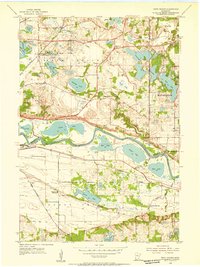
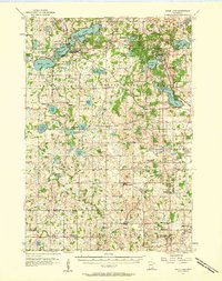 1957 Prior Lake1958 Print · USGSScott and Rice Counties appear here in the late 1950s, showing a region defined by its numerous glacial lakes and small farming hamlets. Genealogists and researchers can trace rural school locations and historic churches such as St Catherine Ch, Elko, and several noted sites like School No 52 (Abandoned).2 unique versions available
 - 1957 Map of New Prague, 1959 Print
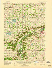
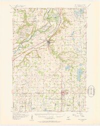 1957 New Prague1959 Print · USGSScott and Le Sueur Counties in the late fifties reveal a landscape of deep-rooted parish settlements and thriving river-valley agriculture. Genealogists can trace family footprints through rural sites like East Union, St Benedict, and the St Josephs Sch Cem.2 unique versions available
 - 1958 Map of Lake Minnetonka, 1959 Print
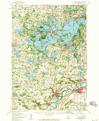 1958 Lake Minnetonka1959 Print · USGSThe western suburbs of Minneapolis appear in a period of transition during the late fifties, centered on the complex shores of Lake Minnetonka. Genealogists and historians can trace the foundations of Wayzata, Deephaven, and Shakopee, or locate family landmarks like Calvin Ch and the Jesuit Seminary.2 unique versions available
 - 1958 Map of Shakopee, 1959 Print
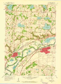 1958 Shakopee1959 Print · USGSThe Minnesota River valley comes alive in the late fifties, showcasing the river towns of Shakopee and Chaska as they sat before major modern development. Genealogists and historians can trace local landmarks like Assumption Seminary, St Johns Cem, and the path of the Minneapolis and St Louis railroad.5 unique versions available
 - 1959 Map of Saint Paul
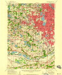
 1959 Saint Paul1959 Print · USGSThe Twin Cities and southeastern Minnesota appear here in the late fifties, showing the peak of the rail era and post-war suburban growth. Genealogists can trace family footprints near Lake Minnetonka, the Univ Of Minn Rosemount Research Center, or the growing neighborhoods of Richfield.2 unique versions available
End of results
Showing maps 1-10 of 10
Top cities of Scott County
- Shakopee historical maps
- Savage historical maps
- Prior Lake historical maps
- Credit River historical maps
- Jordan historical maps
- Belle Plaine historical maps
See more
Frequently asked questions
- What are the different types of historical maps available for Scott County?
- What is the oldest map of Scott County?
- Where can I purchase historical maps of Scott County for my home or office?
- Where can I download high-res historical maps of Scott County?
- Are there historical topographic maps available for Scott County?
- Is there historical aerial imagery available for Scott County?
- Where are historical maps of Scott County sourced from?