2020s Maps of Grey Eagle, Minnesota
Explore 2 historic maps of Grey Eagle from the 2020s. These maps offer a rare glimpse into what life looked like during the 2020s — showing old roads, neighborhoods, homes, and landmarks that have changed or disappeared over time.
Whether you're researching your family's past, planning a metal detecting trip, or studying how Grey Eagle's landscape evolved across the 2020s, these high-resolution maps are a powerful tool for exploring the history of this region.
- Focus on a specific era: All maps on this page are from the 2020s, giving you a focused view of this time period.
- See what’s changed: Compare century-old streets, trails, and buildings to today's modern landscape using overlays and satellite layers.
- Research with precision: Use these maps for genealogy, historical research, land use analysis, or educational projects.
- View, download, or print: Maps are fully viewable online in high resolution, and can be downloaded or printed for your own records.
Start exploring Grey Eagle's history through authentic maps from the 2020s. This is your window into the past.
Grey Eagle, MN maps
(2)- 2022 Map of Burtrum, 2022 Print
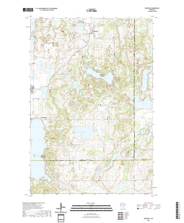 2022 Burtrum2022 Print · USGSCentral Minnesota's lake country is captured here as a patchwork of water and small-town life where three counties converge. Genealogists can trace family names and local landmarks near Burtrum, Old Saint Marys Cem, and Big Birch Lake.
 - 2022 Map of Ward Springs, 2022 Print
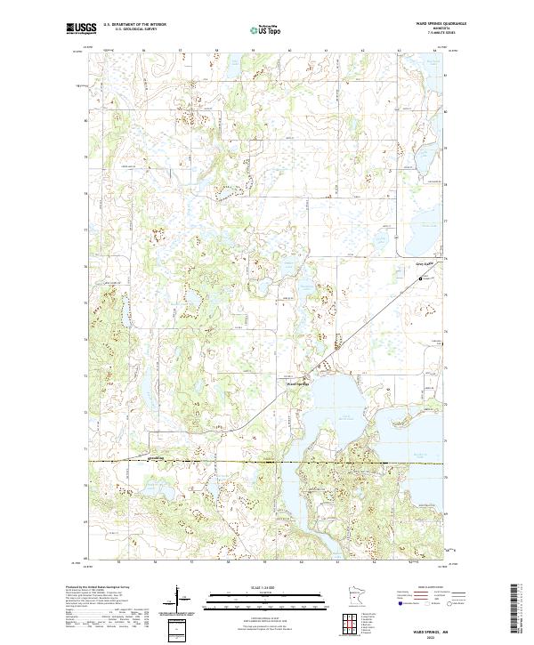 2022 Ward Springs2022 Print · USGSThe lake country of central Minnesota is documented here as it appeared recently, spanning the border of Todd and Stearns counties. Local historians can trace the lakeside settlements of Ward Springs and Grey Eagle or locate Saint Joseph Cem and Lakeview Cem.
End of results
Showing maps 1-2 of 2
Top cities near Grey Eagle
- Sauk Centre historical maps
- Melrose historical maps
- Long Prairie historical maps
- Albany historical maps
- Little Sauk historical maps
- Round Prairie historical maps
See more
Frequently asked questions
- What are the different types of historical maps available for Grey Eagle?
- What is the oldest map of Grey Eagle?
- Where can I purchase historical maps of Grey Eagle for my home or office?
- Where can I download high-res historical maps of Grey Eagle?
- Are there historical topographic maps available for Grey Eagle?
- Is there historical aerial imagery available for Grey Eagle?
- Where are historical maps of Grey Eagle sourced from?