1980s Maps of Cherokee Meadows, Olive Branch
Explore 2 historic maps of Cherokee Meadows from the 1980s. These maps offer a rare glimpse into what life looked like during the 1980s — showing old roads, neighborhoods, homes, and landmarks that have changed or disappeared over time.
Whether you're researching your family's past, planning a metal detecting trip, or studying how Cherokee Meadows's landscape evolved across the 1980s, these high-resolution maps are a powerful tool for exploring the history of this region.
- Focus on a specific era: All maps on this page are from the 1980s, giving you a focused view of this time period.
- See what’s changed: Compare century-old streets, trails, and buildings to today's modern landscape using overlays and satellite layers.
- Research with precision: Use these maps for genealogy, historical research, land use analysis, or educational projects.
- View, download, or print: Maps are fully viewable online in high resolution, and can be downloaded or printed for your own records.
Start exploring Cherokee Meadows's history through authentic maps from the 1980s. This is your window into the past.
Cherokee Meadows, Olive Branch maps
(2)- 1982 Map of Olive Branch
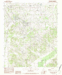 1982 Olive Branch1982 Print · USGSDe Soto County, Mississippi, sits just below the Tennessee line in the early eighties as the area begins a transition toward growth. Genealogists and researchers can trace the roads connecting Olive Branch to smaller settlements like Miller and Fairhaven near the Goldwater River.
 - 1984 Map of Tupelo
 1984 Tupelo1984 Print · USGSNorth Mississippi in the 1980s is defined by its massive river basin reservoirs and the growing regional hubs of Tupelo and Oxford. Researchers can trace the legacy of the Pontotoc Ridge, find the University of Mississippi, and map early Interstate corridors near Sardis Lake.3 unique versions available
End of results
Showing maps 1-2 of 2
Frequently asked questions
- What are the different types of historical maps available for Cherokee Meadows?
- What is the oldest map of Cherokee Meadows?
- Where can I purchase historical maps of Cherokee Meadows for my home or office?
- Where can I download high-res historical maps of Cherokee Meadows?
- Are there historical topographic maps available for Cherokee Meadows?
- Is there historical aerial imagery available for Cherokee Meadows?
- Where are historical maps of Cherokee Meadows sourced from?