Old Maps of Hattiesburg, Mississippi
Explore 16 old maps of Hattiesburg, spanning from 1947 to today. These high-resolution historic maps reveal how streets, neighborhoods, landmarks, and natural features evolved over time — perfect for genealogy, metal detecting, research, and local history exploration.
What you can do with these maps:
- See how Hattiesburg changed over time: Compare historical maps to modern-day views to trace roads, homesites, rail lines & more.
- View detailed metadata: Each map includes creators, publishers, year, scale, and archive source.
- Overlay maps with satellite & LiDAR: Visualize the past alongside modern tools to explore terrain & human change.
- Trusted historical sources: Maps sourced from the USGS, Library of Congress, and other archives.
- Access maps your way: View online, download high-res files, or order prints for personal or research use.
Start exploring old maps of Hattiesburg to uncover forgotten places, hidden landmarks, and the deep history beneath your feet.
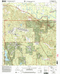
Hattiesburg, MS maps
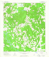
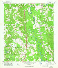
(16)- 1947 Map of New Augusta, 1965 Print
 1947 New Augusta1965 Print · USGSCovers Hattiesburg, including New Augusta, Belleville, and other nearby areas3 unique versions available
 - 1949 Map of New Augusta
 1949 New Augusta1949 Print · USGSCovers Hattiesburg, including New Augusta, Belleville, and other nearby areas2 unique versions available
 - 1953 Map of Hattiesburg, 1965 Print
 1953 Hattiesburg1965 Print · USGSCovers Hattiesburg, including Laurel, Petal, and other nearby areas4 unique versions available
 - 1958 Map of Hattiesburg
 1958 Hattiesburg1958 Print · USGSCovers Hattiesburg, including Laurel, Petal, and other nearby areas2 unique versions available
 - 1964 Map of Carterville
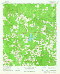
 1964 Carterville1964 Print · USGSCovers Hattiesburg, including Petal, Goodluck, and other nearby areas5 unique versions available
 - 1964 Map of Hattiesburg, 1965 Print
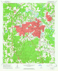 1964 Hattiesburg1965 Print · USGSCovers Hattiesburg, including Petal, Glendale, and other nearby areas4 unique versions available
 - 1965 Map of Hattiesburg SW, 1966 Print
 1965 Hattiesburg SW1966 Print · USGSCovers Hattiesburg, including Oak Grove, Clyde, and other nearby areas4 unique versions available
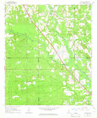
 - 1965 Map of Dixie, 1966 Print
 1965 Dixie1966 Print · USGSCovers Hattiesburg, including Purvis, Dixie, and other nearby areas3 unique versions available
 - 1965 Map of Eastabuchie, 1966 Print
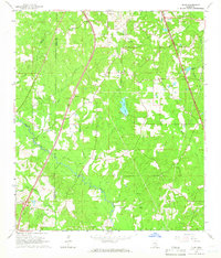
 1965 Eastabuchie1966 Print · USGSCovers Hattiesburg, including Petal, Eastabuchie, and other nearby areas4 unique versions available
 - 1965 Map of Sanford, 1966 Print
 1965 Sanford1966 Print · USGSCovers Hattiesburg, including Sanford, Lux, and other nearby areas3 unique versions available
 - 1983 Map of McLaurin
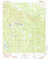 1983 McLaurin1983 Print · USGSCovers Hattiesburg, including Belleville, Ragland, and other nearby areas3 unique versions available
 - 1984 Map of Hattiesburg
 1984 Hattiesburg1984 Print · USGSCovers Hattiesburg, including Laurel, Petal, and other nearby areas2 unique versions available
 - 1984 Map of Hattiesburg
 1984 Hattiesburg1984 Print · USGSCovers Hattiesburg, including Petal, Columbia, and other nearby areas
 - 1994 Map of Hattiesburg, 1995 Print
 1994 Hattiesburg1995 Print · USGSCovers Hattiesburg, including Petal, Columbia, and other nearby areas
 - 1996 Map of Hattiesburg, 2000 Print
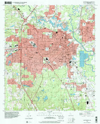 1996 Hattiesburg2000 Print · USGSCovers Hattiesburg, including Petal, Glendale, and other nearby areas
 - 2000 Map of McLaurin, 2003 Print
 2000 McLaurin2003 Print · USGSCovers Hattiesburg, including Belleville, Ragland, and other nearby areas
End of results
Showing maps 1-16 of 16
Top cities near Hattiesburg
Top neighborhoods of Hattiesburg
- Mars Hill historical maps
- Palmers Crossing historical maps
- Bonhomie historical maps
- Dixie Pine historical maps
- Wardwell historical maps
- Country Club Estates historical maps
See more
Frequently asked questions
- What are the different types of historical maps available for Hattiesburg?
- What is the oldest map of Hattiesburg?
- Where can I purchase historical maps of Hattiesburg for my home or office?
- Where can I download high-res historical maps of Hattiesburg?
- Are there historical topographic maps available for Hattiesburg?
- Is there historical aerial imagery available for Hattiesburg?
- Where are historical maps of Hattiesburg sourced from?