Old Maps of Forest Hills, Lamar County for Academic Research
Study the evolution of Forest Hills with 12 high-resolution historic maps. Whether you're teaching, researching, or modeling changes in land use, these maps provide essential visual documentation of urban, environmental, and geographic change.
- Analyze long-term change: Track patterns in development, transportation, and natural features.
- Ideal for environmental or urban studies: Support academic projects with primary historical map data.
- Use in the classroom or lab: Educators and researchers rely on these maps to bring historical context to life.
These maps are a powerful tool for teaching, research, and visualizing how Forest Hills has changed over the decades.
Forest Hills, Lamar County maps
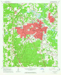
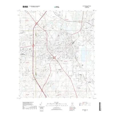
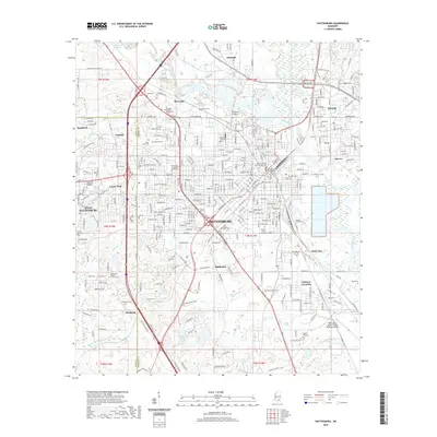
(12)- 1953 Map of Hattiesburg, 1965 Print
 1953 Hattiesburg1965 Print · USGSSouth Mississippi and western Alabama are shown here during the mid-twentieth century as the timber and rail industries shaped the region. Genealogists and historians can trace rail lines like the Mississippi Central and locate rural centers such as Magee, Richton, and Mount Vernon.4 unique versions available
 - 1958 Map of Hattiesburg
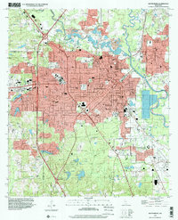
 1958 Hattiesburg1958 Print · USGSSoutheastern Mississippi's timber and rail networks are at their peak during the late fifties, centered on the growing hubs of Hattiesburg and Laurel. Researchers can trace old family landmarks like Sims Chapel, the Busbey Game Refuge, and the vanished stops along the Mississippi Central railroad.2 unique versions available
 - 1964 Map of Hattiesburg, 1965 Print
 1964 Hattiesburg1965 Print · USGSHattiesburg flourished as a vital railway and educational crossroads in the mid-1960s. Genealogists and historians can trace the development of the University of Southern Mississippi and find vanished sites like Dixie Pine and Bonhomie.4 unique versions available
 - 1984 Map of Hattiesburg
 1984 Hattiesburg1984 Print · USGSSouth Mississippi’s Pine Belt is seen here in the mid-eighties, showing the region as a hub of timber production and petroleum extraction. Trace the rail lines of the Illinois Central Gulf RR through old settlements like Richton or the energy developments at the Heidelberg Oil Field.2 unique versions available
 - 1984 Map of Hattiesburg
 1984 Hattiesburg1984 Print · USGSSouth Mississippi’s timber and military heartland comes into focus during the mid-eighties, centering on the hub of Hattiesburg and the winding Pearl River. Researchers can trace the rail lines of the Illinois Central Gulf through old towns like Bassfield and Sumrall, or locate rural landmarks like Society Hill Ch.
 - 1994 Map of Hattiesburg, 1995 Print
 1994 Hattiesburg1995 Print · USGSSouth-central Mississippi's river valleys and timberlands are seen here in the mid-1990s as the region's transport network matured. Researchers can trace rural lineages through sites like Old Pioneer Cem and Spring Cottage or explore the vast Camp Shelby Military Reservation.
 - 1996 Map of Hattiesburg, 2000 Print
 1996 Hattiesburg2000 Print · USGSHattiesburg and the neighboring community of Petal are shown in the mid-nineties during a period of steady institutional and suburban growth. Researchers can locate family landmarks like B'nai Israel Cem, trace the Illinois Central Gulf RR, or study the University of Southern Mississippi campus.
 - 2012 Map of Hattiesburg, 2012 Print
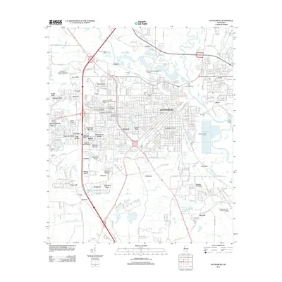 2012 Hattiesburg2012 Print · USGSCovers Forest Hills, including Hattiesburg, Petal, and other nearby areas
 - 2015 Map of Hattiesburg, 2015 Print
 2015 Hattiesburg2015 Print · USGSCovers Forest Hills, including Hattiesburg, Petal, and other nearby areas
 - 2018 Map of Hattiesburg, 2018 Print
 2018 Hattiesburg2018 Print · USGSCovers Forest Hills, including Hattiesburg, Petal, and other nearby areas
 - 2020 Map of Hattiesburg, 2020 Print
 2020 Hattiesburg2020 Print · USGSCovers Forest Hills, including Hattiesburg, Petal, and other nearby areas
 - 2024 Map of Hattiesburg, 2024 Print
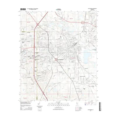
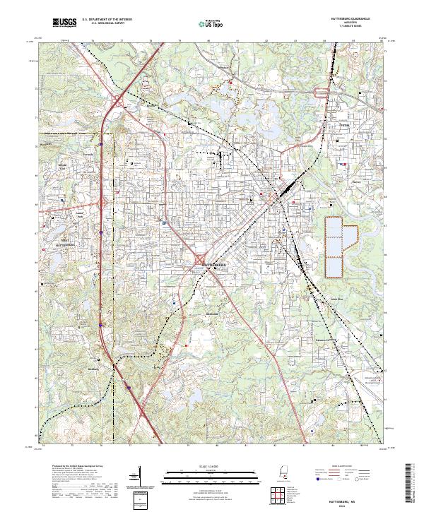 2024 Hattiesburg2024 Print · USGSHattiesburg and Petal sit at the confluence of the Leaf and Bouie Rivers in this recent 2024 survey of the Pine Belt. Trace historic river crossings like Peoples Ferry and legacy sites like the University of Southern Mississippi.
End of results
Showing maps 1-12 of 12
Frequently asked questions
- What are the different types of historical maps available for Forest Hills?
- What is the oldest map of Forest Hills?
- Where can I purchase historical maps of Forest Hills for my home or office?
- Where can I download high-res historical maps of Forest Hills?
- Are there historical topographic maps available for Forest Hills?
- Is there historical aerial imagery available for Forest Hills?
- Where are historical maps of Forest Hills sourced from?