Old Maps of Brandon, Mississippi
Explore 44 old maps of Brandon, spanning from 1903 to today. These high-resolution historic maps reveal how streets, neighborhoods, landmarks, and natural features evolved over time — perfect for genealogy, metal detecting, research, and local history exploration.
What you can do with these maps:
- See how Brandon changed over time: Compare historical maps to modern-day views to trace roads, homesites, rail lines & more.
- View detailed metadata: Each map includes creators, publishers, year, scale, and archive source.
- Overlay maps with satellite & LiDAR: Visualize the past alongside modern tools to explore terrain & human change.
- Trusted historical sources: Maps sourced from the USGS, Library of Congress, and other archives.
- Access maps your way: View online, download high-res files, or order prints for personal or research use.
Start exploring old maps of Brandon to uncover forgotten places, hidden landmarks, and the deep history beneath your feet.
Brandon, MS maps
(44)- 1903 Map of Jackson
 1903 Jackson1903 Print · USGSCentral Mississippi at the dawn of the new century shows a landscape transformed by expanding rail lines and river commerce. Genealogists and researchers can trace family roots through early settlements like Pocahontas, Ridgeland, and Clinton or locate the historic Asylum grounds.
 - 1905 Map of Jackson
 1905 Jackson1905 Print · USGSJackson and its surrounding counties are shown at the height of the railroad era, as five major lines converge on the state capital. Genealogists can trace early rural life through Tougaloo University, family landmarks like Horns Mill, and churches such as Liberty Grove Church.3 unique versions available
 - 1906 Map of Florence, 1965 Print
 1906 Florence1965 Print · USGSThe rural landscapes of Rankin and Hinds Counties are captured here at the start of the century, centered on the growing rail hub of Florence. Genealogists can trace old family locales through numerous landmarks like Hickory Ridge School, Ebenezer Church, and the winding Pearl River.
 - 1908 Map of Jackson
 1908 Jackson1908 Print · USGSCentral Mississippi thrives as a railroad and institutional hub at the beginning of the twentieth century. Genealogists can trace the early footprints of Jackson and Tougaloo University, or locate family landmarks like Beadmans Mill and Madison Station.2 unique versions available
 - 1908 Map of Florence
 1908 Florence1908 Print · USGSCentral Mississippi at the dawn of the twentieth century shows a landscape of rail-dependent villages and rural schoolhouses. Genealogists can trace family roots through sites like Monterey, Poplar Springs Church, and Steepbank School.2 unique versions available
 - 1922 Map of Pelahatchee
 1922 Pelahatchee1922 Print · USGSRankin County during the early 1920s reveals a landscape of dispersed agricultural communities and transit corridors. You can trace the roots of local settlements at Sand Hill and Leesburg, or locate family landmarks like Pisgah School and St Helen Church.
 - 1924 Map of Pelahatchee
 1924 Pelahatchee1924 Print · USGSRankin County in the 1920s is a landscape of rural schoolhouses and family-named prairies centered on the vital Alabama and Vicksburg RR. Researchers can trace the heritage of local communities through landmarks like the Brandon depot, Trickum Bridge, and Goshen Springs.
 - 1950 Map of Pelahatchie, 1968 Print
 1950 Pelahatchie1968 Print · USGSRankin County's rural landscape is captured here at mid-century, from the busy rails of Brandon to the quiet reaches of Goshen Springs. Researchers can trace old family names at Andrews Chapel, St Helens Ch, or the Spring Hill Cem while following the historic Choctaw Treaty Line of 1820.2 unique versions available
 - 1952 Map of Pelahatchie
 1952 Pelahatchie1952 Print · USGSRankin County during the early 1950s shows a landscape still defined by its nineteenth-century boundaries and growing rail hubs. Genealogists and historians can trace family locations near Goshen Springs, the Choctaw Treaty Line of 1820, and Andrews Chapel.
 - 1953 Map of Meridian, 1966 Print
 1953 Meridian1966 Print · USGSEast Central Mississippi and the Alabama borderlands are captured here during a period of steady growth and infrastructure expansion. Genealogists and historians can trace rail-town development along the Gulf Mobile & Ohio Railroad and find early settlements like Scooba, Pelahatchie, and De Kalb.2 unique versions available
 - 1955 Map of Jackson
 1955 Jackson1955 Print · USGSThe Lower Mississippi Valley at the middle of the century reveals a landscape of deep river meanders and growing rail hubs. Genealogists and historians can trace the mid-century footprints of Vicksburg National Military Park, old river landings at Port Gibson, and the rail corridors of the Illinois Central Railroad.3 unique versions available
 - 1957 Map of Meridian
 1957 Meridian1957 Print · USGSEast Central Mississippi and parts of Western Alabama come alive in the mid-1950s, centered on the transit hub of Meridian. Researchers can trace old rail lines like the Illinois Central and find historic sites such as the Choctaw Indian Reservation and Roosevelt State Park.
 - 1961 Map of Jackson
 1961 Jackson1961 Print · USGSThe Lower Mississippi Delta and the state capital area are captured here during the post-war era of infrastructure expansion. Researchers can trace the complex river oxbows and rail lines connecting Vicksburg, Yazoo City, and the Illinois Central Railroad network.
 - 1962 Map of Jackson
 1962 Jackson1962 Print · USGSThe Mississippi Delta and the state capital region are mapped here in the early sixties, showing a landscape defined by the great river and the growing city of JACKSON. Genealogists can trace family roots through numerous landmarks like Cedar Hill Cem, rural stops on the Illinois Central RR, and historic sites like Champion Hill.2 unique versions available
 - 1963 Map of Jackson SE, 1964 Print
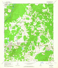 1963 Jackson SE1964 Print · USGSRankin County east of the Pearl River is captured during a period of rapid change in the early sixties as the reservoir began to take shape. Researchers can trace family sites like Old Sea Cem, rural landmarks such as Wallace Chapel, and the era's infrastructure from the Jackson Municipal Airport to the Gulf Mobile and Ohio line.3 unique versions available
 - 1965 Map of Meridian
 1965 Meridian1965 Print · USGSEast Mississippi and West Alabama are mapped here in the mid-sixties as the region's modern highway and reservoir systems began to take shape. Researchers can trace rural lineages through local landmarks like Prince Chapel and Tuscahoma Landing, or follow the historic Gulf Mobile & Ohio rail lines.
 - 1968 Map of Puckett NW, 1970 Print
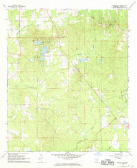 1968 Puckett NW1970 Print · USGSRankin County during the late sixties shows a transition from rural timberland to planned residential development. Researchers can trace family history through numerous burial grounds like Hebron Hill Cem and churches such as Pearlie Grove Ch and Rock Hill Ch.3 unique versions available
 - 1971 Map of Whitfield, 1973 Print
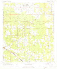 1971 Whitfield1973 Print · USGSRankin County during the early seventies is characterized by large institutional sites and a dense network of rural communities. Genealogists and historians can trace local family life through landmarks like New Hope Ch, Thomasville, and the Mississippi State Hospital.
 - 1980 Map of Whitfield
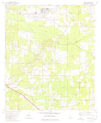 1980 Whitfield1980 Print · USGSRankin County during the late seventies and early eighties shows a landscape of institutional landmarks and tight-knit rural settlements. Genealogists can locate family-named landmarks and institutions like the State Hospital, Wesley College, and Jerusalem Ch.
 - 1980 Map of Jackson SE
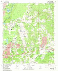 1980 Jackson SE1980 Print · USGSRankin County enters a period of modern expansion in the 1980s, where traditional settlements meet the growing infrastructure of the Pearl River corridor. Researchers can trace family sites at Drakes Ch, Flora Hills Cem, and the neighborhoods of McLaurin Heights.2 unique versions available
 - 1982 Map of Brandon, 1983 Print
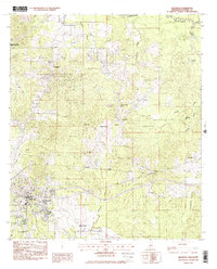 1982 Brandon1983 Print · USGSRankin County enters the early eighties with the bustling town of Brandon anchored by the Illinois Central Gulf rail line. Genealogists and researchers can trace numerous local landmarks including Langford, True Vine Ch, and Andrew Chapel Cem.
 - 1984 Map of Forest
 1984 Forest1984 Print · USGSCentral Mississippi in the mid-eighties centers on the timberlands and rail corridors of the Bienville National Forest. Genealogists and historians can trace old settlements like Conehatta and Hillsboro or follow the Illinois Central Gulf line through Morton and Newton.2 unique versions available
 - 1984 Map of Jackson
 1984 Jackson1984 Print · USGSCentral Mississippi in the mid-eighties shows a landscape defined by the growing suburbs of Jackson and the riverfront legacy of Vicksburg. Researchers can trace the Natchez Trace Parkway or locate local landmarks like Utica College and Mississippi State Hospital.
 - 1998 Map of Jackson SE
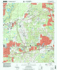 1998 Jackson SE1998 Print · USGSRankin County at the end of the nineties shows a landscape of suburban growth and major aviation infrastructure east of the Pearl River. Researchers can find deep local detail in family cemeteries and community centers like Union Cemetery, Luckney, and Hinds Community College.
 - 2012 Map of Whitfield, 2012 Print
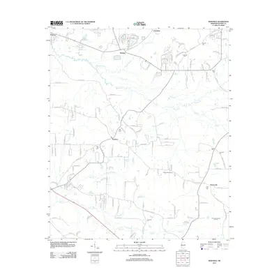 2012 Whitfield2012 Print · USGSRankin County enters a new era of growth in the early 2010s as suburban developments expand around Whitfield and Monterey. Family historians can trace numerous rural burial sites like Sandhill Cem or explore the Thomasville Oil and Gas Field.
Showing maps 1-25 of 44
Top cities near Brandon
- Jackson historical maps
- Madison historical maps
- Pearl historical maps
- Ridgeland historical maps
- Flowood historical maps
- Richland historical maps
See more
Top neighborhoods of Brandon
- Grove Park historical maps
- Hunters Woods historical maps
- The Commons historical maps
- Terrapin Hill historical maps
- Cornerstone Subdivision historical maps
- Easthaven historical maps
See more
Frequently asked questions
- What are the different types of historical maps available for Brandon?
- What is the oldest map of Brandon?
- Where can I purchase historical maps of Brandon for my home or office?
- Where can I download high-res historical maps of Brandon?
- Are there historical topographic maps available for Brandon?
- Is there historical aerial imagery available for Brandon?
- Where are historical maps of Brandon sourced from?