Old Maps of Hurricane, Mississippi for Academic Research
Study the evolution of Hurricane with 12 high-resolution historic maps. Whether you're teaching, researching, or modeling changes in land use, these maps provide essential visual documentation of urban, environmental, and geographic change.
- Analyze long-term change: Track patterns in development, transportation, and natural features.
- Ideal for environmental or urban studies: Support academic projects with primary historical map data.
- Use in the classroom or lab: Educators and researchers rely on these maps to bring historical context to life.
These maps are a powerful tool for teaching, research, and visualizing how Hurricane has changed over the decades.
Hurricane, MS maps
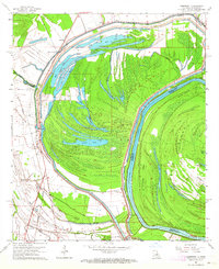
(12)- 1955 Map of Jackson
 1955 Jackson1955 Print · USGSThe Lower Mississippi Valley at the middle of the century reveals a landscape of deep river meanders and growing rail hubs. Genealogists and historians can trace the mid-century footprints of Vicksburg National Military Park, old river landings at Port Gibson, and the rail corridors of the Illinois Central Railroad.3 unique versions available
 - 1961 Map of Jackson
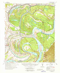
 1961 Jackson1961 Print · USGSThe Lower Mississippi Delta and the state capital area are captured here during the post-war era of infrastructure expansion. Researchers can trace the complex river oxbows and rail lines connecting Vicksburg, Yazoo City, and the Illinois Central Railroad network.
 - 1962 Map of Jackson
 1962 Jackson1962 Print · USGSThe Mississippi Delta and the state capital region are mapped here in the early sixties, showing a landscape defined by the great river and the growing city of JACKSON. Genealogists can trace family roots through numerous landmarks like Cedar Hill Cem, rural stops on the Illinois Central RR, and historic sites like Champion Hill.2 unique versions available
 - 1963 Map of Somerset, 1964 Print
 1963 Somerset1964 Print · USGSThe Mississippi River bottomlands in the early sixties reveal a landscape shaped by water and rail. Genealogists and local historians can trace family sites at Somerset Cem, find rural churches like St John Ch, or locate old river stops at Palmyra Landing.2 unique versions available
 - 1965 Map of Davis Island
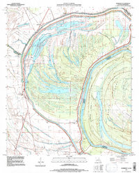
 1965 Davis Island1965 Print · USGSThe Mississippi River and its intricate floodplains define this mid-1960s survey of the Louisiana and Mississippi border. Genealogists and historians can trace family locations near Newellton, Somerset Cem, and the historic Grand Gulf Mil Mon.3 unique versions available
 - 1982 Map of Tallulah, 1983 Print
 1982 Tallulah1983 Print · USGSNortheast Louisiana in the early eighties was a landscape of intricate oxbow lakes and railroad towns. Researchers can trace the heritage of parish centers like Tallulah and Winnsboro, or locate rural landmarks near Yucatan Lake and the Illinois Central Gulf tracks.
 - 1994 Map of Somerset, 1997 Print
 1994 Somerset1997 Print · USGSTensas Parish and the Mississippi River border are captured in the mid-1990s, showcasing a landscape of massive oxbows and river islands. Genealogists can locate family sites at Somerset Cem and St John Cem or trace old river access at Palmyra Landing.
 - 2012 Map of Somerset, 2012 Print
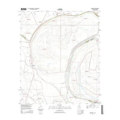
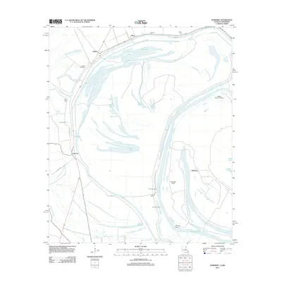 2012 Somerset2012 Print · USGSCovers Hurricane, including Quimby, Afton, and other nearby areas
 - 2015 Map of Somerset, 2015 Print
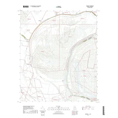
 2015 Somerset2015 Print · USGSCovers Hurricane, including Quimby, Afton, and other nearby areas
 - 2018 Map of Somerset, 2018 Print
 2018 Somerset2018 Print · USGSCovers Hurricane, including Quimby, Afton, and other nearby areas
 - 2020 Map of Somerset, 2020 Print
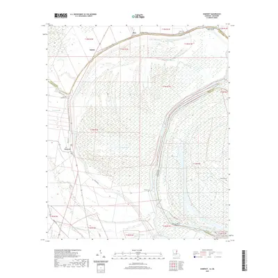 2020 Somerset2020 Print · USGSCovers Hurricane, including Quimby, Afton, and other nearby areas
 - 2024 Map of Somerset, 2024 Print
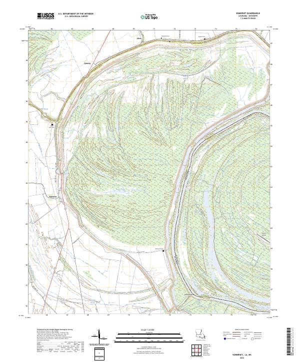 2024 Somerset2024 Print · USGSThe Delta lowlands along the Louisiana and Mississippi border are captured here in the 2020s. Genealogists can trace family landmarks and rural burials at Somerset Cem, Saint John Cem, and Allendale Cem near the river's Palmyra Bend.
End of results
Showing maps 1-12 of 12
Top cities near Hurricane
- Vicksburg historical maps
- Tallulah historical maps
- Port Gibson historical maps
- Newellton historical maps
- Richmond historical maps
- Delta historical maps
See more
Frequently asked questions
- What are the different types of historical maps available for Hurricane?
- What is the oldest map of Hurricane?
- Where can I purchase historical maps of Hurricane for my home or office?
- Where can I download high-res historical maps of Hurricane?
- Are there historical topographic maps available for Hurricane?
- Is there historical aerial imagery available for Hurricane?
- Where are historical maps of Hurricane sourced from?