Old Maps of Wayside, Mississippi for Academic Research
Study the evolution of Wayside with 12 high-resolution historic maps. Whether you're teaching, researching, or modeling changes in land use, these maps provide essential visual documentation of urban, environmental, and geographic change.
- Analyze long-term change: Track patterns in development, transportation, and natural features.
- Ideal for environmental or urban studies: Support academic projects with primary historical map data.
- Use in the classroom or lab: Educators and researchers rely on these maps to bring historical context to life.
These maps are a powerful tool for teaching, research, and visualizing how Wayside has changed over the decades.
Wayside, MS maps
(12)- 1939 Map of Refuge, 1949 Print
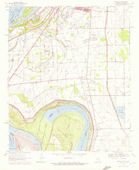
 1939 Refuge1949 Print · USGSThe Mississippi River delta in the late thirties reveals a landscape shaped by massive engineering projects and traditional river life. Trace the shifting banks and cutoff channels alongside rural settlements like Refuge, the rails of the Yazoo and Mississippi Valley Railroad, and local landmarks like Macedonia Ch.4 unique versions available
 - 1953 Map of Greenwood, 1966 Print
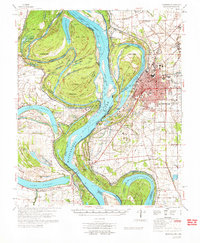
 1953 Greenwood1966 Print · USGSThe Mississippi Delta in the mid-fifties is captured here as a thriving network of river towns, railroads, and oxbow lakes. Researchers can trace the legacy of the Illinois Central Railroad and locate landmarks like the State Penal Farm and Greenville Air Force Base.5 unique versions available
 - 1956 Map of Greenwood
 1956 Greenwood1956 Print · USGSThe Mississippi Delta in the mid-fifties is captured here during a period of significant military and agricultural activity. Researchers can trace the rail lines of the Illinois Central RR, find the Greenville Air Force Base, or locate the State Penal Farm.
 - 1970 Map of Wayside, 1972 Print
 1970 Wayside1972 Print · USGSThe Mississippi Delta riverfront south of Greenville appears here in the early seventies, defined by oxbows and rural church communities. Genealogists and historians can trace family locations near Lakeview Gardens Cem, Wayside, and The Old Evening Star Ch.
 - 1972 Map of Greenville
 1972 Greenville1972 Print · USGSThe Mississippi Delta's winding riverbanks and fertile lowlands are captured here in the early seventies, detailing the region's complex water management and rural settlements. Genealogists can locate family-named landmarks like The Old Evening Star Ch, Trigg Sch, and the Red Leaf Cem across the Washington County landscape.
 - 1986 Map of Crossett
 1986 Crossett1986 Print · USGSSoutheast Arkansas and the Mississippi Delta meet in the mid-1980s, revealing a landscape of rail-linked towns and river bottomlands. Researchers can trace the Missouri Pacific line through Hamburg and Parkdale or locate Millers Chapel and Winterville Mounds State Park.2 unique versions available
 - 2011 Map of Wayside, 2011 Print
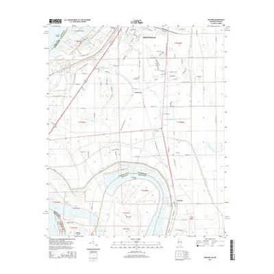
 2011 Wayside2011 Print · USGSCovers Wayside, including Greenville, Swiftwater, and other nearby areas
 - 2012 Map of Wayside, 2012 Print
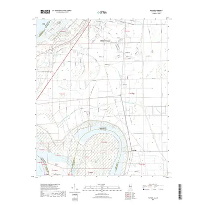
 2012 Wayside2012 Print · USGSCovers Wayside, including Greenville, Swiftwater, and other nearby areas
 - 2015 Map of Wayside, 2015 Print
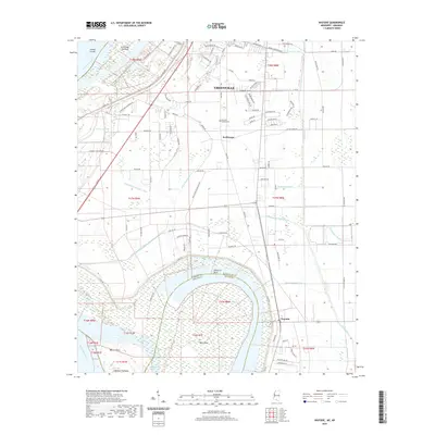
 2015 Wayside2015 Print · USGSCovers Wayside, including Greenville, Swiftwater, and other nearby areas
 - 2018 Map of Wayside, 2018 Print
 2018 Wayside2018 Print · USGSCovers Wayside, including Greenville, Swiftwater, and other nearby areas
 - 2020 Map of Wayside, 2020 Print
 2020 Wayside2020 Print · USGSCovers Wayside, including Greenville, Swiftwater, and other nearby areas
 - 2024 Map of Wayside, 2024 Print
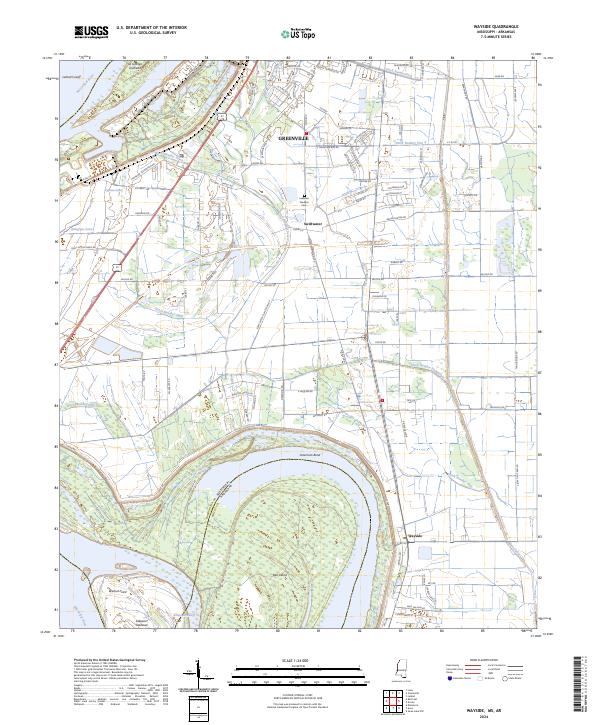 2024 Wayside2024 Print · USGSThe Mississippi Delta south of Greenville is captured here in its modern agricultural and riverine state. Researchers can trace the shifting river boundary near American Bend and locate family landmarks like Lakeview Gardens Cem or the settlement at Wayside.
End of results
Showing maps 1-12 of 12
Top cities near Wayside
- Greenville historical maps
- Leland historical maps
- Hollandale historical maps
- Eudora historical maps
- Metcalfe historical maps
- Arcola historical maps
Frequently asked questions
- What are the different types of historical maps available for Wayside?
- What is the oldest map of Wayside?
- Where can I purchase historical maps of Wayside for my home or office?
- Where can I download high-res historical maps of Wayside?
- Are there historical topographic maps available for Wayside?
- Is there historical aerial imagery available for Wayside?
- Where are historical maps of Wayside sourced from?