Old Maps of Brashear, Missouri
Explore 15 old maps of Brashear, spanning from 1903 to today. These high-resolution historic maps reveal how streets, neighborhoods, landmarks, and natural features evolved over time — perfect for genealogy, metal detecting, research, and local history exploration.
What you can do with these maps:
- See how Brashear changed over time: Compare historical maps to modern-day views to trace roads, homesites, rail lines & more.
- View detailed metadata: Each map includes creators, publishers, year, scale, and archive source.
- Overlay maps with satellite & LiDAR: Visualize the past alongside modern tools to explore terrain & human change.
- Trusted historical sources: Maps sourced from the USGS, Library of Congress, and other archives.
- Access maps your way: View online, download high-res files, or order prints for personal or research use.
Start exploring old maps of Brashear to uncover forgotten places, hidden landmarks, and the deep history beneath your feet.
Brashear, MO maps
(15)- 1903 Map of Edina
 1903 Edina1903 Print · USGSNortheast Missouri at the turn of the century shows a bustling landscape of rail-fed market towns and river valley townships. Researchers can trace the path of the Santa Fe Railroad through Baring or locate early settlements like Pleasant Retreat and Bible Grove.2 unique versions available
 - 1954 Map of Centerville, 1967 Print
 1954 Centerville1967 Print · USGSThe Iowa-Missouri borderlands at mid-century reveal a landscape shaped by river valleys and the height of the regional rail network. Genealogists and historians can trace the paths of the Wabash railroad and locate old townsites like Mystic, Moulton, and Greentop.3 unique versions available
 - 1957 Map of Centerville
 1957 Centerville1957 Print · USGSThe Iowa-Missouri borderlands in the mid-fifties reveal a landscape of river-valley agriculture and vital rail corridors. Genealogists and historians can trace family-named landmarks and small-town growth in Centerville, Kirksville, and along the Wabash railroad line.
 - 1958 Map of Centerville
 1958 Centerville1958 Print · USGSThe Iowa-Missouri borderlands come into focus during the mid-fifties, showing a landscape defined by river valleys and intersecting rail lines. Genealogists and local historians can trace family roots through dozens of rural hubs like Bloomfield, Unionville, and Corydon.
 - 1966 Map of Brashear, 1967 Print
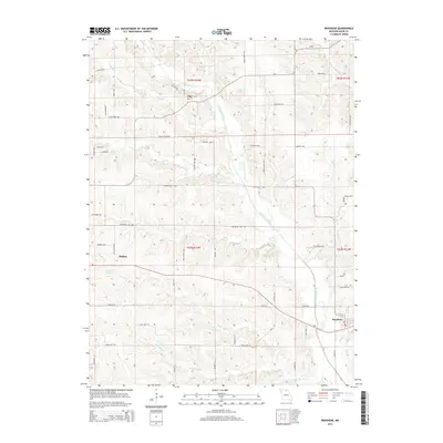
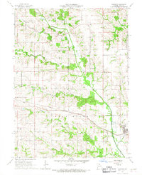 1966 Brashear1967 Print · USGSEastern Adair County comes alive in the mid-sixties, showing a landscape defined by the railroad and the many forks of the Salt River. Genealogists can trace family roots through East Center Ch, Sabbath Home Ch, and the small settlements of Bullion and Clay.
 - 1966 Map of Hurdland, 1967 Print
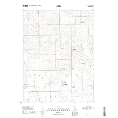
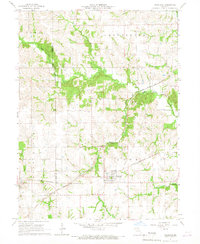 1966 Hurdland1967 Print · USGSThe rail-driven landscape of Adair and Knox counties is preserved here in the mid-sixties, centered on the crossing of two major Midwestern lines. Genealogists and rail historians can trace the paths of the Atchison Topeka and Santa Fe through Hurdland and locate the Paultown Cem near the Salt River.
 - 1981 Map of Kirksville, 1982 Print
 1981 Kirksville1982 Print · USGSNortheast Missouri in the early eighties was a landscape of rail-connected trade towns and significant river valleys. Researchers can trace the legacy of medical education at the Kirksville College of Osteopathic Med or locate family roots in Unionville, Edina, and Bible Grove.
 - 2012 Map of Hurdland, 2012 Print
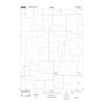 2012 Hurdland2012 Print · USGSCovers Brashear, including Hurdland, Paultown, and other nearby areas
 - 2012 Map of Brashear, 2012 Print
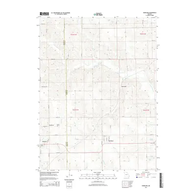
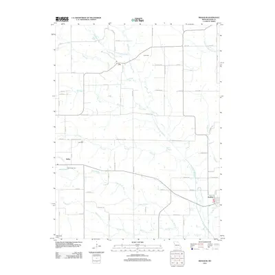 2012 Brashear2012 Print · USGSCovers Brashear, including Bullion, Clay, and other nearby areas
 - 2015 Map of Hurdland, 2015 Print
 2015 Hurdland2015 Print · USGSCovers Brashear, including Hurdland, Paultown, and other nearby areas
 - 2015 Map of Brashear, 2015 Print
 2015 Brashear2015 Print · USGSCovers Brashear, including Bullion, Clay, and other nearby areas
 - 2017 Map of Brashear, 2017 Print
 2017 Brashear2017 Print · USGSCovers Brashear, including Bullion, Clay, and other nearby areas
 - 2017 Map of Hurdland, 2017 Print
 2017 Hurdland2017 Print · USGSCovers Brashear, including Hurdland, Paultown, and other nearby areas
 - 2021 Map of Brashear, 2021 Print
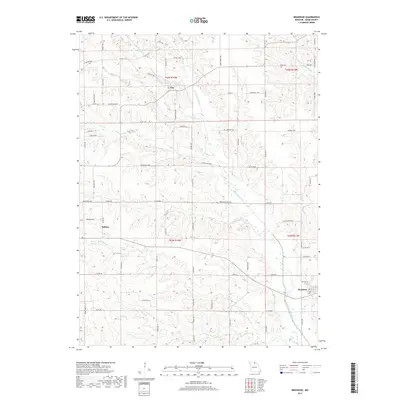
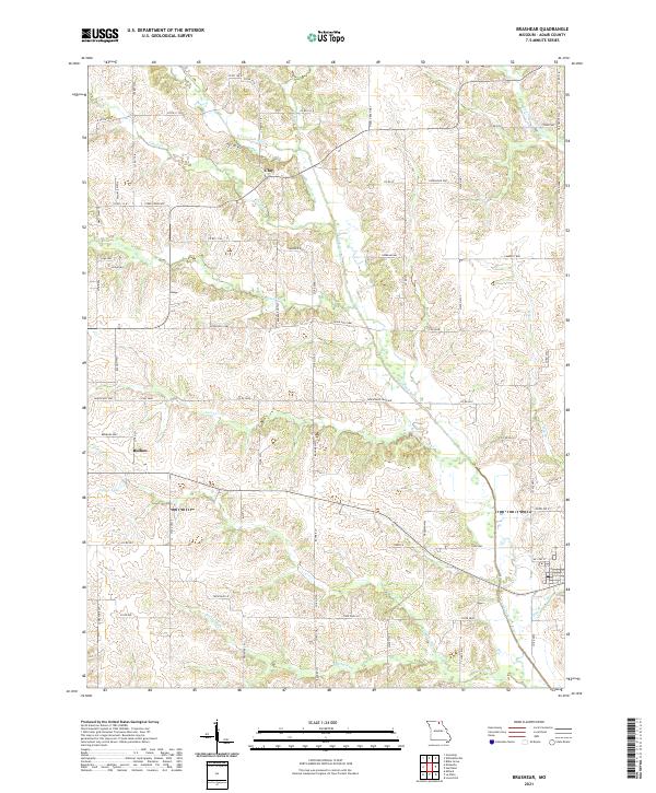 2021 Brashear2021 Print · USGSAdair County farmland and the winding N Fork Salt River are captured here in the early twenty-first century. Genealogists and local historians can trace the road networks around Clay and Bullion or locate landmarks like Patten Lake.
 - 2021 Map of Hurdland, 2021 Print
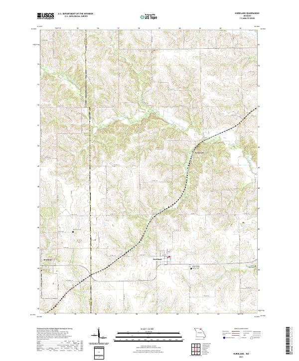 2021 Hurdland2021 Print · USGSThe rural border of Adair and Knox counties comes into focus in this recent survey of Northeast Missouri farm country. Genealogists and local historians can trace family sites at Brashear Cem and Rock Creek Cem or locate the small communities of Hurdland and Kenwood.
End of results
Showing maps 1-15 of 15
Top cities near Brashear
- Kirksville historical maps
- La Plata historical maps
- Edina historical maps
- Hurdland historical maps
- Baring historical maps
- Novelty historical maps
See more
Frequently asked questions
- What are the different types of historical maps available for Brashear?
- What is the oldest map of Brashear?
- Where can I purchase historical maps of Brashear for my home or office?
- Where can I download high-res historical maps of Brashear?
- Are there historical topographic maps available for Brashear?
- Is there historical aerial imagery available for Brashear?
- Where are historical maps of Brashear sourced from?