1930s Maps of Schlatitz, Missouri
Explore 2 historic maps of Schlatitz from the 1930s. These maps offer a rare glimpse into what life looked like during the 1930s — showing old roads, neighborhoods, homes, and landmarks that have changed or disappeared over time.
Whether you're researching your family's past, planning a metal detecting trip, or studying how Schlatitz's landscape evolved across the 1930s, these high-resolution maps are a powerful tool for exploring the history of this region.
- Focus on a specific era: All maps on this page are from the 1930s, giving you a focused view of this time period.
- See what’s changed: Compare century-old streets, trails, and buildings to today's modern landscape using overlays and satellite layers.
- Research with precision: Use these maps for genealogy, historical research, land use analysis, or educational projects.
- View, download, or print: Maps are fully viewable online in high resolution, and can be downloaded or printed for your own records.
Start exploring Schlatitz's history through authentic maps from the 1930s. This is your window into the past.
Schlatitz, MO maps
(2)- 1934 Map of Advance
 1934 Advance1934 Print · USGSSoutheast Missouri in the 1930s is mapped here during a period of major hydrological change and railroad activity. You can trace the Diversion Channel across the landscape or find rural schools and family burial sites like Toga No 2 Sch and St Joseph Cem.3 unique versions available
 - 1939 Map of Advance, 1942 Print
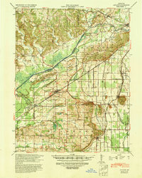 1939 Advance1942 Print · USGSSoutheast Missouri in the late thirties is defined here by its massive drainage projects and thriving rail towns. Researchers can trace the heritage of rural communities through dozens of local landmarks like Cruse Cem, Dongola Sch, and Union Grove Ch.
End of results
Showing maps 1-2 of 2
Top cities near Schlatitz
- Marble Hill historical maps
- Advance historical maps
- Puxico historical maps
- Bell City historical maps
- Whitewater historical maps
- Zalma historical maps
Frequently asked questions
- What are the different types of historical maps available for Schlatitz?
- What is the oldest map of Schlatitz?
- Where can I purchase historical maps of Schlatitz for my home or office?
- Where can I download high-res historical maps of Schlatitz?
- Are there historical topographic maps available for Schlatitz?
- Is there historical aerial imagery available for Schlatitz?
- Where are historical maps of Schlatitz sourced from?