Old Maps of Angus, Missouri
Explore 11 old maps of Angus, spanning from 1935 to today. These high-resolution historic maps reveal how streets, neighborhoods, landmarks, and natural features evolved over time — perfect for genealogy, metal detecting, research, and local history exploration.
What you can do with these maps:
- See how Angus changed over time: Compare historical maps to modern-day views to trace roads, homesites, rail lines & more.
- View detailed metadata: Each map includes creators, publishers, year, scale, and archive source.
- Overlay maps with satellite & LiDAR: Visualize the past alongside modern tools to explore terrain & human change.
- Trusted historical sources: Maps sourced from the USGS, Library of Congress, and other archives.
- Access maps your way: View online, download high-res files, or order prints for personal or research use.
Start exploring old maps of Angus to uncover forgotten places, hidden landmarks, and the deep history beneath your feet.
Angus, MO maps
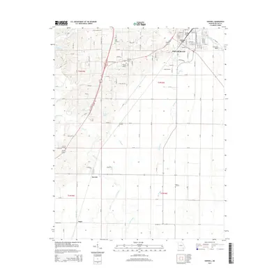
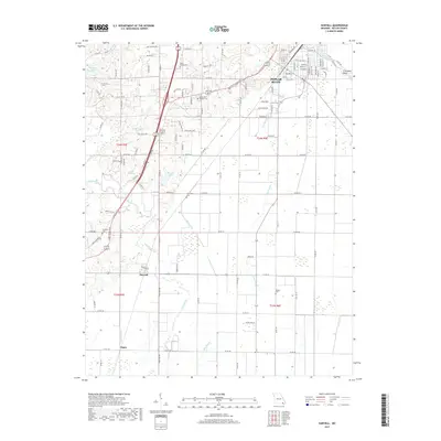
(11)- 1935 Map of Harviell, 1943 Print
 1935 Harviell1943 Print · USGSButler County in the mid-1930s was a landscape of river bends and scattered rural schoolhouses along the St Louis San Francisco Railroad. Genealogists can trace family roots at Black Creek Ch & Cem or locate vanished local schools like Gillis Bluff Sch and Havam Sch.2 unique versions available
 - 1957 Map of Poplar Bluff, 1968 Print
 1957 Poplar Bluff1968 Print · USGSThe Missouri-Arkansas border region is captured here as the timber and rail industries shaped the Ozark foothills. Genealogists and historians can trace the Missouri Pacific Railroad through river towns like Pocahontas, Greenville, and Van Buren.3 unique versions available
 - 1959 Map of Poplar Bluff
 1959 Poplar Bluff1959 Print · USGSThe Missouri Ozarks and Arkansas borderlands meet in this late 1950s study of the region's diverse terrain and rail-fed towns. Researchers can trace the path of the Missouri Pacific Railroad through Poplar Bluff or locate smaller settlements like Birch Tree and Myrtle.
 - 1960 Map of Poplar Bluff
 1960 Poplar Bluff1960 Print · USGSSoutheast Missouri and Northeast Arkansas are captured here during the post-war era, showing the transition from the Ozark highlands to the Delta. Genealogists and historians can trace rail corridors like the St. Louis Southwestern RR and remote settlements such as Birch Tree and Warm Springs.
 - 1964 Map of Harviell, 1965 Print
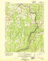
 1964 Harviell1965 Print · USGSSouthern Butler County in the mid-sixties reveals a landscape shaped by the Black River and the crossroads at Harviell. Local researchers can trace family roots through numerous sites like Black Creek Ch Cem, Eugene Field Sch, and the Lone Star Ch.3 unique versions available
 - 1964 Map of Harviell, 1968 Print
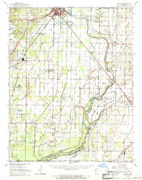 1964 Harviell1968 Print · USGSButler County in the mid-sixties reveals a landscape defined by the drainage of the Missouri Bootheel and the growth of Poplar Bluff. Genealogists can trace family names at Melton Cem and Kelly Cem or locate vanished rural schoolhouses like Willow Oak Sch.3 unique versions available
 - 1983 Map of Poplar Bluff
 1983 Poplar Bluff1983 Print · USGSSoutheast Missouri in the early 1980s reveals a landscape defined by the Ozark foothills and the complex drainage systems of the Bootheel. Researchers can trace the rail corridors of the Missouri Pacific RR through Poplar Bluff or locate rural sites like Wilhelmina Church and Lone Hill Lookout.
 - 2011 Map of Harviell, 2011 Print
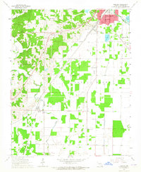
 2011 Harviell2011 Print · USGSCovers Angus, including Poplar Bluff, Harviell, and other nearby areas
 - 2015 Map of Harviell, 2015 Print
 2015 Harviell2015 Print · USGSCovers Angus, including Poplar Bluff, Harviell, and other nearby areas
 - 2017 Map of Harviell, 2017 Print
 2017 Harviell2017 Print · USGSCovers Angus, including Poplar Bluff, Harviell, and other nearby areas
 - 2021 Map of Harviell, 2021 Print
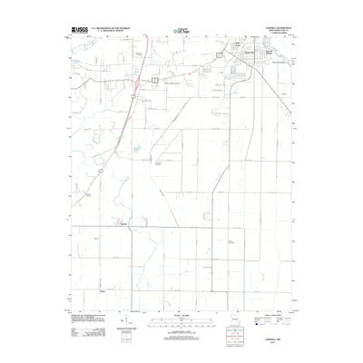
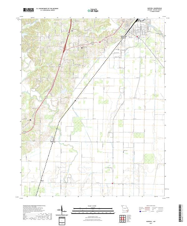 2021 Harviell2021 Print · USGSThe southern outskirts of Poplar Bluff meet the drainage lowlands of Butler County in this contemporary survey. Researchers can trace the Union Pacific RR through Harviell and locate local burial grounds like Melton Cem and Friendship Cem.
End of results
Showing maps 1-11 of 11
Top cities near Angus
- Poplar Bluff historical maps
- Corning historical maps
- Naylor historical maps
- Neelyville historical maps
- Qulin historical maps
- Pollard historical maps
See more
Frequently asked questions
- What are the different types of historical maps available for Angus?
- What is the oldest map of Angus?
- Where can I purchase historical maps of Angus for my home or office?
- Where can I download high-res historical maps of Angus?
- Are there historical topographic maps available for Angus?
- Is there historical aerial imagery available for Angus?
- Where are historical maps of Angus sourced from?