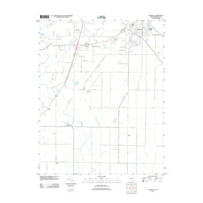
2011 Map of Harviell
USGS Topo · Published 2011About this map
Harviell serves as a central hub in this corner of Butler County, where the landscape is defined by an intricate network of drainage ditches and waterways. The map illustrates a transition from the structured residential blocks of Kelly Town and Vinegar Hill in the north to the more rural, aquatic environments of the south. Water management is a dominant theme, evidenced by the prominent Craven Ditch and Harviell Ditch which cut across the terrain to manage the flow toward Pike Slough. Genealogists will find significant value in the distribution of local burial grounds, including Black Creek Cemetery, Memorial Gardens Cemetery, and the more isolated Dunning Cemetery near the western edge. The presence of Ashcroft Addition and Alfrey near the Black River corridor highlights the early 21st-century residential footprint of the area surrounding Poplar Bluff.
Find a feature on this map
90 named features on this map. Tap any name to fly to it.
Don’t see what you’re looking for? This feature index may not catch every label — zoom into the map to look around manually.
Map Details
Editions of this 2011 Harviell Map
This is the sole edition of this map. No revisions or reprints were ever made.
Other maps of this area

1934 · Williamsville
USGS Topo · 1:48,000

1935 · Poplar Bluff
USGS Topo · 1:62,500

1935 · Acorn
USGS Topo · 1:62,500

1935 · Harviell
USGS Topo · 1:62,500

1939 · Poplar Bluff
USGS Topo · 1:62,500

1940 · Williamsville
USGS Topo · 1:62,500

1940 · Naylor
USGS Topo · 1:62,500

1944 · Naylor
USGS Topo · 1:62,500

1949 · Poplar Bluff
USGS Topo · 1:62,500

1957 · Poplar Bluff
USGS Topo · 1:250,000