
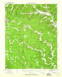
1934 Map of Williamsville
USGS Topo · Published 1934About this map
The Missouri Pacific and St Louis San Francisco railroads intersect at Williamsville, a central hub in this 1934 landscape where Wayne, Butler, Carter, and Ripley counties meet. The survey reveals a settled backcountry defined by narrow ridges and hollows, such as Cane Hollow and S Fork Hollow, where local life centered around remote schools and rural congregations. Small communities like Ellsinore and the uniquely named Budapest appear alongside industrial or rail-dependent markers like Mill Town and Orchard Switch.
Find a feature on this map
74 named features on this map. Tap any name to fly to it.
Don’t see what you’re looking for? This feature index may not catch every label — zoom into the map to look around manually.
Map Details
Editions of this 1934 Williamsville Map
4 editions found
Other maps of this area

1932 · Piedmont
USGS Topo · 1:62,500

1934 · Greenville
USGS Topo · 1:62,500

1935 · Poplar Bluff
USGS Topo · 1:62,500

1935 · Piedmont
USGS Topo · 1:62,500

1935 · Acorn
USGS Topo · 1:62,500

1935 · Harviell
USGS Topo · 1:62,500

1939 · Greenville
USGS Topo · 1:62,500

1939 · Poplar Bluff
USGS Topo · 1:62,500

1939 · Doniphan
USGS Topo · 1:62,500

1940 · Williamsville
USGS Topo · 1:62,500