Old Maps of Wayne County, Missouri
Explore 154 old maps of Wayne County, spanning from 1926 to today. These high-resolution historic maps reveal how streets, neighborhoods, landmarks, and natural features evolved over time — perfect for genealogy, metal detecting, research, and local history exploration.
What you can do with these maps:
- See how Wayne County changed over time: Compare historical maps to modern-day views to trace roads, homesites, rail lines & more.
- View detailed metadata: Each map includes creators, publishers, year, scale, and archive source.
- Overlay maps with satellite & LiDAR: Visualize the past alongside modern tools to explore terrain & human change.
- Trusted historical sources: Maps sourced from the USGS, Library of Congress, and other archives.
- Access maps your way: View online, download high-res files, or order prints for personal or research use.
Start exploring old maps of Wayne County to uncover forgotten places, hidden landmarks, and the deep history beneath your feet.
Wayne County, MO maps
(154)- 1926 Map of Des Arc, 1960 Print
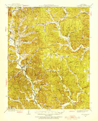
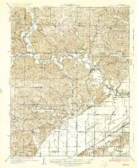
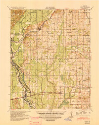
 1926 Des Arc1960 Print · USGSIron and Wayne County hills are captured here in the mid-1920s, showing a landscape defined by the Missouri Pacific rail line. Genealogists can locate family-named landmarks like Emilys Chapel and numerous rural schoolhouses from Glover Sch to Brunot Sch.2 unique versions available
 - 1929 Map of Des Arc
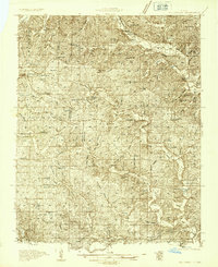
 1929 Des Arc1929 Print · USGSIron and Madison counties in the late 1920s show a landscape of mountain hollows and railroad towns. Trace the Missouri Pacific line through Des Arc and Annapolis, or locate ancestral sites like Emily's Chapel and the Jewett Sch.3 unique versions available
 - 1930 Map of Coldwater
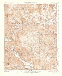
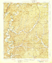 1930 Coldwater1930 Print · USGSMadison County's rugged river valleys and early Ozark settlements are documented here between the world wars. Genealogists can trace family roots at Revelle Cem, early river crossings like Wade Ford, and local centers like Coldwater or French Mills.4 unique versions available
 - 1932 Map of Piedmont, 1955 Print
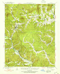 1932 Piedmont1955 Print · USGSThe Ozark foothills come to life in the early 1930s, showing a landscape defined by the Black Missouri River and the railroad. Genealogists can trace family roots through numerous rural landmarks like Hog Eye Sch, Dees Chapel, and the community of Patterson.2 unique versions available
 - 1933 Map of Marquand, 1966 Print
 1933 Marquand1966 Print · USGSMadison and Bollinger counties are shown in the early 1930s, documenting a landscape defined by the Missouri Pacific rail corridor and the Castor River. Genealogists can trace family landmarks like Younts Store, the Starkey Mine, and numerous remote burial grounds including the Whitener Cem.2 unique versions available
 - 1934 Map of Greenville
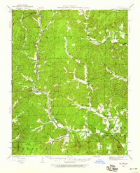
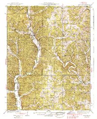
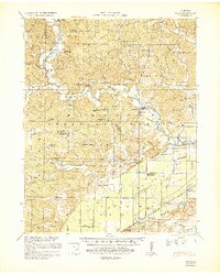
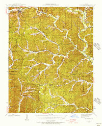
 1934 Greenville1934 Print · USGSWayne County, Missouri, is shown here in the mid-1930s, documenting a landscape of tight-knit river communities and rural hill schools. Genealogists can trace family landmarks like Smoot Cem, locate the CCC Camp, or find local centers like Silva PO and Holmes Chapel Sch & Ch.2 unique versions available
 - 1934 Map of Williamsville
 1934 Williamsville1934 Print · USGSThe Ozark foothills near the Wayne and Butler county line come into focus during the mid-1930s, showing a landscape of timbered hollows and nascent highways. Researchers can locate vanished rural landmarks like the Lone Star School, Kearney Cem, and the specialized Keener Cave Resort.4 unique versions available
 - 1934 Map of Puxico
 1934 Puxico1934 Print · USGSThe Missouri Bootheel comes into focus during the 1930s as drainage projects and rail lines reshape the swampy lowlands. Genealogists can locate dozens of country schools like Wilkerson Sch and Zoll Sch, or trace the tracks of the St Louis San Francisco through Puxico.2 unique versions available
 - 1935 Map of Poplar Bluff
 1935 Poplar Bluff1935 Print · USGSSoutheast Missouri’s river-and-rail landscape is captured here in the mid-thirties as the timber and agricultural economy flourished. Trace family homesteads near Taskee Sta, identify old rural schools like Snyder Sch, and follow the original routes of the Missouri Pacific.3 unique versions available
 - 1935 Map of Zalma
 1935 Zalma1935 Print · USGSSoutheast Missouri in the mid-1930s reveals a landscape undergoing transformation through massive drainage projects and the reach of the rail. Trace old schoolhouses like Patterson Sch, vanished landmarks like Sitzke Store, and the path of the St Louis San Francisco railroad.3 unique versions available
 - 1935 Map of Piedmont
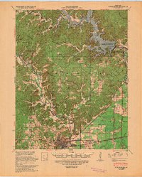
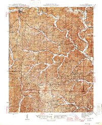
 1935 Piedmont1935 Print · USGSWayne County is shown in the mid-1930s as a landscape of timbered ridges and river valleys centered on the rail hub of Piedmont. Genealogists can trace family landmarks like Watkins Store or locate rural centers like Gads Hill and Dees Chapel Sch.2 unique versions available
 - 1938 Map of Marquand
 1938 Marquand1938 Print · USGSThe Missouri Ozarks borderlands appear here in the late 1930s, showing a landscape of river-valley towns and hilltop mines. Researchers can trace ancestral locations through dozens of rural sites, including Rhodes Chapel, Starke Mine, and the Marquand rail depot.2 unique versions available
 - 1939 Map of Greenville
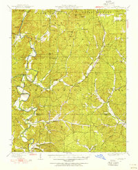
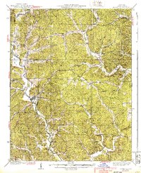 1939 Greenville1939 Print · USGSWayne County during the late thirties reveals a landscape of tight-knit river communities and rural schools along the St Francis River. Genealogists and historians can trace local family roots through sites like Montgomery Ch, Bounds Cem, and the CCC Camp.2 unique versions available
 - 1939 Map of Puxico, 1942 Print
 1939 Puxico1942 Print · USGSSoutheast Missouri's bootheel region comes to life in the late 1930s, showing a landscape defined by extensive drainage projects and burgeoning rail towns. Trace the locations of rural schoolhouses like Edmundson Sch and lost junctions along the St Louis - San Francisco Ry.
 - 1939 Map of Zalma, 1943 Print
 1939 Zalma1943 Print · USGSSoutheast Missouri’s river hills and delta margins are captured here in the late thirties, as the region’s drainage and rail networks were undergoing significant change. Genealogists can trace family names through landmarks like the Buchanan Post Office, Bright Prospect Ch, and Snake Bluff School No 2.2 unique versions available
 - 1939 Map of Poplar Bluff, 1949 Print
 1939 Poplar Bluff1949 Print · USGSSoutheast Missouri’s river-and-rail hub is captured here during the transformative period when the Black River was being dammed. Genealogists can trace family names across a landscape of schools and churches like Baskey Sch, Butler Cem, and Taskee Sta.
 - 1940 Map of Williamsville
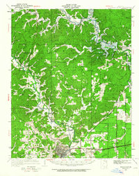
 1940 Williamsville1940 Print · USGSThe eastern Ozarks at the start of the 1940s reveal a bustling rail-and-river economy centered on the junction of the Missouri Pacific and St Louis - San Francisco. Researchers can trace the unique immigrant history of Budapest or locate vanished landmarks like the Fire Tower CCC Camp and Barrett Mine.2 unique versions available
 - 1943 Map of Ellington, 1956 Print
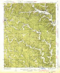
 1943 Ellington1956 Print · USGSThe Reynolds County timberlands and river valleys are captured here in the 1940s as the local landscape faced significant change. Genealogists can trace family footprints through numerous rural landmarks like Pine Valley Cem, Garwood, and Carter Mill Sch.
 - 1945 Map of Ellington
 1945 Ellington1945 Print · USGSThe Missouri Ozarks are captured here during the mid-forties, showing the deep-valley settlements of Reynolds and Carter counties. Genealogists can locate family landmarks such as Newton Cem, Doe Run Ch, and the Upper Doe Run Sch.2 unique versions available
 - 1949 Map of Rolla, 1950 Print
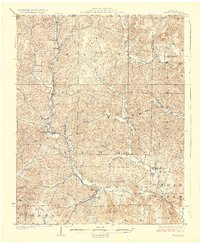
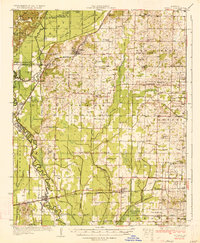
 1949 Rolla1950 Print · USGSThe Missouri Ozarks are captured here just after the war, showing a landscape of deep river valleys and emerging reservoir projects. Genealogists and historians can trace the mining towns of Bonne Terre and Potosi or follow the early route of U.S. Highway 66.
 - 1949 Map of Coldwater, 1955 Print
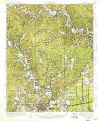
 1949 Coldwater1955 Print · USGSThe Madison County Ozarks are mapped here in the late 1940s, showing a landscape of river bends and mountain ridges before modern development. Researchers can trace rural life through sites like French Mills, the Revelle Cem, and several river crossings including Reed Bend Ford.2 unique versions available
 - 1949 Map of Poplar Bluff, 1964 Print
 1949 Poplar Bluff1964 Print · USGSThe area surrounding Poplar Bluff is shown during a period of transition as the Ozark hills meet the engineered drainage canals of the lowlands. Researchers can trace the St Louis San Francisco railroad through rural stops like Chaonia and Taskee Sta.
 - 1953 Map of Rolla
 1953 Rolla1953 Print · USGSSoutheast Missouri’s mining towns and timberlands are seen here at the start of the 1950s. Genealogists and historians can trace the rail-and-river economy through local hubs like Fredericktown and the lead-mining heritage of Potosi and Desloge.
 - 1954 Map of Rolla, 1970 Print
 1954 Rolla1970 Print · USGSThe Missouri Ozarks and the historic Lead Belt are captured in the late sixties, showing a landscape of deep river hollows and industrial mines. Researchers can trace the routes of the Missouri Pacific RR to extraction sites like the Iron Mountain Mine or Pea Ridge Mine.2 unique versions available
 - 1957 Map of Poplar Bluff, 1968 Print
 1957 Poplar Bluff1968 Print · USGSThe Missouri-Arkansas border region is captured here as the timber and rail industries shaped the Ozark foothills. Genealogists and historians can trace the Missouri Pacific Railroad through river towns like Pocahontas, Greenville, and Van Buren.3 unique versions available
Showing maps 1-25 of 154
Top cities of Wayne County
- Piedmont historical maps
- Greenville historical maps
- Williamsville historical maps
- Mill Spring historical maps
Frequently asked questions
- What are the different types of historical maps available for Wayne County?
- What is the oldest map of Wayne County?
- Where can I purchase historical maps of Wayne County for my home or office?
- Where can I download high-res historical maps of Wayne County?
- Are there historical topographic maps available for Wayne County?
- Is there historical aerial imagery available for Wayne County?
- Where are historical maps of Wayne County sourced from?