2020s Maps of Wayne County, Missouri
Explore 24 historic maps of Wayne County from the 2020s. These maps offer a rare glimpse into what life looked like during the 2020s — showing old roads, neighborhoods, homes, and landmarks that have changed or disappeared over time.
Whether you're researching your family's past, planning a metal detecting trip, or studying how Wayne County's landscape evolved across the 2020s, these high-resolution maps are a powerful tool for exploring the history of this region.
- Focus on a specific era: All maps on this page are from the 2020s, giving you a focused view of this time period.
- See what’s changed: Compare century-old streets, trails, and buildings to today's modern landscape using overlays and satellite layers.
- Research with precision: Use these maps for genealogy, historical research, land use analysis, or educational projects.
- View, download, or print: Maps are fully viewable online in high resolution, and can be downloaded or printed for your own records.
Start exploring Wayne County's history through authentic maps from the 2020s. This is your window into the past.
Wayne County, MO maps
(24)- 2021 Map of Piedmont SE, 2021 Print
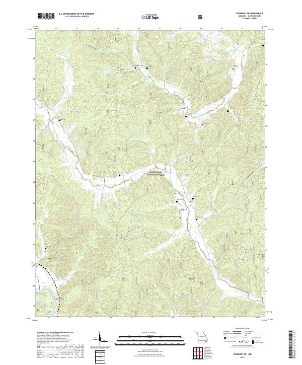 2021 Piedmont SE2021 Print · USGSThe Ozark foothills of Wayne County are shown here in the 2020s, dominated by the heavily timbered tracts of the Mark Twain National Forest. Family researchers can trace ancestral sites through local landmarks like Granite Bend, Meador Valley, and the Pigg Cem.
 - 2021 Map of Mill Spring, 2021 Print
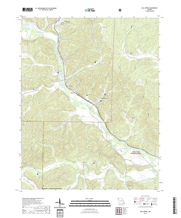 2021 Mill Spring2021 Print · USGSModern-day Mill Spring and Leeper are traced here along the Black River as they appeared in 2021. Genealogists can locate several family burial sites, including Warmack Cem, Scott Cem, and Leeper Cem, tucked within the ridges of the Mark Twain National Forest.
 - 2021 Map of Piedmont, 2021 Print
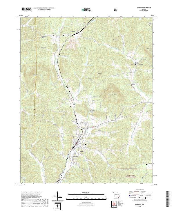 2021 Piedmont2021 Print · USGSSoutheast Missouri in the early 2020s remains a landscape of deep hollows and family homesteads within the Ozarks. Genealogists and historians can trace numerous rural burial sites like Anderson Cemetery and the Peach Tree Church Cemetery, or locate the settlements of Beckville and Gads Hill.
 - 2021 Map of Patterson, 2021 Print
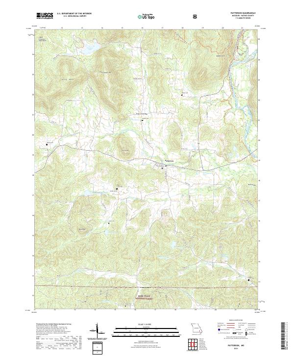 2021 Patterson2021 Print · USGSWayne County is shown here in the early 2020s, featuring the settlement of Patterson surrounded by the steep peaks of the Saint Francois Mountains. Genealogists can locate several local burial sites like English Cem and Julian Cem, or trace the historical Black Bridge crossing.
 - 2021 Map of Sturdivant, 2021 Print
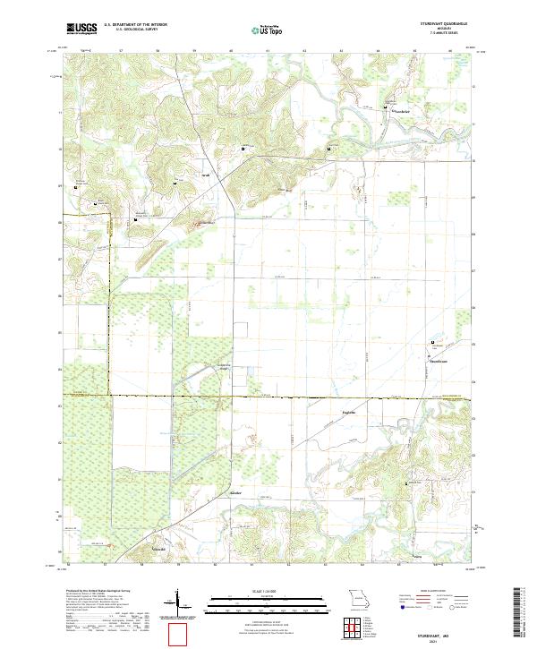 2021 Sturdivant2021 Print · USGSSoutheast Missouri's wet lowlands and bluff-lined ridges come into focus in this modern record of Bollinger County. Researchers can trace rural lineages through numerous family sites like Beatty Cem and Stratman Chapel Cem or locate the village of Sturdivant.
 - 2021 Map of Cascade, 2021 Print
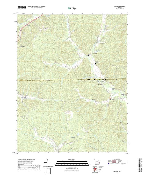 2021 Cascade2021 Print · USGSMadison and Wayne Counties are shown in the early twenty-first century, revealing a landscape of high Ozark ridges and deeply incised hollows. Genealogists can locate several family burial grounds like Graham Cem and Berry Cem near the communities of Gravelton and Buckhorn.
 - 2021 Map of Hendrickson, 2021 Print
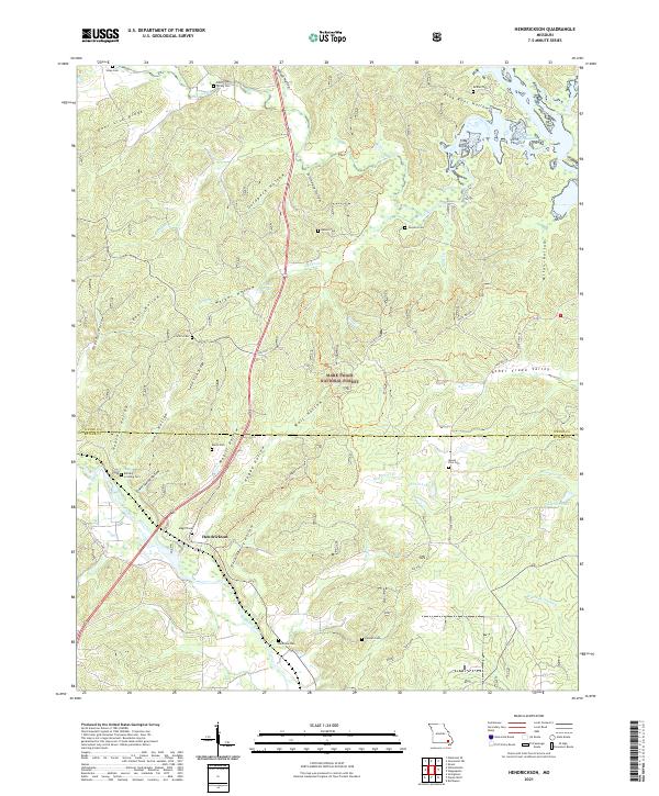 2021 Hendrickson2021 Print · USGSThe rural border of Wayne and Butler Counties comes into focus in this recent survey of the Missouri Ozarks. Genealogists and researchers can trace local family lineages through a high density of burial sites like Keele Cem, Mount Zion Cem, and Military Crossing Cem.
 - 2021 Map of Williamsville, 2021 Print
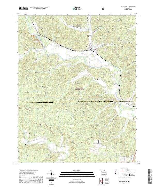 2021 Williamsville2021 Print · USGSThe Black River valley in southern Missouri is shown here in the early twenty-first century as it winds through the Mark Twain National Forest. Family researchers can locate rural landmarks like Flatwoods School and several burial sites including Holliday Cem and Shiloh Cem.
 - 2021 Map of Clearwater Dam, 2021 Print
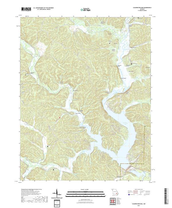 2021 Clearwater Dam2021 Print · USGSIn the Ozark foothills at the turn of the decade, this survey captures the intersection of water management and rural life. Genealogists can locate family-named landmarks like Pinedale Cem, Carter Spring, and Webb Valley near Clearwater Dam.
 - 2021 Map of Allbright, 2021 Print
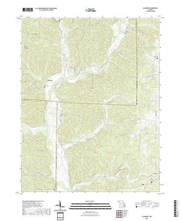 2021 Allbright2021 Print · USGSThe foothills of the Missouri Ozarks are captured here in the early twenty-first century, showcasing the rural landscapes of Madison and Bollinger Counties. Researchers can find numerous ancestral burial sites like Moores Chapel Cem and Old Trace Creek Cem tucked away near the Upper Castor River.
 - 2021 Map of Greenville SW, 2021 Print
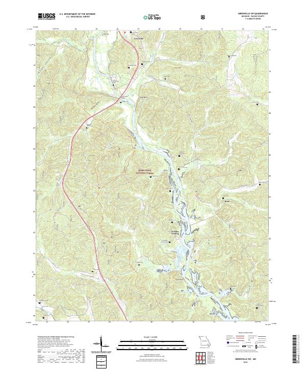 2021 Greenville SW2021 Print · USGSWayne County’s river-bottoms and ridges are captured here during a period of modern conservation and deep-rooted local history. Genealogists can trace family names across over twenty burial sites, including Old Greenville Cem and the remote Holladay-Aldrich Cem near Holliday Landing.
 - 2021 Map of Ellington SE, 2021 Print
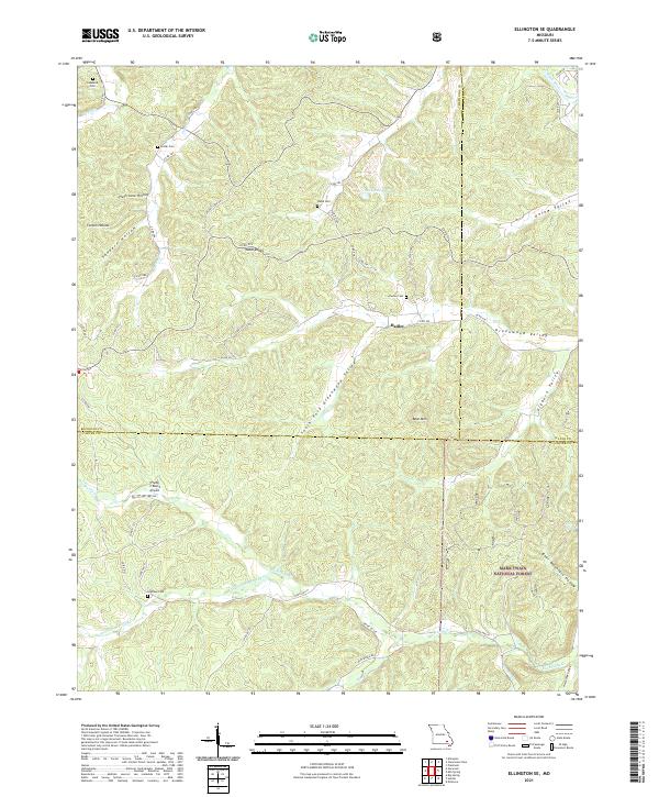 2021 Ellington SE2021 Print · USGSSoutheast Missouri at the intersection of Carter, Wayne, and Reynolds counties reveals a landscape defined by deep-seated family roots and timberlands. Genealogists and hikers can trace historical burials at Potter Cem or explore the drainage of Big Brushy Cr and Webb Cr.
 - 2021 Map of McGee, 2021 Print
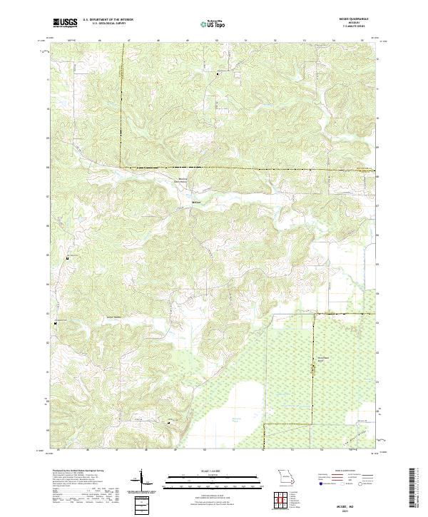 2021 McGee2021 Print · USGSWayne County and the surrounding Missouri lowlands appear in detail during this recent survey of the transition from Ozark ridges to managed wetlands. Researchers can locate family burial sites like Richmann Cem and Wilfong Cem or trace the drainage of Mingo Swamp.
 - 2021 Map of Greenville, 2021 Print
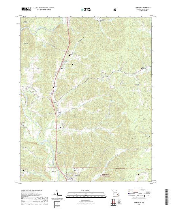 2021 Greenville2021 Print · USGSWayne County serves as a focal point in the early 2020s, where the Missouri hills meet the river valleys of the Ozarks. Researchers can trace family ties through numerous rural burial sites like Tidwell Cem and Vavak Cem or locate the Wayne County Courthouse in Greenville.
 - 2021 Map of Lowndes, 2021 Print
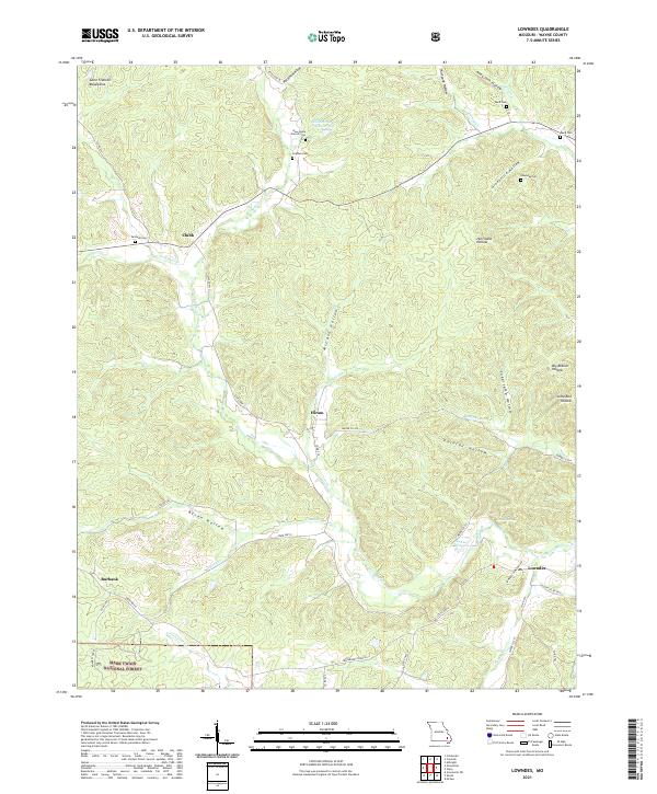 2021 Lowndes2021 Print · USGSSettlement in the eastern Ozarks follows the winding creek valleys and forest boundaries of Wayne County. Researchers can trace family roots at New Home Church Cem or locate old community hubs like Clubb, Hiram, and Burbank.
 - 2021 Map of Wappapello, 2021 Print
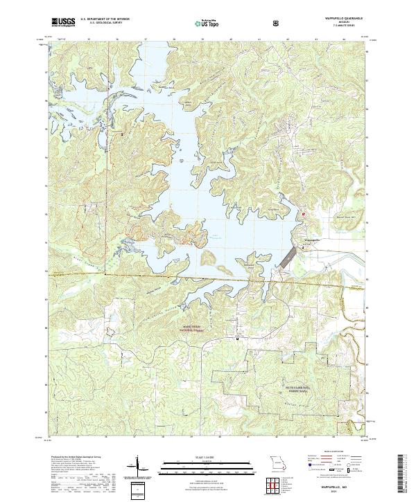 2021 Wappapello2021 Print · USGSSoutheast Missouri at the edge of the Ozarks is centered on the expansive waters of Lake Wappapello and its many wooded hollows. Genealogists and local historians can locate Kelly Cem and Little Brushy Cem near the town of Wappapello.
 - 2021 Map of Gipsy, 2021 Print
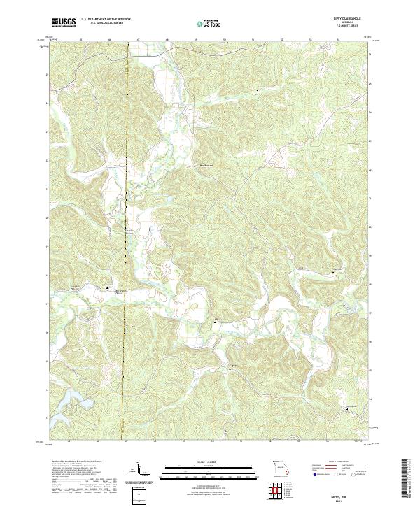 2021 Gipsy2021 Print · USGSBollinger County in the early 2020s remains a landscape of deep hollows and river bends along the Upper Castor River. Genealogists can locate several historic burial sites like Clubb Cem and Berrong Cem near the settlements of Gipsy and Buchanan.
 - 2021 Map of Des Arc, 2021 Print
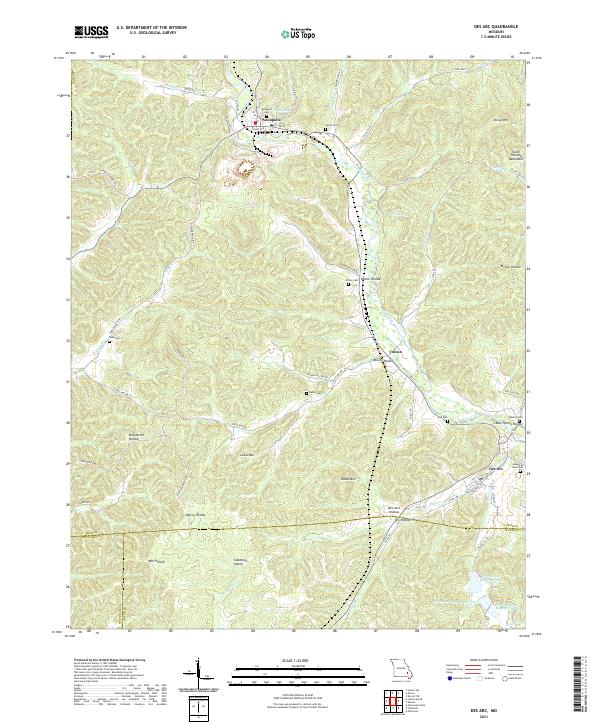 2021 Des Arc2021 Print · USGSThe northern edge of the Ozark foothills comes to life here in the early 2020s, centered on the historic communities of Annapolis and Des Arc. Researchers can trace family history through local landmarks like Slabtown Valley, Sutton Cem, and the many hollows branching off Big Creek.
 - 2021 Map of Brunot, 2021 Print
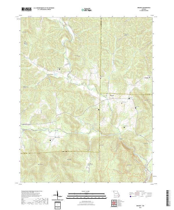 2021 Brunot2021 Print · USGSThe Missouri Ozarks are showcased at the meeting point of Iron, Madison, and Wayne counties in the early 2020s. Genealogists can locate several small family burial sites like Lucy Cem and Nichols Cem tucked between Des Arc Mtn and Big Creek.
 - 2021 Map of Shook, 2021 Print
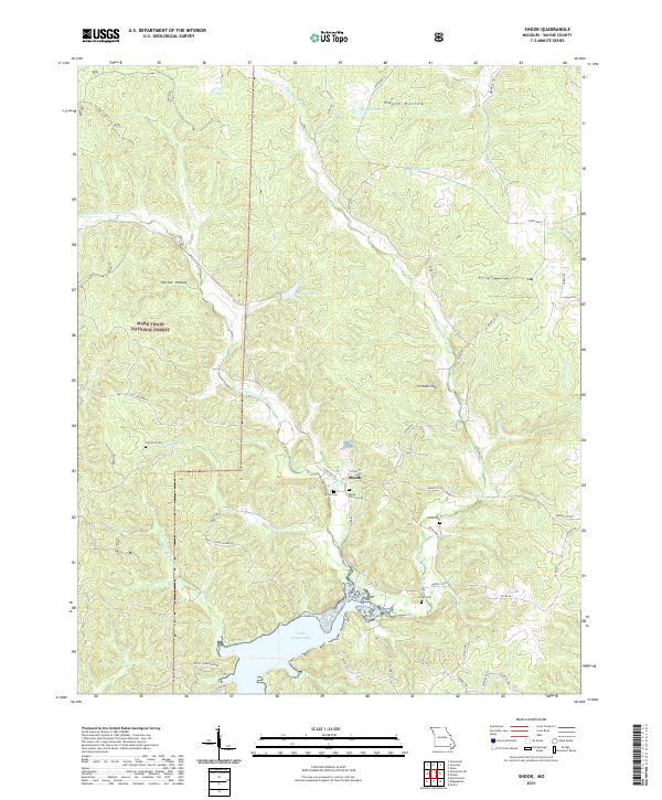 2021 Shook2021 Print · USGSSoutheast Missouri's rural landscape is captured here in the early 2020s, centered on the settlement of Shook near the upper reaches of Lake Wappapello. Genealogists and local historians can trace several community burial sites, including Shiloh Church Cem, Thornton Cem, and Helm Cem.
 - 2021 Map of Puxico, 2021 Print
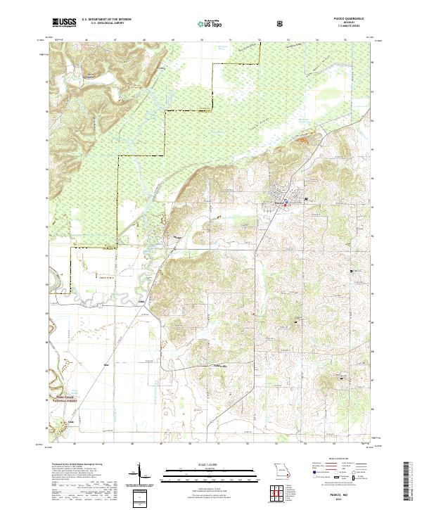 2021 Puxico2021 Print · USGSSoutheast Missouri at the edge of the Ozarks reveals a landscape of complex wetlands and timbered ridges. Researchers can trace rural lineages at Puxico Cem and Rock Hill Cem or explore the vast reaches of Mingo Swamp and the Mark Twain National Forest.
 - 2021 Map of Ellsinore, 2021 Print
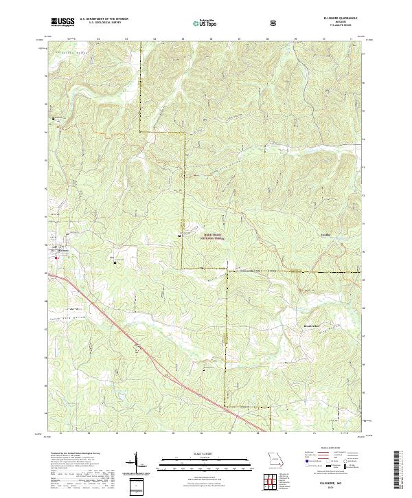 2021 Ellsinore2021 Print · USGSEllsinore and the eastern Ozarks are documented here in 2021, showing the modern character of this forested landscape. Researchers can locate family landmarks like Henson Cem and Kelly Ridge or trace the rural settlement of Upalika.
 - 2021 Map of Coldwater, 2021 Print
 2021 Coldwater2021 Print · USGSCovers Wayne County, including Saco, Shelton Ford, and other nearby areas
 - 2023 Map of Coldwater, 2023 Print
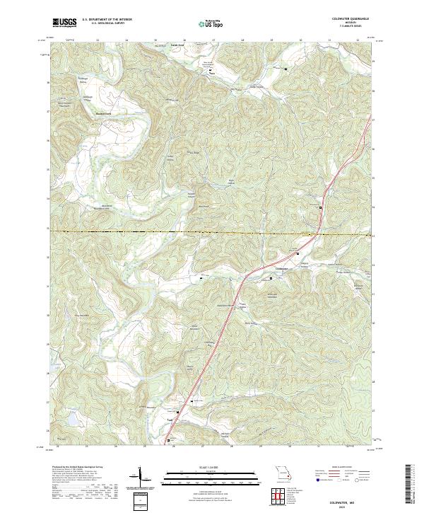 2023 Coldwater2023 Print · USGSThe foothills of the Saint Francois Mountains come alive in this survey of the Madison and Wayne County border. Genealogists can trace family footprints at New Home General Baptist Church-Cem, Saco, and Reed Bend Ford.
End of results
Showing maps 1-24 of 24
Top cities of Wayne County
- Piedmont historical maps
- Greenville historical maps
- Williamsville historical maps
- Mill Spring historical maps
Frequently asked questions
- What are the different types of historical maps available for Wayne County?
- What is the oldest map of Wayne County?
- Where can I purchase historical maps of Wayne County for my home or office?
- Where can I download high-res historical maps of Wayne County?
- Are there historical topographic maps available for Wayne County?
- Is there historical aerial imagery available for Wayne County?
- Where are historical maps of Wayne County sourced from?