Old Maps of Broseley, Missouri
Explore 11 old maps of Broseley, spanning from 1940 to today. These high-resolution historic maps reveal how streets, neighborhoods, landmarks, and natural features evolved over time — perfect for genealogy, metal detecting, research, and local history exploration.
What you can do with these maps:
- See how Broseley changed over time: Compare historical maps to modern-day views to trace roads, homesites, rail lines & more.
- View detailed metadata: Each map includes creators, publishers, year, scale, and archive source.
- Overlay maps with satellite & LiDAR: Visualize the past alongside modern tools to explore terrain & human change.
- Trusted historical sources: Maps sourced from the USGS, Library of Congress, and other archives.
- Access maps your way: View online, download high-res files, or order prints for personal or research use.
Start exploring old maps of Broseley to uncover forgotten places, hidden landmarks, and the deep history beneath your feet.
Broseley, MO maps
(11)- 1940 Map of Valley Ridge, 1943 Print
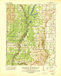 1940 Valley Ridge1943 Print · USGSDunklin and Butler counties come to life in the early 1940s, where the St Francis River winds through a landscape of new drainage ditches and high ridges. Researchers can locate family landmarks like Stephens Cem or trace old river crossings at Higginbothams Ferry.
 - 1956 Map of Valley Ridge
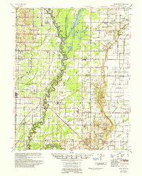 1956 Valley Ridge1956 Print · USGSDunklin and Butler counties in the mid-fifties show a landscape shaped by river transport and extensive drainage projects. Genealogists can locate many rural social hubs like Depoyster Ch & Sch, Higginbothams Ferry, and the St Louis Southwestern Railroad.
 - 1957 Map of Poplar Bluff, 1968 Print
 1957 Poplar Bluff1968 Print · USGSThe Missouri-Arkansas border region is captured here as the timber and rail industries shaped the Ozark foothills. Genealogists and historians can trace the Missouri Pacific Railroad through river towns like Pocahontas, Greenville, and Van Buren.3 unique versions available
 - 1959 Map of Poplar Bluff
 1959 Poplar Bluff1959 Print · USGSThe Missouri Ozarks and Arkansas borderlands meet in this late 1950s study of the region's diverse terrain and rail-fed towns. Researchers can trace the path of the Missouri Pacific Railroad through Poplar Bluff or locate smaller settlements like Birch Tree and Myrtle.
 - 1960 Map of Poplar Bluff
 1960 Poplar Bluff1960 Print · USGSSoutheast Missouri and Northeast Arkansas are captured here during the post-war era, showing the transition from the Ozark highlands to the Delta. Genealogists and historians can trace rail corridors like the St. Louis Southwestern RR and remote settlements such as Birch Tree and Warm Springs.
 - 1983 Map of Poplar Bluff
 1983 Poplar Bluff1983 Print · USGSSoutheast Missouri in the early 1980s reveals a landscape defined by the Ozark foothills and the complex drainage systems of the Bootheel. Researchers can trace the rail corridors of the Missouri Pacific RR through Poplar Bluff or locate rural sites like Wilhelmina Church and Lone Hill Lookout.
 - 1984 Map of Broseley
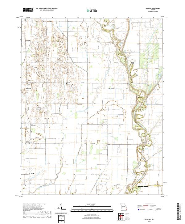
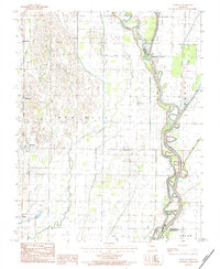 1984 Broseley1984 Print · USGSSoutheast Missouri in the early eighties shows a landscape shaped by the St Francis River and extensive drainage projects. Genealogists and local historians can trace family locations near Broseley, Nyssa, and the high ground of Ash Hill.
 - 2011 Map of Broseley, 2011 Print
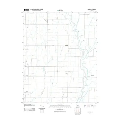 2011 Broseley2011 Print · USGSCovers Broseley, including Hicoria Spur, Quercus, and other nearby areas
 - 2015 Map of Broseley, 2015 Print
 2015 Broseley2015 Print · USGSCovers Broseley, including Hicoria Spur, Quercus, and other nearby areas
 - 2017 Map of Broseley, 2017 Print
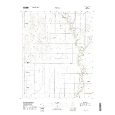 2017 Broseley2017 Print · USGSCovers Broseley, including Hicoria Spur, Quercus, and other nearby areas
 - 2021 Map of Broseley, 2021 Print
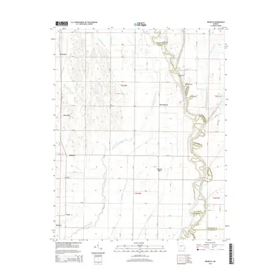
 2021 Broseley2021 Print · USGSButler County agricultural life is centered around the Broseley and Rossville areas in this modern survey of the Missouri Bootheel. Researchers can trace local heritage at Browns Chapel Cem and locate river landmarks like Upper Shoals and Otter Slough.
End of results
Showing maps 1-11 of 11
Top cities near Broseley
- Poplar Bluff historical maps
- Campbell historical maps
- Qulin historical maps
- Fisk historical maps
- Dudley historical maps
- Saint Francis historical maps
Frequently asked questions
- What are the different types of historical maps available for Broseley?
- What is the oldest map of Broseley?
- Where can I purchase historical maps of Broseley for my home or office?
- Where can I download high-res historical maps of Broseley?
- Are there historical topographic maps available for Broseley?
- Is there historical aerial imagery available for Broseley?
- Where are historical maps of Broseley sourced from?