Old Maps of Parks, Missouri for Metal Detecting
Plan your next treasure hunt with 12 historic maps of Parks. Find old homesites, ghost towns, trails, and gathering spots that may be lost to time — perfect for identifying promising metal detecting locations.
- Locate forgotten sites: Uncover places like long-lost settlements, abandoned rail lines, or gathering spots.
- Plan better hunts: Use map overlays combined with LiDAR or satellite views to narrow in on historically rich areas.
- Made for detectorists: Thousands of hobbyists use these maps to discover relics, coins, and hidden history.
Use these historic maps to boost your research and find new opportunities beneath the surface of Parks.
Parks, MO maps
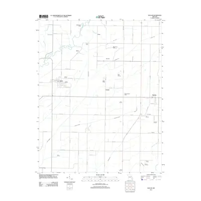
(12)- 1935 Map of Acorn, 1936 Print
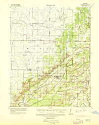 1935 Acorn1936 Print · USGSRipley and Butler counties are captured in the mid-1930s just as drainage projects were reshaping the river bottomlands. Researchers can trace vanished rail stops and numerous combined community hubs like Spring Hill Sch & Cem, Venerable Sch, and Torch.
 - 1940 Map of Naylor
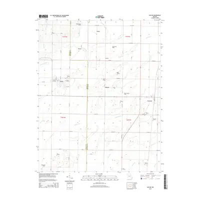
 1940 Naylor1940 Print · USGSRipley and Butler counties are captured here just before the mid-century, showing a landscape defined by the Little Black River and a dense rail network. Genealogists can trace family roots through dozens of local sites like Sixteen to One Sch and the Military Cem.
 - 1944 Map of Naylor
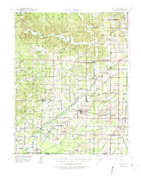
 1944 Naylor1944 Print · USGSThe Missouri-Arkansas border region in the early 1940s reveals a landscape shaped by the St Louis San Francisco railroad and the historic Military Road. Researchers can trace old family-named sites like Cochran Cem, Sewell Sch, and the riverside settlement of Naylor.2 unique versions available
 - 1957 Map of Poplar Bluff, 1968 Print
 1957 Poplar Bluff1968 Print · USGSThe Missouri-Arkansas border region is captured here as the timber and rail industries shaped the Ozark foothills. Genealogists and historians can trace the Missouri Pacific Railroad through river towns like Pocahontas, Greenville, and Van Buren.3 unique versions available
 - 1959 Map of Poplar Bluff
 1959 Poplar Bluff1959 Print · USGSThe Missouri Ozarks and Arkansas borderlands meet in this late 1950s study of the region's diverse terrain and rail-fed towns. Researchers can trace the path of the Missouri Pacific Railroad through Poplar Bluff or locate smaller settlements like Birch Tree and Myrtle.
 - 1960 Map of Poplar Bluff
 1960 Poplar Bluff1960 Print · USGSSoutheast Missouri and Northeast Arkansas are captured here during the post-war era, showing the transition from the Ozark highlands to the Delta. Genealogists and historians can trace rail corridors like the St. Louis Southwestern RR and remote settlements such as Birch Tree and Warm Springs.
 - 1979 Map of Naylor, 1980 Print
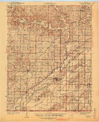
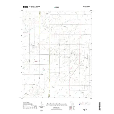
 1979 Naylor1980 Print · USGSRipley and Butler counties in the late seventies show a landscape defined by the Little Black River and the Missouri Pacific railroad. Genealogists and historians can trace numerous rural burial sites and congregations, including Masonic Cem, Corinth General Ch, and the settlement of Neelyville.
 - 1983 Map of Poplar Bluff
 1983 Poplar Bluff1983 Print · USGSSoutheast Missouri in the early 1980s reveals a landscape defined by the Ozark foothills and the complex drainage systems of the Bootheel. Researchers can trace the rail corridors of the Missouri Pacific RR through Poplar Bluff or locate rural sites like Wilhelmina Church and Lone Hill Lookout.
 - 2011 Map of Naylor, 2011 Print
 2011 Naylor2011 Print · USGSCovers Parks, including Naylor, Neelyville, and other nearby areas
 - 2015 Map of Naylor, 2015 Print
 2015 Naylor2015 Print · USGSCovers Parks, including Naylor, Neelyville, and other nearby areas
 - 2017 Map of Naylor, 2017 Print
 2017 Naylor2017 Print · USGSCovers Parks, including Naylor, Neelyville, and other nearby areas
 - 2021 Map of Naylor, 2021 Print
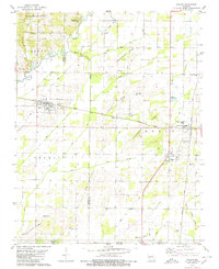
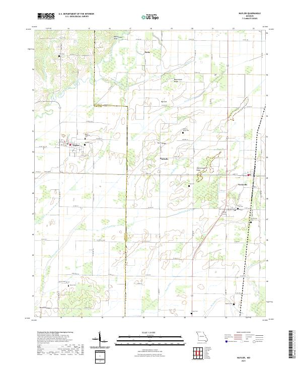 2021 Naylor2021 Print · USGSThe Missouri lowlands near the Arkansas border are captured here in the modern era, showing a landscape defined by drainage and local heritage. Researchers can locate numerous family burial sites like Crab Cem and Eaton Cem along with the prominent Rattlesnake Knob.
End of results
Showing maps 1-12 of 12
Top cities near Parks
- Poplar Bluff historical maps
- Corning historical maps
- Naylor historical maps
- Neelyville historical maps
- Success historical maps
- McDougal historical maps
See more
Frequently asked questions
- What are the different types of historical maps available for Parks?
- What is the oldest map of Parks?
- Where can I purchase historical maps of Parks for my home or office?
- Where can I download high-res historical maps of Parks?
- Are there historical topographic maps available for Parks?
- Is there historical aerial imagery available for Parks?
- Where are historical maps of Parks sourced from?