Old Maps of Buckner, Missouri
Explore 20 old maps of Buckner, spanning from 1894 to today. These high-resolution historic maps reveal how streets, neighborhoods, landmarks, and natural features evolved over time — perfect for genealogy, metal detecting, research, and local history exploration.
What you can do with these maps:
- See how Buckner changed over time: Compare historical maps to modern-day views to trace roads, homesites, rail lines & more.
- View detailed metadata: Each map includes creators, publishers, year, scale, and archive source.
- Overlay maps with satellite & LiDAR: Visualize the past alongside modern tools to explore terrain & human change.
- Trusted historical sources: Maps sourced from the USGS, Library of Congress, and other archives.
- Access maps your way: View online, download high-res files, or order prints for personal or research use.
Start exploring old maps of Buckner to uncover forgotten places, hidden landmarks, and the deep history beneath your feet.
Buckner, MO maps
(20)- 1894 Map of Independence
 1894 Independence1894 Print · USGSThe river valley and rail corridors of western Missouri are captured in detail during the late nineteenth century. Researchers can trace the early layouts of Liberty and Independence alongside lost river features like Liberty Landing and Cooley Lake.5 unique versions available
 - 1934 Map of Oak Grove
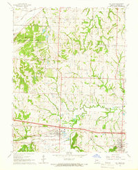
 1934 Oak Grove1934 Print · USGSJackson County in the 1930s shows a landscape of growing railroad towns and scattered rural school districts. Genealogists can locate family landmarks like Sunny Nook Sch and Macklin Sch or trace early routes along Sni A Bar Creek.2 unique versions available
 - 1935 Map of Buckner
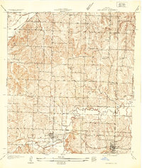
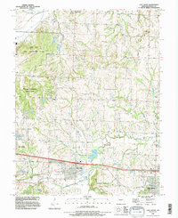
 1935 Buckner1935 Print · USGSThe Missouri River bottoms and Fort Osage bluffs are captured here in the mid-1930s during a period of heavy rail and river activity. Genealogists and historians can trace the locations of numerous rural landmarks like Union Ch, Egypt Sch, and the Hossenflow Duck Camp.2 unique versions available
 - 1950 Map of Kansas City
 1950 Kansas City1950 Print · USGSMid-century Kansas and Missouri are captured here during a period of industrial growth and shifting transportation. Genealogists and historians can trace rail lines like the Wabash RR or locate ancestral homes near the Potawatomi Indian Reservation and Horton.
 - 1954 Map of Kansas City
 1954 Kansas City1954 Print · USGSThe Missouri-Kansas borderlands flourished in the post-war era as river commerce and rail networks converged at the Missouri River. Genealogists and historians can trace the foundations of Kansas City and smaller rural hubs like Hiawatha or Sabetha.
 - 1956 Map of Kansas City, 1967 Print
 1956 Kansas City1967 Print · USGSThe Kansas-Missouri border region thrived during the mid-fifties, centered on the growing metropolitan cores and the busy river valleys. Researchers can trace the layout of significant government sites like Fort Leavenworth and the Lake City Army Ammunition Plant.4 unique versions available
 - 1960 Map of Kansas City
 1960 Kansas City1960 Print · USGSMid-century Kansas and Missouri meet at the river forks, showing a sprawling rail-and-river economy during the 1950s growth era. Genealogists and researchers can trace tribal lands like the Kickapoo Indian Reservation or follow the early interstate corridors through Saint Joseph and Independence.3 unique versions available
 - 1965 Map of Buckner, 1966 Print
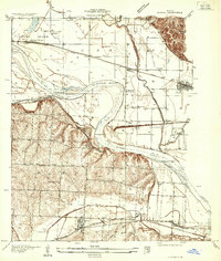
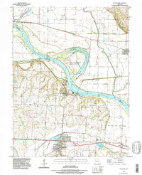
 1965 Buckner1966 Print · USGSJackson County and the Missouri River valley are captured in the mid-sixties, showcasing a landscape of river-bottom farms and growing rail hubs. Genealogists and historians can trace family roots through sites like Buckner Hill Cem, Clevenger Sch, and the historic grounds of Fort Osage.2 unique versions available
 - 1965 Map of Oak Grove, 1966 Print
 1965 Oak Grove1966 Print · USGSJackson County is documented here in the mid-1960s as small-town centers began to interface with modern industrial and aviation sites. Researchers can trace the heritage of Grain Valley and Oak Grove, locating numerous landmarks like Mecklin Cem, Pink Hill Ch, and the East Kansas City Airport.3 unique versions available
 - 1983 Map of Kansas City
 1983 Kansas City1983 Print · USGSThe Missouri-Kansas borderlands reached a peak of suburban and industrial connectivity by the early eighties. Researchers can trace established neighborhoods and major landmarks like the Fort Leavenworth Military Reservation, Swope Park, and the U.S. Army Ammunition Plant.
 - 1990 Map of Oak Grove, 1995 Print
 1990 Oak Grove1995 Print · USGSJackson County in the early nineties shows a landscape of suburban expansion meeting deep-rooted rural history. Genealogists and researchers can trace local lineage through the Levasy Cem and Oakland Cem or locate the sprawling Lake City Army Ammunition Plant.
 - 1990 Map of Buckner, 1997 Print
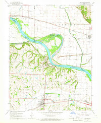
 1990 Buckner1997 Print · USGSThe Missouri River floodplain comes to life in the 1990s as it meanders between Clay, Ray, and Jackson counties. Local historians can trace family roots at Buckner Hill Cem or explore the riverfront geography of Sibley and the oxbow at Jackass Bend.
 - 2012 Map of Oak Grove, 2012 Print
 2012 Oak Grove2012 Print · USGSCovers Buckner, including Independence, Blue Springs, and other nearby areas
 - 2012 Map of Buckner, 2012 Print
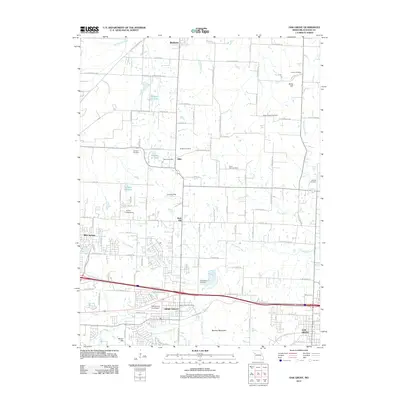
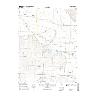
 2012 Buckner2012 Print · USGSCovers Buckner, including Independence, Orrick, and other nearby areas
 - 2014 Map of Buckner, 2014 Print
 2014 Buckner2014 Print · USGSCovers Buckner, including Independence, Orrick, and other nearby areas
 - 2014 Map of Oak Grove, 2014 Print
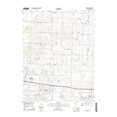 2014 Oak Grove2014 Print · USGSCovers Buckner, including Independence, Blue Springs, and other nearby areas
 - 2017 Map of Buckner, 2017 Print
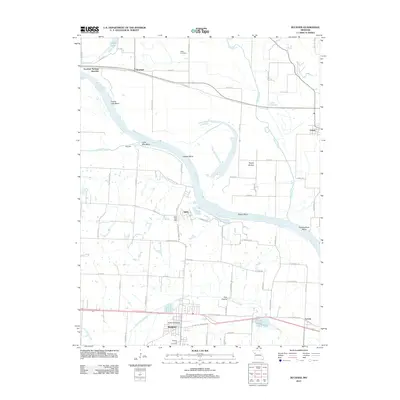
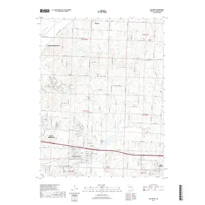
 2017 Buckner2017 Print · USGSCovers Buckner, including Independence, Orrick, and other nearby areas
 - 2017 Map of Oak Grove, 2017 Print
 2017 Oak Grove2017 Print · USGSCovers Buckner, including Independence, Blue Springs, and other nearby areas
 - 2021 Map of Buckner, 2021 Print
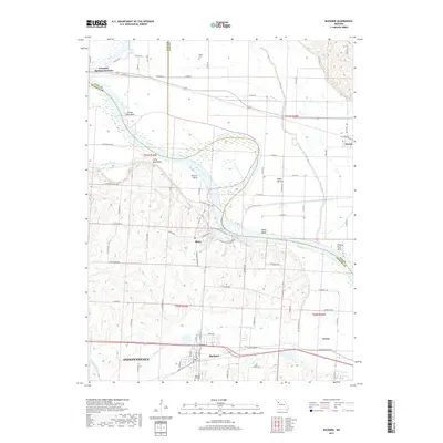
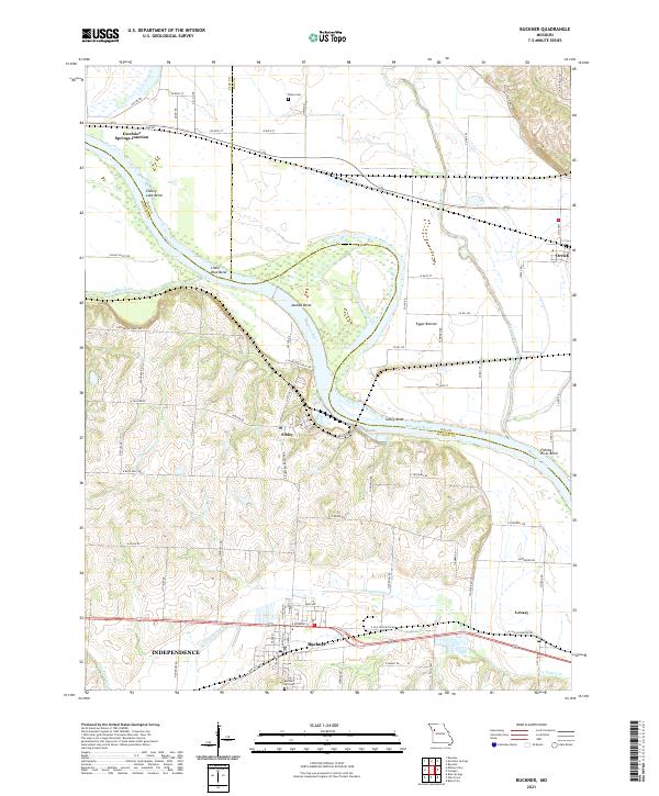 2021 Buckner2021 Print · USGSThe Missouri River bottoms near the Jackson, Clay, and Ray county lines are shown here in detail during the early 2020s. Genealogists and local historians can trace family sites at Buckner Hill Cem and Dillen Cem or locate the riverside settlements of Sibley and Levasy.
 - 2021 Map of Oak Grove, 2021 Print
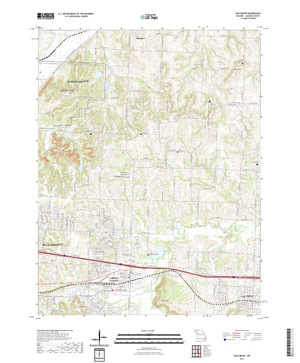 2021 Oak Grove2021 Print · USGSJackson County settlement and modern growth converge here in the early twenty-first century as suburban expansion reaches the edges of the Missouri prairie. Researchers can trace ancestral sites at Oakland Cemetery and Bone Hill or locate the East Kansas City Airport.
End of results
Showing maps 1-20 of 20
Top cities near Buckner
- Kansas City historical maps
- Independence historical maps
- Lee's Summit historical maps
- Blue Springs historical maps
- Liberty historical maps
- Grain Valley historical maps
See more
Frequently asked questions
- What are the different types of historical maps available for Buckner?
- What is the oldest map of Buckner?
- Where can I purchase historical maps of Buckner for my home or office?
- Where can I download high-res historical maps of Buckner?
- Are there historical topographic maps available for Buckner?
- Is there historical aerial imagery available for Buckner?
- Where are historical maps of Buckner sourced from?