1980s Maps of Linneus, Missouri
Explore 3 historic maps of Linneus from the 1980s. These maps offer a rare glimpse into what life looked like during the 1980s — showing old roads, neighborhoods, homes, and landmarks that have changed or disappeared over time.
Whether you're researching your family's past, planning a metal detecting trip, or studying how Linneus's landscape evolved across the 1980s, these high-resolution maps are a powerful tool for exploring the history of this region.
- Focus on a specific era: All maps on this page are from the 1980s, giving you a focused view of this time period.
- See what’s changed: Compare century-old streets, trails, and buildings to today's modern landscape using overlays and satellite layers.
- Research with precision: Use these maps for genealogy, historical research, land use analysis, or educational projects.
- View, download, or print: Maps are fully viewable online in high resolution, and can be downloaded or printed for your own records.
Start exploring Linneus's history through authentic maps from the 1980s. This is your window into the past.
Linneus, MO maps
(3)- 1981 Map of Chillicothe
 1981 Chillicothe1981 Print · USGSNorth Missouri's Grand River basin comes into focus during the early 1980s, showcasing a network of vital rail lines and river settlements. Genealogists and historians can trace rail-town development from Gallatin to Brookfield and explore extensive conservation lands like Swan Lake National Wildlife Refuge.
 - 1984 Map of Laclede, 1985 Print
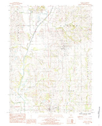
 1984 Laclede1985 Print · USGSLinn County in the early eighties centers on the railroad town of Laclede and the southern reaches of Linneus. Researchers can trace the wetlands of Pershing State Park and rural landmarks like the Burlington Northern rail line and local Cem sites.
 - 1984 Map of Linneus, 1985 Print
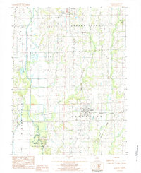
 1984 Linneus1985 Print · USGSLinn County's agricultural heartland is captured here in the early eighties, centered on the historic community of Linneus. Genealogists and local researchers can trace the rural landscape from Purdin down to Locust Creek, locating family homesteads near landmarks like Strawberry Branch and several local Cem sites.
End of results
Showing maps 1-3 of 3
Top cities near Linneus
- Brookfield historical maps
- Marceline historical maps
- Meadville historical maps
- Laclede historical maps
- Browning historical maps
- Wheeling historical maps
See more
Frequently asked questions
- What are the different types of historical maps available for Linneus?
- What is the oldest map of Linneus?
- Where can I purchase historical maps of Linneus for my home or office?
- Where can I download high-res historical maps of Linneus?
- Are there historical topographic maps available for Linneus?
- Is there historical aerial imagery available for Linneus?
- Where are historical maps of Linneus sourced from?