Old Maps of Moniteau County, Missouri
Explore 97 old maps of Moniteau County, spanning from 1886 to today. These high-resolution historic maps reveal how streets, neighborhoods, landmarks, and natural features evolved over time — perfect for genealogy, metal detecting, research, and local history exploration.
What you can do with these maps:
- See how Moniteau County changed over time: Compare historical maps to modern-day views to trace roads, homesites, rail lines & more.
- View detailed metadata: Each map includes creators, publishers, year, scale, and archive source.
- Overlay maps with satellite & LiDAR: Visualize the past alongside modern tools to explore terrain & human change.
- Trusted historical sources: Maps sourced from the USGS, Library of Congress, and other archives.
- Access maps your way: View online, download high-res files, or order prints for personal or research use.
Start exploring old maps of Moniteau County to uncover forgotten places, hidden landmarks, and the deep history beneath your feet.
Moniteau County, MO maps
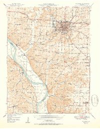
(97)- 1886 Map of Jefferson City
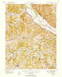
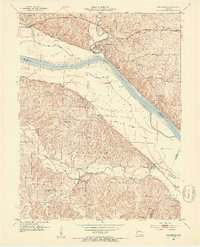
 1886 Jefferson City1886 Print · USGSMid-Missouri was a bustling corridor of river traffic and rail expansion during the 1880s. You can trace the early tracks of the Missouri Pacific Railroad and locate vanished river landings like Nashville or Providence along the winding Missouri River.
 - 1888 Map of Versailles
 1888 Versailles1888 Print · USGSCentral Missouri in the late 1880s shows the winding Osage River valley long before the creation of the Lake of the Ozarks. Researchers can trace the original locations of Linn Creek, find the Osage Iron Works, and follow the Missouri Pacific Railroad to its end in Versailles.
 - 1888 Map of Tuscumbia
 1888 Tuscumbia1888 Print · USGSThe Osage River valley comes to life in the 1880s, showcasing the intricate river bends and rugged hills of central Missouri. Genealogists and researchers can trace the original locations of early settlements like Tuscumbia, St. Elizabeth, and Iberia.
 - 1888 Map of Boonville
 1888 Boonville1888 Print · USGSCentral Missouri comes to life in the late nineteenth century as the river economy of Boonville meets the iron rails of the Missouri Pacific Railroad. Genealogists and historians can trace old community centers like Latham Store, Chouteau Springs, and the townships of Richland and Saline.5 unique versions available
 - 1893 Map of Versailles
 1893 Versailles1893 Print · USGSCentral Missouri's river-and-rail landscape is captured here in the late nineteenth century, decades before the valley was transformed by dams. Genealogists can trace family roots in early settlements like Versailles, Bagnell, and the original site of Linn Creek.4 unique versions available
 - 1894 Map of Tuscumbia
 1894 Tuscumbia1894 Print · USGSCentral Missouri's river-and-rail landscape is captured here in the 1890s as the Osage River served as the region's main artery. Genealogists and historians can trace the early boundaries of communities like Tuscumbia, St. Elizabeth, and Iberia.3 unique versions available
 - 1894 Map of Jefferson City
 1894 Jefferson City1894 Print · USGSMid-Missouri during the late nineteenth century was a landscape of river landings and burgeoning rail towns. Genealogists and historians can trace early track layouts of the Missouri Pacific Railroad and locate interior settlements like Ashland, Millersburg, and Centretown.4 unique versions available
 - 1904 Map of Eldon
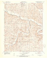
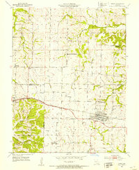
 1904 Eldon1904 Print · USGSMiller and Morgan counties thrived at the turn of the century as the new railroad network connected agricultural hills to outside markets. Genealogists can trace family roots through early settlements like Barnett Sta. and Olean or locate the historic Simpson Coalmine.
 - 1947 Map of Jefferson City, 1949 Print
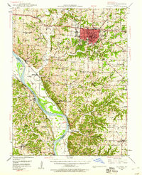
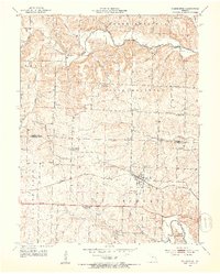
 1947 Jefferson City1949 Print · USGSCentral Missouri and the northern Ozarks come into focus in this late 1940s survey of the river-and-rail landscape. Genealogists and historians can trace the growth of Jefferson City and Sedalia or locate family roots near Bagnell Dam and the Lake of the Ozarks.
 - 1948 Map of Centertown, 1954 Print
 1948 Centertown1954 Print · USGSMid-Missouri farming life in the late forties is captured here, centered on the river bluffs and rail lines between Centertown and Russellville. Researchers can trace rural school districts like Brick School and locate family burial grounds including Enloe Cem and Eberhardt Cem.
 - 1948 Map of Columbia, 1960 Print
 1948 Columbia1960 Print · USGSMid-century Boone County is captured here just as the educational and agricultural landscape began its post-war transition. Genealogists can trace family landmarks like Sugar Grove Ch and Vaughter Sch or follow the Missouri Pacific along the Missouri River.2 unique versions available
 - 1948 Map of Eugene, 1966 Print
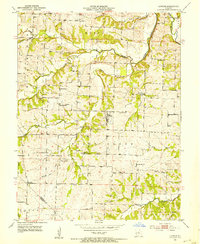
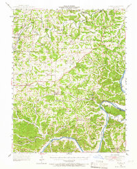 1948 Eugene1966 Print · USGSCentral Missouri rural life is captured here in the years following the war, centered on the rail corridor through Eugene. Researchers can trace family sites and community landmarks like Marys Home, Rush Chapel, and the river bluffs along the Osage River.2 unique versions available
 - 1949 Map of Centertown
 1949 Centertown1949 Print · USGSMid-Missouri river life and rural settlement are captured here just after the war, from the Missouri River bottoms to the uplands. Genealogists can trace family roots through numerous sites like Sweetwater Cem, Bonds Chapel, and the National Cem.
 - 1950 Map of Columbia
 1950 Columbia1950 Print · USGSMid-century Columbia and the Missouri River bottoms are captured here during a period of steady institutional and rail-driven growth. Genealogists and researchers can locate numerous country schools and churches like Mt Zion Ch, Huntsdale, and Valley Springs Sch.2 unique versions available
 - 1951 Map of Eugene
 1951 Eugene1951 Print · USGSMid-century life in central Missouri centered on the Chicago Rock Island and Pacific rail corridor and the deep valleys of the Osage River. Researchers can locate dozens of historic rural landmarks, from the McCann Bridge Cem to small communities like Marys Home and Etterville.2 unique versions available
 - 1951 Map of California South, 1953 Print
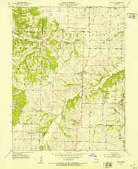
 1951 California South1953 Print · USGSMoniteau County's rural townships are captured here in the early 1950s, showing a landscape of small family farms and local parish life. Researchers can trace ancestral roots through numerous family cemeteries and old school sites like Gamble Cem, Pluck Sch, and Corticelli Ch.3 unique versions available
 - 1951 Map of Latham, 1954 Print
 1951 Latham1954 Print · USGSMid-Missouri farming life in the early fifties is preserved here, centered on the village of Latham. Genealogists and historians can trace family roots through numerous rural landmarks like Latham Cem, Pilot Grove Ch, and the many namesake schools like Pilot Sch.2 unique versions available
 - 1952 Map of Rocheport, 1953 Print
 1952 Rocheport1953 Print · USGSThe river bluffs of Boone and Cooper County come alive in the early fifties, showing the vital junctions of the Missouri River and two major rail lines. Researchers can trace the layout of Rocheport, locate family sites like Gooch Mill, or find old rural landmarks like Highland Sch and Copp Chapel.4 unique versions available
 - 1952 Map of Tipton, 1953 Print
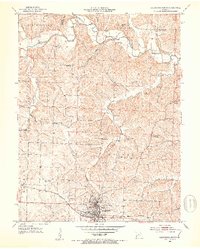
 1952 Tipton1953 Print · USGSTipton and Syracuse sit at the junction of Cooper, Morgan, and Moniteau counties during the early fifties rail era. Researchers can trace the sprawling campus of the State Industrial Home for Girls or locate several decommissioned schools like Glendale Sch.3 unique versions available
 - 1952 Map of Clarksburg, 1953 Print
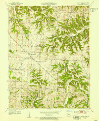
 1952 Clarksburg1953 Print · USGSMoniteau County's rural character and post-war transitions are on full display in the early fifties, centered on the Clarksburg rail stop. Genealogists can trace family landmarks like Sappington Cem and several closed schoolhouses, including Gill Sch.3 unique versions available
 - 1952 Map of Fortuna, 1953 Print
 1952 Fortuna1953 Print · USGSMoniteau and Morgan counties are shown in the early fifties, capturing a network of rural schools and family cemeteries. Trace the locations of historic local institutions like St Martins Sch, Hickory Grove Sch, and the Prairie View Ch.3 unique versions available
 - 1952 Map of Prairie Home, 1953 Print
 1952 Prairie Home1953 Print · USGSCooper County agriculture and rural life are preserved here in the early fifties, as the era of the one-room schoolhouse began to fade. Trace local family history through mapped landmarks like Providence Cem, St Peters Ch, and the defunct Cedron Sch.3 unique versions available
 - 1952 Map of California North, 1953 Print
 1952 California North1953 Print · USGSIn the early 1950s, the area north of California, Missouri, was a landscape of small family farms and rural schoolhouses. Genealogists can trace family roots through several private burial grounds like Strickfaden Cem and identify local landmarks like the Old Salem Ch.4 unique versions available
 - 1954 Map of Jefferson City
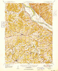
 1954 Jefferson City1954 Print · USGSCentral Missouri in the early postwar years showcases a landscape defined by the winding Lake of the Ozarks and the state capital at Jefferson City. Researchers can trace the mid-century rail networks of the Missouri Pacific RR and locate rural communities like Tuscumbia, St Elizabeth, and St Anthony.2 unique versions available
 - 1955 Map of Jefferson City, 1967 Print
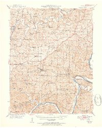
 1955 Jefferson City1967 Print · USGSCentral Missouri in the mid-fifties is defined by the winding Missouri River and the expanding reach of Lake of the Ozarks. Researchers can trace the rail corridors of the Missouri Pacific or locate the early footprint of Whiteman AFB and Jefferson City.4 unique versions available
Showing maps 1-25 of 97
Top cities of Moniteau County
- California historical maps
- Tipton historical maps
- Jamestown historical maps
- Clarksburg historical maps
- Lupus historical maps
Frequently asked questions
- What are the different types of historical maps available for Moniteau County?
- What is the oldest map of Moniteau County?
- Where can I purchase historical maps of Moniteau County for my home or office?
- Where can I download high-res historical maps of Moniteau County?
- Are there historical topographic maps available for Moniteau County?
- Is there historical aerial imagery available for Moniteau County?
- Where are historical maps of Moniteau County sourced from?