1940s Maps of Proctor, Missouri
Explore 2 historic maps of Proctor from the 1940s. These maps offer a rare glimpse into what life looked like during the 1940s — showing old roads, neighborhoods, homes, and landmarks that have changed or disappeared over time.
Whether you're researching your family's past, planning a metal detecting trip, or studying how Proctor's landscape evolved across the 1940s, these high-resolution maps are a powerful tool for exploring the history of this region.
- Focus on a specific era: All maps on this page are from the 1940s, giving you a focused view of this time period.
- See what’s changed: Compare century-old streets, trails, and buildings to today's modern landscape using overlays and satellite layers.
- Research with precision: Use these maps for genealogy, historical research, land use analysis, or educational projects.
- View, download, or print: Maps are fully viewable online in high resolution, and can be downloaded or printed for your own records.
Start exploring Proctor's history through authentic maps from the 1940s. This is your window into the past.
Proctor, MO maps
(2)- 1947 Map of Jefferson City, 1949 Print
 1947 Jefferson City1949 Print · USGSCentral Missouri and the northern Ozarks come into focus in this late 1940s survey of the river-and-rail landscape. Genealogists and historians can trace the growth of Jefferson City and Sedalia or locate family roots near Bagnell Dam and the Lake of the Ozarks.
 - 1949 Map of Gravois Mills, 1956 Print
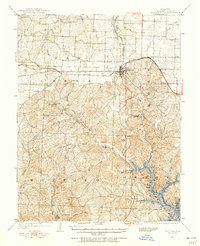 1949 Gravois Mills1956 Print · USGSMorgan County in the late 1940s shows a landscape of deep valleys and rising waters where the Lake of the Ozarks meets the Missouri hills. Researchers can trace old rail corridors and find early mining sites like Juliette Mine or the small settlement of Lodema.
End of results
Showing maps 1-2 of 2
Top cities near Proctor
- Camdenton historical maps
- Versailles historical maps
- Four Seasons historical maps
- Stover historical maps
- Laurie historical maps
- Sunrise Beach historical maps
See more
Frequently asked questions
- What are the different types of historical maps available for Proctor?
- What is the oldest map of Proctor?
- Where can I purchase historical maps of Proctor for my home or office?
- Where can I download high-res historical maps of Proctor?
- Are there historical topographic maps available for Proctor?
- Is there historical aerial imagery available for Proctor?
- Where are historical maps of Proctor sourced from?