Old Maps of Cookville, Missouri
Explore 14 old maps of Cookville, spanning from 1941 to today. These high-resolution historic maps reveal how streets, neighborhoods, landmarks, and natural features evolved over time — perfect for genealogy, metal detecting, research, and local history exploration.
What you can do with these maps:
- See how Cookville changed over time: Compare historical maps to modern-day views to trace roads, homesites, rail lines & more.
- View detailed metadata: Each map includes creators, publishers, year, scale, and archive source.
- Overlay maps with satellite & LiDAR: Visualize the past alongside modern tools to explore terrain & human change.
- Trusted historical sources: Maps sourced from the USGS, Library of Congress, and other archives.
- Access maps your way: View online, download high-res files, or order prints for personal or research use.
Start exploring old maps of Cookville to uncover forgotten places, hidden landmarks, and the deep history beneath your feet.
Cookville, MO maps
(14)- 1941 Map of Big Piney
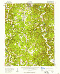
 1941 Big Piney1941 Print · USGSThe Ozarks at the dawn of the war years reveal a landscape of rural schoolhouses and river bends before military expansion. Genealogists can trace family roots through Lone Star Sch, Cook Cem, and the now-transformed settlement of Bloodland.
 - 1943 Map of Big Piney
 1943 Big Piney1943 Print · USGSThe Missouri Ozarks are shown here during the early years of the Second World War as federal land expansion reshaped the region. Genealogists and local historians can trace family roots through numerous country schools like Lone Star Sch and churches including St Annie Ch and Dondas Ch.2 unique versions available
 - 1954 Map of Springfield
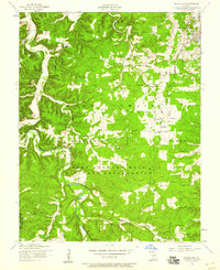
 1954 Springfield1954 Print · USGSThe Missouri Ozarks are captured here during the post-war era, showing the expansion of Springfield and the surrounding river valleys. Genealogists and historians can trace local landmarks like Mount Comfort Cemetery and the Fort Leonard Wood military grounds.6 unique versions available
 - 1954 Map of Big Piney, 1958 Print
 1954 Big Piney1958 Print · USGSThe mid-century Ozark highlands are captured here during a period of massive federal transition, as military expansion met traditional rural life. Researchers can trace family names and vanished sites through the Bloodland Cemetery, the Roby Lookout Tower, and several abandoned schoolhouses like Morman Valley School.3 unique versions available
 - 1954 Map of Bloodland, 1959 Print
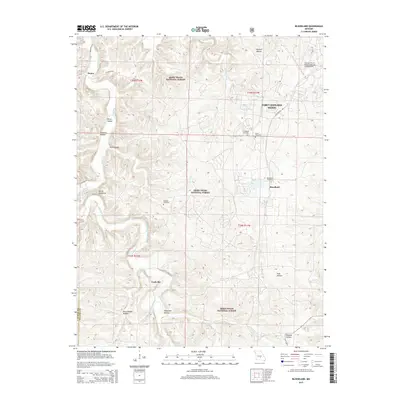
 1954 Bloodland1959 Print · USGSIn the mid-1950s, this area of Pulaski County shows the growth of the military installation alongside traditional Ozark settlements. Genealogists and historians can locate old rural burial grounds like Friendship Cem and McCann Cem, or trace the path of Roubidoux Creek near Hanna.3 unique versions available
 - 1958 Map of Springfield
 1958 Springfield1958 Print · USGSThe Missouri Ozarks are captured during the mid-century era of growth, centered on the bustling hub of Springfield. Genealogists and historians can trace family roots through numerous landmarks like Ebenezer Church, Stockton Cem, and the various county courthouses.
 - 1959 Map of Springfield
 1959 Springfield1959 Print · USGSThe Missouri Ozarks are captured here during a decade of postwar growth and increasing highway connectivity. Researchers can trace the legacy of the St Louis-San Francisco RR and locate early sites in Springfield, Lebanon, and Mountain Grove.
 - 1976 Map of Bloodland, 1980 Print
 1976 Bloodland1980 Print · USGSThe Ozark highlands of Pulaski County are revealed in this mid-seventies aerial study of the Bloodland area. Researchers can trace the winding course of Roubidoux Creek and see the early development footprint of Fort Leonard Wood.
 - 1982 Map of Lebanon, 1983 Print
 1982 Lebanon1983 Print · USGSThe Missouri Ozarks are captured in the early eighties as Interstate 44 and the St Louis-San Francisco rail line link growing towns with the Fort Leonard Wood Military Reservation. Genealogists and historians can trace family-named sites like Flatwood Church and old post offices at Sleeper and Nebo.
 - 2004 Map of Bloodland, 2006 Print
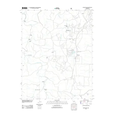
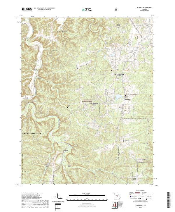
 2004 Bloodland2006 Print · USGSPulaski County at the start of the millennium shows the intersection of the Mark Twain National Forest and expanding military grounds. Genealogists can locate family burial sites like Clark Cem and the former locations of Bloodland (Site) and Cookville (Site).
 - 2012 Map of Bloodland, 2012 Print
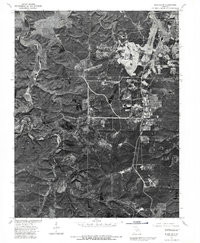
 2012 Bloodland2012 Print · USGSCovers Cookville, including Hanna, Bloodland, and other nearby areas
 - 2015 Map of Bloodland, 2015 Print
 2015 Bloodland2015 Print · USGSCovers Cookville, including Hanna, Bloodland, and other nearby areas
 - 2017 Map of Bloodland, 2017 Print
 2017 Bloodland2017 Print · USGSCovers Cookville, including Hanna, Bloodland, and other nearby areas
 - 2021 Map of Bloodland, 2021 Print
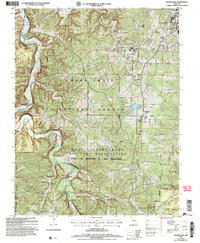
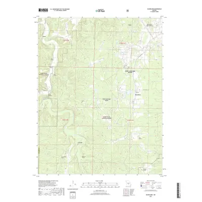
 2021 Bloodland2021 Print · USGSPulaski County at the start of the 2020s shows a landscape of military reservations and deep Missouri hollows. Researchers can trace ancestral burial sites at Bloodland Cem and McCann Cem or locate the rural settlements of Cookville and Hanna.
End of results
Showing maps 1-14 of 14
Top cities near Cookville
- Saint Robert historical maps
- Waynesville historical maps
- Richland historical maps
- Plato historical maps
Frequently asked questions
- What are the different types of historical maps available for Cookville?
- What is the oldest map of Cookville?
- Where can I purchase historical maps of Cookville for my home or office?
- Where can I download high-res historical maps of Cookville?
- Are there historical topographic maps available for Cookville?
- Is there historical aerial imagery available for Cookville?
- Where are historical maps of Cookville sourced from?