Old Maps of Dardenne Prairie, Missouri
Explore 23 old maps of Dardenne Prairie, spanning from 1903 to today. These high-resolution historic maps reveal how streets, neighborhoods, landmarks, and natural features evolved over time — perfect for genealogy, metal detecting, research, and local history exploration.
What you can do with these maps:
- See how Dardenne Prairie changed over time: Compare historical maps to modern-day views to trace roads, homesites, rail lines & more.
- View detailed metadata: Each map includes creators, publishers, year, scale, and archive source.
- Overlay maps with satellite & LiDAR: Visualize the past alongside modern tools to explore terrain & human change.
- Trusted historical sources: Maps sourced from the USGS, Library of Congress, and other archives.
- Access maps your way: View online, download high-res files, or order prints for personal or research use.
Start exploring old maps of Dardenne Prairie to uncover forgotten places, hidden landmarks, and the deep history beneath your feet.
Dardenne Prairie, MO maps
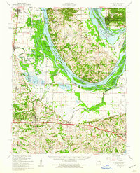
(23)- 1903 Map of O'Fallon
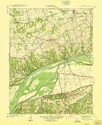
 1903 O'Fallon1903 Print · USGSCovers Dardenne Prairie, including O'Fallon, Saint Charles, and other nearby areas5 unique versions available
 - 1931 Map of Brussels
 1931 Brussels1931 Print · USGSCovers Dardenne Prairie, including O'Fallon, Saint Charles, and other nearby areas2 unique versions available
 - 1937 Map of Weldon Spring
 1937 Weldon Spring1937 Print · USGSCovers Dardenne Prairie, including O'Fallon, Saint Peters, and other nearby areas
 - 1939 Map of Brussels, 1955 Print
 1939 Brussels1955 Print · USGSCovers Dardenne Prairie, including O'Fallon, Saint Charles, and other nearby areas
 - 1940 Map of Weldon Spring
 1940 Weldon Spring1940 Print · USGSCovers Dardenne Prairie, including O'Fallon, Saint Peters, and other nearby areas
 - 1941 Map of Troy, 1964 Print
 1941 Troy1964 Print · USGSCovers Dardenne Prairie, including O'Fallon, Wentzville, and other nearby areas2 unique versions available
 - 1943 Map of Brussels
 1943 Brussels1943 Print · USGSCovers Dardenne Prairie, including O'Fallon, Saint Charles, and other nearby areas2 unique versions available
 - 1945 Map of Troy
 1945 Troy1945 Print · USGSCovers Dardenne Prairie, including O'Fallon, Wentzville, and other nearby areas2 unique versions available
 - 1949 Map of Saint Louis
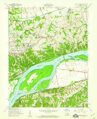
 1949 Saint Louis1949 Print · USGSCovers Dardenne Prairie, including St. Louis, O'Fallon, and other nearby areas2 unique versions available
 - 1954 Map of O'Fallon, 1959 Print
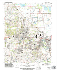
 1954 O'Fallon1959 Print · USGSCovers Dardenne Prairie, including O'Fallon, Saint Peters, and other nearby areas4 unique versions available
 - 1954 Map of Weldon Spring, 1959 Print
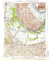
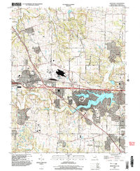
 1954 Weldon Spring1959 Print · USGSCovers Dardenne Prairie, including O'Fallon, Saint Peters, and other nearby areas5 unique versions available
 - 1954 Map of Brussels, 1960 Print
 1954 Brussels1960 Print · USGSCovers Dardenne Prairie, including O'Fallon, Saint Charles, and other nearby areas2 unique versions available
 - 1962 Map of St. Louis
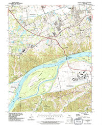
 1962 St. Louis1962 Print · USGSCovers Dardenne Prairie, including St. Louis, O'Fallon, and other nearby areas
 - 1963 Map of St. Louis, 1970 Print
 1963 St. Louis1970 Print · USGSCovers Dardenne Prairie, including St. Louis, O'Fallon, and other nearby areas4 unique versions available
 - 1966 Map of St. Louis
 1966 St. Louis1966 Print · USGSCovers Dardenne Prairie, including St. Louis, O'Fallon, and other nearby areas
 - 1972 Map of Wentzville, 1973 Print
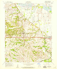
 1972 Wentzville1973 Print · USGSCovers Dardenne Prairie, including O'Fallon, Wentzville, and other nearby areas2 unique versions available
 - 1979 Map of Wentzville, 1980 Print
 1979 Wentzville1980 Print · USGSCovers Dardenne Prairie, including O'Fallon, Wentzville, and other nearby areas
 - 1979 Map of Weldon Spring, 1981 Print
 1979 Weldon Spring1981 Print · USGSCovers Dardenne Prairie, including O'Fallon, Saint Peters, and other nearby areas
 - 1985 Map of St Louis
 1985 St Louis1985 Print · USGSCovers Dardenne Prairie, including St. Louis, O'Fallon, and other nearby areas3 unique versions available
 - 1994 Map of O'Fallon, 1995 Print
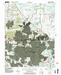
 1994 O'Fallon1995 Print · USGSCovers Dardenne Prairie, including O'Fallon, Saint Peters, and other nearby areas
 - 1994 Map of Weldon Spring, 1995 Print
 1994 Weldon Spring1995 Print · USGSCovers Dardenne Prairie, including O'Fallon, Saint Peters, and other nearby areas
 - 2000 Map of Wentzville, 2003 Print
 2000 Wentzville2003 Print · USGSCovers Dardenne Prairie, including O'Fallon, Wentzville, and other nearby areas
 - 2002 Map of O'Fallon, 2003 Print
 2002 O'Fallon2003 Print · USGSCovers Dardenne Prairie, including O'Fallon, Saint Peters, and other nearby areas
End of results
Showing maps 1-23 of 23
Top cities near Dardenne Prairie
- O'Fallon historical maps
- Saint Charles historical maps
- Saint Peters historical maps
- Chesterfield historical maps
- Wentzville historical maps
- Wildwood historical maps
See more
Top neighborhoods of Dardenne Prairie
Frequently asked questions
- What are the different types of historical maps available for Dardenne Prairie?
- What is the oldest map of Dardenne Prairie?
- Where can I purchase historical maps of Dardenne Prairie for my home or office?
- Where can I download high-res historical maps of Dardenne Prairie?
- Are there historical topographic maps available for Dardenne Prairie?
- Is there historical aerial imagery available for Dardenne Prairie?
- Where are historical maps of Dardenne Prairie sourced from?