Old Maps of San Luis Hills, Saint Louis County for Genealogy
Trace your family roots with 14 historic maps of San Luis Hills. These high-res maps reveal old neighborhoods, homesites, landmarks, and streets — helping you uncover where your ancestors lived and how the area evolved over time.
- Explore historic neighborhoods: Identify where your relatives may have lived in the 1800s or 1900s.
- Compare maps over time: Trace the changes in streets, buildings, and landmarks for multi-generational research.
- Perfect for genealogy & ancestry research: Used by family historians and researchers to map out lineage and migration.
These maps are an incredible resource for exploring your personal connection to San Luis Hills's past.
San Luis Hills, Saint Louis County maps
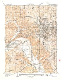
(14)- 1903 Map of O'Fallon
 1903 O'Fallon1903 Print · USGSCovers San Luis Hills, including O'Fallon, Saint Charles, and other nearby areas5 unique versions available
 - 1931 Map of Manchester SE
 1931 Manchester SE1931 Print · USGSCovers San Luis Hills, including Chesterfield, Wildwood, and other nearby areas
 - 1933 Map of Kirkwood
 1933 Kirkwood1933 Print · USGSCovers San Luis Hills, including Kirkwood, Webster Groves, and other nearby areas
 - 1940 Map of Kirkwood
 1940 Kirkwood1940 Print · USGSCovers San Luis Hills, including Kirkwood, Webster Groves, and other nearby areas3 unique versions available
 - 1945 Map of Manchester, 1955 Print
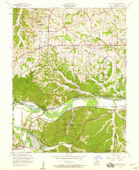
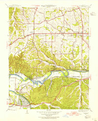 1945 Manchester1955 Print · USGSCovers San Luis Hills, including Chesterfield, Wildwood, and other nearby areas
 - 1947 Map of Manchester
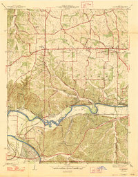 1947 Manchester1947 Print · USGSCovers San Luis Hills, including Chesterfield, Wildwood, and other nearby areas2 unique versions available
 - 1949 Map of Saint Louis
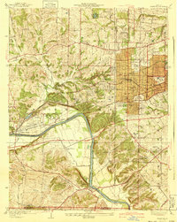
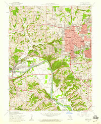
 1949 Saint Louis1949 Print · USGSCovers San Luis Hills, including St. Louis, O'Fallon, and other nearby areas2 unique versions available
 - 1954 Map of Kirkwood, 1959 Print
 1954 Kirkwood1959 Print · USGSCovers San Luis Hills, including Kirkwood, Webster Groves, and other nearby areas7 unique versions available
 - 1954 Map of Manchester, 1959 Print
 1954 Manchester1959 Print · USGSCovers San Luis Hills, including Chesterfield, Wildwood, and other nearby areas8 unique versions available
 - 1962 Map of St. Louis
 1962 St. Louis1962 Print · USGSCovers San Luis Hills, including St. Louis, O'Fallon, and other nearby areas
 - 1963 Map of St. Louis, 1970 Print
 1963 St. Louis1970 Print · USGSCovers San Luis Hills, including St. Louis, O'Fallon, and other nearby areas4 unique versions available
 - 1966 Map of St. Louis
 1966 St. Louis1966 Print · USGSCovers San Luis Hills, including St. Louis, O'Fallon, and other nearby areas
 - 1979 Map of Manchester, 1981 Print
 1979 Manchester1981 Print · USGSCovers San Luis Hills, including Chesterfield, Wildwood, and other nearby areas
 - 1985 Map of St Louis
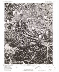
 1985 St Louis1985 Print · USGSCovers San Luis Hills, including St. Louis, O'Fallon, and other nearby areas3 unique versions available
End of results
Showing maps 1-14 of 14
Frequently asked questions
- What are the different types of historical maps available for San Luis Hills?
- What is the oldest map of San Luis Hills?
- Where can I purchase historical maps of San Luis Hills for my home or office?
- Where can I download high-res historical maps of San Luis Hills?
- Are there historical topographic maps available for San Luis Hills?
- Is there historical aerial imagery available for San Luis Hills?
- Where are historical maps of San Luis Hills sourced from?