1930s Maps of St. Louis, Missouri
Explore 8 historic maps of St. Louis from the 1930s. These maps offer a rare glimpse into what life looked like during the 1930s — showing old roads, neighborhoods, homes, and landmarks that have changed or disappeared over time.
Whether you're researching your family's past, planning a metal detecting trip, or studying how St. Louis's landscape evolved across the 1930s, these high-resolution maps are a powerful tool for exploring the history of this region.
- Focus on a specific era: All maps on this page are from the 1930s, giving you a focused view of this time period.
- See what’s changed: Compare century-old streets, trails, and buildings to today's modern landscape using overlays and satellite layers.
- Research with precision: Use these maps for genealogy, historical research, land use analysis, or educational projects.
- View, download, or print: Maps are fully viewable online in high resolution, and can be downloaded or printed for your own records.
Start exploring St. Louis's history through authentic maps from the 1930s. This is your window into the past.
St. Louis, MO maps
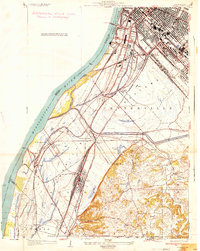
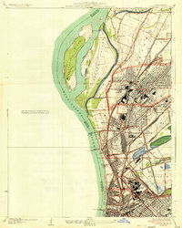
(8)- 1933 Map of Granite City
 1933 Granite City1933 Print · USGSThe riverfront and urban neighborhoods of St. Louis thrive during the early thirties as a hub of rail and river commerce. Genealogists and historians can trace family roots through numerous local parishes like St Joseph Ch and the vast Calvary Cemetery.2 unique versions available
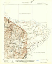
 - 1933 Map of Jefferson Barracks
 1933 Jefferson Barracks1933 Print · USGSSouth St. Louis County and the riverfront during the mid-thirties reveal a landscape of expanding suburbs and deep military roots. Genealogists and historians can trace family plots in National Cem or locate the early centers of Luxemburg and Affton PO Grevois Sta.
 - 1933 Map of Cahokia
 1933 Cahokia1933 Print · USGSThe riverfront neighborhoods of south St. Louis are captured in detail during the early 1930s, showing a bustling landscape of schools and industry. Genealogists can trace family locations near Carondelet, St Anthony Ch, or the Mo Pac Hospital.
 - 1933 Map of Clayton
 1933 Clayton1933 Print · USGSGreater St. Louis was expanding rapidly in the early thirties, as new subdivisions and flight paths began to reshape the western suburbs. Genealogists and historians can trace the foundations of Kinloch Park, the Lambert St Louis Airport, and landmarks like Valhalla Cem.
 - 1934 Map of Cahokia
 1934 Cahokia1934 Print · USGSThe industrial corridor and riverfront of St. Clair County are captured here in the mid-1930s as heavy rail and river commerce defined the landscape. Genealogists and historians can trace family-named schools and early settlements like Dupo, Lark Cem, and Falling Spring.2 unique versions available
 - 1934 Map of Alton
 1934 Alton1934 Print · USGSThe confluence of the Mississippi and Missouri rivers in the early 1930s shows a dense industrial and rail corridor centered on Alton. Genealogists and researchers can trace dozens of rural schools and landmarks like Monticello Seminary, Mt Olive Church, and the City of St Louis Farms.2 unique versions available
 - 1935 Map of Granite City
 1935 Granite City1935 Print · USGSThe industrial riverfront of Madison County thrives in the mid-1930s, showing a dense landscape of rail yards and expanding cities. Researchers can trace the complex trackage of the ILLINOIS TERMINAL RR and locate landmarks like the NATIONAL STOCK YARDS or Wilson Park.2 unique versions available
 - 1935 Map of Columbia Bottom
 1935 Columbia Bottom1935 Print · USGSSt. Louis County and the river confluence are captured here in the mid-1930s, showing a landscape of municipal farms and rural school districts. Genealogists can trace local roots through landmarks like Ruegg PO, Larimore, and the Vossenkemper School.
End of results
Showing maps 1-8 of 8
Top cities of St. Louis
Frequently asked questions
- What are the different types of historical maps available for St. Louis?
- What is the oldest map of St. Louis?
- Where can I purchase historical maps of St. Louis for my home or office?
- Where can I download high-res historical maps of St. Louis?
- Are there historical topographic maps available for St. Louis?
- Is there historical aerial imagery available for St. Louis?
- Where are historical maps of St. Louis sourced from?