1990s Maps of Carondelet, St. Louis
Explore 4 historic maps of Carondelet from the 1990s. These maps offer a rare glimpse into what life looked like during the 1990s — showing old roads, neighborhoods, homes, and landmarks that have changed or disappeared over time.
Whether you're researching your family's past, planning a metal detecting trip, or studying how Carondelet's landscape evolved across the 1990s, these high-resolution maps are a powerful tool for exploring the history of this region.
- Focus on a specific era: All maps on this page are from the 1990s, giving you a focused view of this time period.
- See what’s changed: Compare century-old streets, trails, and buildings to today's modern landscape using overlays and satellite layers.
- Research with precision: Use these maps for genealogy, historical research, land use analysis, or educational projects.
- View, download, or print: Maps are fully viewable online in high resolution, and can be downloaded or printed for your own records.
Start exploring Carondelet's history through authentic maps from the 1990s. This is your window into the past.
Carondelet, St. Louis maps
(4)- 1993 Map of Cahokia, 1996 Print
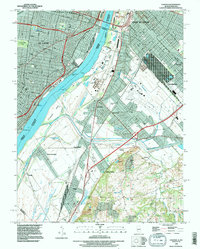 1993 Cahokia1996 Print · USGSThe industrial heart of the Mississippi riverfront comes alive in this survey of the St. Louis and East St. Louis corridor. Genealogists can trace family connections at Holy Family Cem or Bohnemeier Cem while exploring the rail hubs of Dupo.
 - 1993 Map of Webster Groves, 1996 Print
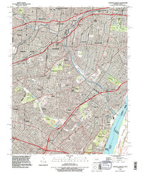 1993 Webster Groves1996 Print · USGSThe southwestern suburbs of St. Louis are shown in the early nineties, revealing a dense landscape of established neighborhoods and major cemetery grounds. Genealogists can trace family sites at Ss Peter and Paul Cemetery or explore the historic Jefferson Barracks riverfront.
 - 1998 Map of Cahokia, 1999 Print
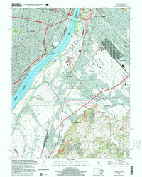 1998 Cahokia1999 Print · USGSThe industrial riverfronts of St. Louis and East St. Louis are captured here in the late 1990s as they bridge the Mississippi River. Genealogists and local historians can trace legacy sites like Holy Family Cem, Arsenal Island, and the U S Engineers Depot.
 - 1998 Map of Webster Groves, 1999 Print
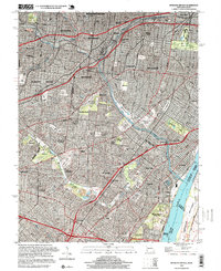 1998 Webster Groves1999 Print · USGSThe southern suburbs of St. Louis are shown in high detail during the late nineties, documenting a landscape shaped by rail lines and riverfront industry. Researchers can trace historic burial sites like Resurrection Cemetery and the sprawling grounds of Jefferson Barracks.2 unique versions available
End of results
Showing maps 1-4 of 4
Frequently asked questions
- What are the different types of historical maps available for Carondelet?
- What is the oldest map of Carondelet?
- Where can I purchase historical maps of Carondelet for my home or office?
- Where can I download high-res historical maps of Carondelet?
- Are there historical topographic maps available for Carondelet?
- Is there historical aerial imagery available for Carondelet?
- Where are historical maps of Carondelet sourced from?