1900s (20th Century) Maps of Forest Park Southeast, St. Louis
Explore 19 historic maps of Forest Park Southeast from the 1900s (20th Century). These maps offer a rare glimpse into what life looked like during the 1900s — showing old roads, neighborhoods, homes, and landmarks that have changed or disappeared over time.
Whether you're researching your family's past, planning a metal detecting trip, or studying how Forest Park Southeast's landscape evolved across the 1900s, these high-resolution maps are a powerful tool for exploring the history of this region.
- Focus on a specific era: All maps on this page are from the 1900s, giving you a focused view of this time period.
- See what’s changed: Compare century-old streets, trails, and buildings to today's modern landscape using overlays and satellite layers.
- Research with precision: Use these maps for genealogy, historical research, land use analysis, or educational projects.
- View, download, or print: Maps are fully viewable online in high resolution, and can be downloaded or printed for your own records.
Start exploring Forest Park Southeast's history through authentic maps from the 1900s. This is your window into the past.
Forest Park Southeast, St. Louis maps
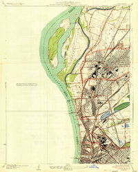
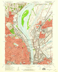
(19)- 1933 Map of Granite City
 1933 Granite City1933 Print · USGSThe riverfront and urban neighborhoods of St. Louis thrive during the early thirties as a hub of rail and river commerce. Genealogists and historians can trace family roots through numerous local parishes like St Joseph Ch and the vast Calvary Cemetery.2 unique versions available
 - 1933 Map of Jefferson Barracks
 1933 Jefferson Barracks1933 Print · USGSSouth St. Louis County and the riverfront during the mid-thirties reveal a landscape of expanding suburbs and deep military roots. Genealogists and historians can trace family plots in National Cem or locate the early centers of Luxemburg and Affton PO Grevois Sta.
 - 1933 Map of Clayton
 1933 Clayton1933 Print · USGSGreater St. Louis was expanding rapidly in the early thirties, as new subdivisions and flight paths began to reshape the western suburbs. Genealogists and historians can trace the foundations of Kinloch Park, the Lambert St Louis Airport, and landmarks like Valhalla Cem.
 - 1935 Map of Granite City
 1935 Granite City1935 Print · USGSThe industrial riverfront of Madison County thrives in the mid-1930s, showing a dense landscape of rail yards and expanding cities. Researchers can trace the complex trackage of the ILLINOIS TERMINAL RR and locate landmarks like the NATIONAL STOCK YARDS or Wilson Park.2 unique versions available
 - 1940 Map of Granite City
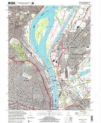
 1940 Granite City1940 Print · USGSThe industrial heart of the bi-state region comes alive in this 1940s survey of the riverfront between Illinois and Missouri. Researchers can trace the massive rail yards and river docks supporting Granite City, alongside historic landmarks like Union Station, St Louis University, and the Bellefontaine Cemetery.4 unique versions available
 - 1941 Map of Clayton
 1941 Clayton1941 Print · USGSGreater St Louis is shown just before the mid-century expansion, detailing the dense street grids and rail lines connecting Clayton and University City. Genealogists and researchers can locate family sites near St Peters Cemetery, trace the early grounds of Washington University, or find local landmarks like the Daniel Boone Sch.2 unique versions available
 - 1941 Map of Jefferson Barracks
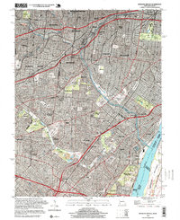
 1941 Jefferson Barracks1941 Print · USGSThe suburbs south of St. Louis were maturing into a dense network of rail-side towns and institutions just before the mid-century. Genealogists and historians can trace family roots through numerous sites like Grants Farm, National Cemetery, and Webster College.3 unique versions available
 - 1949 Map of Saint Louis
 1949 Saint Louis1949 Print · USGSGreater St. Louis and its surrounding river valleys are captured here just after the war, showing the metropolitan core and the rural Ozark fringe. Researchers can trace the sprawling rail network of the Wabash RR or locate landmarks like Meramec Caverns Airport and Scott Air Force Base.2 unique versions available
 - 1954 Map of Granite City, 1958 Print
 1954 Granite City1958 Print · USGSThe mid-century riverfront industrial landscape comes alive here where Missouri and Illinois meet at the Mississippi. Researchers can trace historic neighborhoods and landmarks from Busch Stadium to the sprawling Calvary Cemetery and the Chain of Rocks Canal.6 unique versions available
 - 1954 Map of Clayton, 1959 Print
 1954 Clayton1959 Print · USGSSt. Louis County was undergoing a massive postwar expansion during the 1950s, bridging the gap between the city and its growing western suburbs. Genealogists and urban historians can trace family locations through dozens of neighborhood schools, cemeteries like Memorial Park Cemetery, and landmarks like the U S Army Records Center.6 unique versions available
 - 1954 Map of Webster Groves, 1959 Print
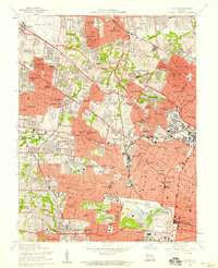
 1954 Webster Groves1959 Print · USGSMid-century St. Louis and Webster Groves appear here during a period of rapid suburban maturation and institutional development. Genealogists can trace family sites near Jefferson Barracks, Resurrection Cemetery, and Luxemburg.5 unique versions available
 - 1962 Map of St. Louis
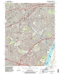
 1962 St. Louis1962 Print · USGSThe mid-century gateway to the west shows the metropolitan expansion of St Louis alongside its critical river confluences. Genealogists and historians can trace the rail corridors of the Missouri Pacific RR and settlements from Fulton to De Soto.
 - 1963 Map of St. Louis, 1970 Print
 1963 St. Louis1970 Print · USGSSt. Louis and its surrounding river valleys are captured here during the peak of mid-century suburban expansion and industrial activity. Trace the historic rail routes of the Norfolk and Western Ry or locate the St Louis Ordnance Plant and early stretches of US Highway 66.4 unique versions available
 - 1966 Map of St. Louis
 1966 St. Louis1966 Print · USGSThe St. Louis metropolitan area and its surrounding river valleys are captured here during the mid-sixties era of suburban growth and industrial strength. Genealogists and historians can trace the foundations of local communities through sites like Old Pioneer Cem, Parks College, and the Jefferson Barracks Military Reservation.
 - 1985 Map of St Louis
 1985 St Louis1985 Print · USGSThe St. Louis metropolitan area and its river confluences are captured here during a period of significant suburban expansion in the 1980s. Genealogists and historians can trace the development of older neighborhoods and landmarks like Jefferson Barracks, Cahokia Mounds State Park, and Washington University.3 unique versions available
 - 1993 Map of Granite City, 1996 Print
 1993 Granite City1996 Print · USGSThe Mississippi riverfront near St. Louis and Granite City is shown here in the 1990s as a hub of industry and transit. Trace family plots in Calvary Cemetery or locate the Brooklyn (Lovejoy PO) post office and Mc Kinley Bridge.
 - 1993 Map of Webster Groves, 1996 Print
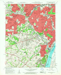
 1993 Webster Groves1996 Print · USGSThe southwestern suburbs of St. Louis are shown in the early nineties, revealing a dense landscape of established neighborhoods and major cemetery grounds. Genealogists can trace family sites at Ss Peter and Paul Cemetery or explore the historic Jefferson Barracks riverfront.
 - 1998 Map of Granite City, 1999 Print
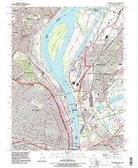
 1998 Granite City1999 Print · USGSGreater St. Louis and the Illinois riverfront are captured here in the late 1990s as the region's industrial and river infrastructure remained in full force. Genealogists and historians can trace family plots in Calvary Cemetery or locate the historic Brooklyn (Lovejoy PO) and the Municipal Dock.
 - 1998 Map of Webster Groves, 1999 Print
 1998 Webster Groves1999 Print · USGSThe southern suburbs of St. Louis are shown in high detail during the late nineties, documenting a landscape shaped by rail lines and riverfront industry. Researchers can trace historic burial sites like Resurrection Cemetery and the sprawling grounds of Jefferson Barracks.2 unique versions available
End of results
Showing maps 1-19 of 19
Frequently asked questions
- What are the different types of historical maps available for Forest Park Southeast?
- What is the oldest map of Forest Park Southeast?
- Where can I purchase historical maps of Forest Park Southeast for my home or office?
- Where can I download high-res historical maps of Forest Park Southeast?
- Are there historical topographic maps available for Forest Park Southeast?
- Is there historical aerial imagery available for Forest Park Southeast?
- Where are historical maps of Forest Park Southeast sourced from?