1950s Maps of Carr Lane, Missouri
Explore 3 historic maps of Carr Lane from the 1950s. These maps offer a rare glimpse into what life looked like during the 1950s — showing old roads, neighborhoods, homes, and landmarks that have changed or disappeared over time.
Whether you're researching your family's past, planning a metal detecting trip, or studying how Carr Lane's landscape evolved across the 1950s, these high-resolution maps are a powerful tool for exploring the history of this region.
- Focus on a specific era: All maps on this page are from the 1950s, giving you a focused view of this time period.
- See what’s changed: Compare century-old streets, trails, and buildings to today's modern landscape using overlays and satellite layers.
- Research with precision: Use these maps for genealogy, historical research, land use analysis, or educational projects.
- View, download, or print: Maps are fully viewable online in high resolution, and can be downloaded or printed for your own records.
Start exploring Carr Lane's history through authentic maps from the 1950s. This is your window into the past.
Carr Lane, MO maps
(3)- 1950 Map of Shell Knob, 1957 Print
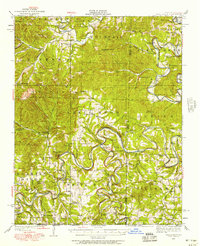 1950 Shell Knob1957 Print · USGSThe White River valley in the early 1950s retains its original character, defined by an intricate network of river fords and rural schoolhouses. Researchers can trace ancestral connections through named crossings like Cole Ford and community centers like Liberty Church or the Schreiner Ferry.3 unique versions available
 - 1954 Map of Harrison
 1954 Harrison1954 Print · USGSThe Ozarks and Boston Mountains meet during a period of massive river engineering in the mid-fifties. Researchers can trace the early shorelines of Bull Shoals Lake and Table Rock Reservoir or locate inland towns like Berryville and Harrison.
 - 1958 Map of Harrison, 1973 Print
 1958 Harrison1973 Print · USGSThe Ozark and Boston Mountains appear in this mid-century survey as the great White River impoundments were reshaping the region. Researchers can trace the rail lines of the St Louis-San Francisco Ry and locate early settlements like Berryville and Gainesville.
End of results
Showing maps 1-3 of 3
Top cities near Carr Lane
- Berryville historical maps
- Green Forest historical maps
- Kimberling City historical maps
- Eureka Springs historical maps
- Reeds Spring historical maps
- Branson West historical maps
See more
Frequently asked questions
- What are the different types of historical maps available for Carr Lane?
- What is the oldest map of Carr Lane?
- Where can I purchase historical maps of Carr Lane for my home or office?
- Where can I download high-res historical maps of Carr Lane?
- Are there historical topographic maps available for Carr Lane?
- Is there historical aerial imagery available for Carr Lane?
- Where are historical maps of Carr Lane sourced from?