1980s Maps of Hartland Hutterite Colony, Montana
Explore 2 historic maps of Hartland Hutterite Colony from the 1980s. These maps offer a rare glimpse into what life looked like during the 1980s — showing old roads, neighborhoods, homes, and landmarks that have changed or disappeared over time.
Whether you're researching your family's past, planning a metal detecting trip, or studying how Hartland Hutterite Colony's landscape evolved across the 1980s, these high-resolution maps are a powerful tool for exploring the history of this region.
- Focus on a specific era: All maps on this page are from the 1980s, giving you a focused view of this time period.
- See what’s changed: Compare century-old streets, trails, and buildings to today's modern landscape using overlays and satellite layers.
- Research with precision: Use these maps for genealogy, historical research, land use analysis, or educational projects.
- View, download, or print: Maps are fully viewable online in high resolution, and can be downloaded or printed for your own records.
Start exploring Hartland Hutterite Colony's history through authentic maps from the 1980s. This is your window into the past.
Hartland Hutterite Colony, MT maps
(2)- 1984 Map of Havre
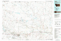 1984 Havre1984 Print · USGSThe Milk River valley and the northern high plains come into focus in the mid-1980s, detailing a landscape defined by rail, ranching, and water management. Trace the path of the Burlington Northern through Havre and Chinook, or locate sites like the Havre Air Force Station and Hilldale Colony.
 - 1984 Map of North Chinook Reservoir NW
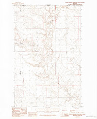 1984 North Chinook Reservoir NW1984 Print · USGSThe international border between Montana and Saskatchewan comes into sharp focus during the mid-1980s. Genealogists and land historians can trace the rugged drainage patterns of Battle Creek along the Hill and Blaine county lines, as well as the paths of Woodpile Coulee and Hay Coulee.
End of results
Showing maps 1-2 of 2
Frequently asked questions
- What are the different types of historical maps available for Hartland Hutterite Colony?
- What is the oldest map of Hartland Hutterite Colony?
- Where can I purchase historical maps of Hartland Hutterite Colony for my home or office?
- Where can I download high-res historical maps of Hartland Hutterite Colony?
- Are there historical topographic maps available for Hartland Hutterite Colony?
- Is there historical aerial imagery available for Hartland Hutterite Colony?
- Where are historical maps of Hartland Hutterite Colony sourced from?