Old Maps of Cooper, Montana for Metal Detecting
Plan your next treasure hunt with 12 historic maps of Cooper. Find old homesites, ghost towns, trails, and gathering spots that may be lost to time — perfect for identifying promising metal detecting locations.
- Locate forgotten sites: Uncover places like long-lost settlements, abandoned rail lines, or gathering spots.
- Plan better hunts: Use map overlays combined with LiDAR or satellite views to narrow in on historically rich areas.
- Made for detectorists: Thousands of hobbyists use these maps to discover relics, coins, and hidden history.
Use these historic maps to boost your research and find new opportunities beneath the surface of Cooper.
Cooper, MT maps
(12)- 1886 Map of Great Falls
 1886 Great Falls1886 Print · USGSCentral Montana in the mid-1880s is defined by its great river systems and the early footprints of frontier outposts. Researchers can trace the early development of Great Falls, find the site of St. Peter's Mission, and locate river settlements like Truly and Fort Shaw.4 unique versions available
 - 1948 Map of Portage
 1948 Portage1948 Print · USGSThe Missouri River corridor near Great Falls is shown in the late 1940s, a landscape shaped by hydroelectric dams and expanding military aviation. Genealogists and researchers can trace local landmarks like Goffe Ranch, Salem Sch, and the Great Northern rail lines.4 unique versions available
 - 1949 Map of Portage
 1949 Portage1949 Print · USGSThe Missouri River breaks through the Montana high plains in the late 1940s, revealing a landscape of vital hydroelectric dams and rural rail stops. Local historians can trace the development of Morony Dam, family holdings at Golie Ranch, and early settlements like Portage.2 unique versions available
 - 1954 Map of Great Falls
 1954 Great Falls1954 Print · USGSThe Missouri River valley in the mid-1950s is shown at a time of significant industrial and military growth. Genealogists and historians can locate early schools and rail stops like Tiger Butte Community Center, Fort Benton, and the Anaconda Wire Plant.4 unique versions available
 - 1957 Map of Great Falls
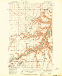
 1957 Great Falls1957 Print · USGSMontana's central plains and mountain foothills are captured here in the mid-fifties, showing the hub of Great Falls and the surrounding grain-shipping towns. Genealogists can trace family roots through the rail sidings of the Great Northern and small rural communities like Sand Coulee or Fort Benton.
 - 1965 Map of Northeast Great Falls, 1968 Print
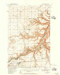
 1965 Northeast Great Falls1968 Print · USGSNortheast of Great Falls in the mid-sixties, the landscape reveals a heavy reliance on the river and the air base. Trace the industrial footprint of Ryan Dam and Malmstrom Air Force Base, or locate local landmarks like Giant Springs and Morningside Sch.3 unique versions available
 - 1976 Map of Great Falls North, 1990 Print
 1976 Great Falls North1990 Print · USGSNorth of the Missouri River in the mid-seventies, this survey shows a region defined by extensive irrigation projects and the growing footprint of Great Falls. Researchers can trace the Burlington Northern rail lines through Dutton or locate the sprawling Benton Lake National Wildlife Refuge.
 - 2011 Map of Northeast Great Falls, 2011 Print
 2011 Northeast Great Falls2011 Print · USGSCovers Cooper, including Great Falls, Sheffels, and other nearby areas
 - 2014 Map of Northeast Great Falls, 2014 Print
 2014 Northeast Great Falls2014 Print · USGSCovers Cooper, including Great Falls, Sheffels, and other nearby areas
 - 2017 Map of Northeast Great Falls, 2017 Print
 2017 Northeast Great Falls2017 Print · USGSCovers Cooper, including Great Falls, Sheffels, and other nearby areas
 - 2020 Map of Northeast Great Falls, 2020 Print
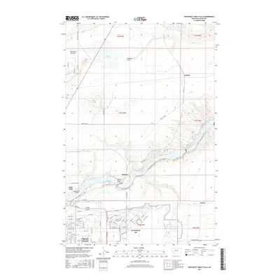
 2020 Northeast Great Falls2020 Print · USGSCovers Cooper, including Great Falls, Sheffels, and other nearby areas
 - 2024 Map of Northeast Great Falls, 2024 Print
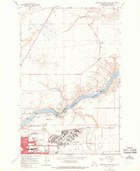
 2024 Northeast Great Falls2024 Print · USGSNortheast of the city in the 2020s, the river valley remains a centerpiece of the landscape alongside the strategic military presence. Local historians can trace the river's path through Rainbow Falls and Giant Springs or locate rural landmarks like Sheffels.
End of results
Showing maps 1-12 of 12
Top cities near Cooper
Frequently asked questions
- What are the different types of historical maps available for Cooper?
- What is the oldest map of Cooper?
- Where can I purchase historical maps of Cooper for my home or office?
- Where can I download high-res historical maps of Cooper?
- Are there historical topographic maps available for Cooper?
- Is there historical aerial imagery available for Cooper?
- Where are historical maps of Cooper sourced from?