Old Maps of Bozeman, Montana
Explore 27 old maps of Bozeman, spanning from 1888 to today. These high-resolution historic maps reveal how streets, neighborhoods, landmarks, and natural features evolved over time — perfect for genealogy, metal detecting, research, and local history exploration.
What you can do with these maps:
- See how Bozeman changed over time: Compare historical maps to modern-day views to trace roads, homesites, rail lines & more.
- View detailed metadata: Each map includes creators, publishers, year, scale, and archive source.
- Overlay maps with satellite & LiDAR: Visualize the past alongside modern tools to explore terrain & human change.
- Trusted historical sources: Maps sourced from the USGS, Library of Congress, and other archives.
- Access maps your way: View online, download high-res files, or order prints for personal or research use.
Start exploring old maps of Bozeman to uncover forgotten places, hidden landmarks, and the deep history beneath your feet.
Bozeman, MT maps
(27)- 1888 Map of Three Forks
 1888 Three Forks1888 Print · USGSSouthwestern Montana was a land of mining camps and river junctions in the late nineteenth century, as the railroad began to connect established valleys. Genealogists can trace family roots through pioneer settlements like Virginia City, Salesville, and Spring Hill, or locate early crossings at Barton's Bridge.
 - 1891 Map of Livingston
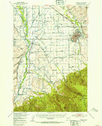
 1891 Livingston1891 Print · USGSUpper Yellowstone River country is documented here in the late nineteenth century as the railroad transformed the valley. Genealogists and historians can trace rail-stop towns like Cokedale, the military grounds at Ft. Ellis, and the Old Crow Agency.
 - 1893 Map of Livingston
 1893 Livingston1893 Print · USGSThe Montana mountain country and the gateway to the national park are captured here in the late nineteenth century. Trace the industrial rail corridor through Livingston to mining sites like Coke and the historic Old Crow Agency.5 unique versions available
 - 1894 Map of Three Forks
 1894 Three Forks1894 Print · USGSSouthwestern Montana thrives along the river forks and rail lines during the mid-1880s. Genealogists and historians can trace early town sites like Pony, Logan, and Salesville while locating river crossings such as Fly's Bridge and Shedds Bridge.
 - 1895 Map of Three Forks
 1895 Three Forks1895 Print · USGSSouthern Montana was a landscape of emerging rail towns and gold-country gulches during the mid-1890s. Genealogists and historians can trace the early footprints of Bozeman, locate Guns Ranch, and follow the Northern Pacific Railroad through Three Forks.5 unique versions available
 - 1947 Map of Bozeman, 1948 Print
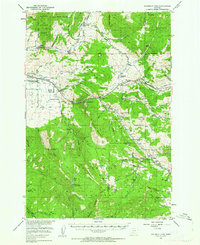
 1947 Bozeman1948 Print · USGSBozeman and the surrounding mountain ranges are captured here just after the war, showing the vital rail and river networks of southwestern Montana. Genealogists and historians can trace routes to early settlements like Virginia City, Gallatin Gateway, and the mountain community of Jardine.
 - 1948 Map of Bozeman, 1951 Print
 1948 Bozeman1951 Print · USGSSouthern Montana in the late 1940s is shown as a high-country crossroads of rail lines and river headwaters. Genealogists and historians can trace old town sites like Virginia City and McLeod alongside the Northern Pacific and Milwaukee Road railroads.
 - 1951 Map of Bozeman Pass, 1952 Print
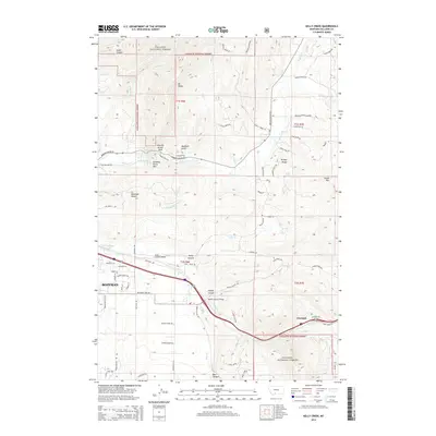
 1951 Bozeman Pass1952 Print · USGSGallatin and Park counties are captured during the early 1950s, showing the high-country divide between Bozeman and Livingston. Genealogists and historians can trace family-named homesteads and old industrial sites like the Anaconda Copper Mines, Malmborg School, and the Shaodan Sawmill.5 unique versions available
 - 1953 Map of Bozeman
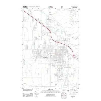
 1953 Bozeman1953 Print · USGSBozeman and the surrounding Gallatin Valley are captured here in the early fifties, showing a landscape defined by collegiate growth and irrigation. Researchers can trace family ranch lands like Patterson Ranch or locate local landmarks including Bozeman Hot Springs and Montana State College.5 unique versions available
 - 1955 Map of Bozeman
 1955 Bozeman1955 Print · USGSBozeman and the upper Missouri River headwaters are captured here during the mid-fifties, showing the vital rail and river networks of southwestern Montana. Local historians can trace the routes of the Northern Pacific railroad through Livingston and locate smaller settlements like Trident, Anceney, and Jardine.
 - 1958 Map of Bozeman, 1968 Print
 1958 Bozeman1968 Print · USGSThe Gallatin and Madison River valleys are captured here in the late fifties, showing the region's transition into a modern mountain hub. Genealogists and historians can trace the paths of the Northern Pacific RR, locate the Anceney School, and see the early layout of Bozeman.3 unique versions available
 - 1965 Map of Bozeman
 1965 Bozeman1965 Print · USGSSouthwestern Montana's river valleys and mountain ranges appear in detail during the early 1960s. Genealogists and historians can trace rail-era settlements like Trident, locate the Anceney School, and see the early footprint of Montana State College.
 - 1987 Map of Kelly Creek
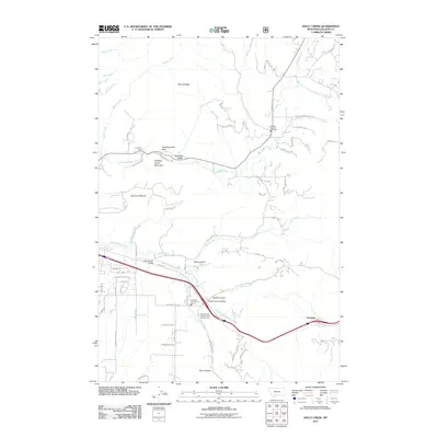
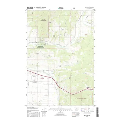
 1987 Kelly Creek1987 Print · USGSGallatin County during the 1980s reveals a landscape where the Bridger Range meets the growing outskirts of Bozeman. Researchers can locate the Mount Ellis Academy, trace the old Bridger Canyon Road, and find local landmarks like the La Motte Sch or the Mine near Chestnut.2 unique versions available
 - 1987 Map of Bozeman, 1988 Print
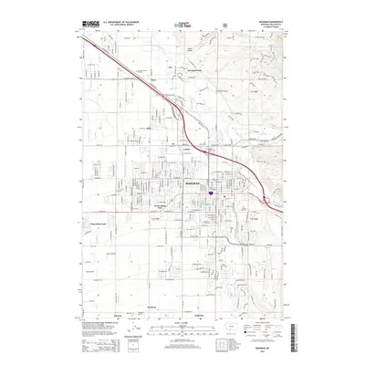
 1987 Bozeman1988 Print · USGSBozeman in the late 1980s reveals a growing university town still deeply integrated with its canal-irrigated valley. Researchers can trace the layout of the Montana State University campus, the historic Northern Pacific line, and irrigation routes like the Farmers Canal.2 unique versions available
 - 1992 Map of Bozeman
 1992 Bozeman1992 Print · USGSThe Gallatin and Madison valleys are captured here in the early nineties, centered on the growth of the Montana State University area. Researchers can trace the legacy of mining in the Tobacco Root Mountains or locate landmarks like the Madison Buffalo Jump State Monument and Church Hill Church.
 - 1992 Map of Livingston
 1992 Livingston1992 Print · USGSPark County in the early nineties remains a landscape of river valleys and high wilderness, centered on the historic rail hub of Livingston. Researchers can trace the Burlington Northern Railroad through mountain passes and locate rural markers like the Coal Mine and Clyde Park.
 - 2000 Map of Kelly Creek, 2005 Print
 2000 Kelly Creek2005 Print · USGSGallatin County at the turn of the millennium shows the intersection of suburban Bozeman and the wild foothills. Trace the terrain from Mount Ellis Academy and Chestnut to landmarks like Drinking Horse Mountain.
 - 2011 Map of Bozeman, 2011 Print
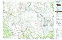
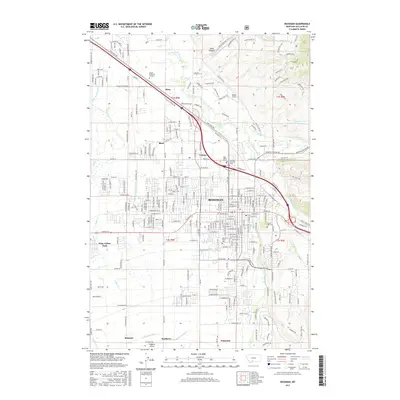
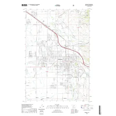
 2011 Bozeman2011 Print · USGSCovers Bozeman, including Matthews, Patterson, and other nearby areas
 - 2011 Map of Kelly Creek, 2011 Print
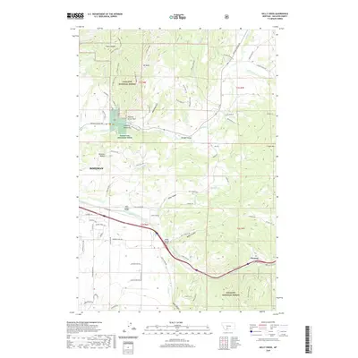
 2011 Kelly Creek2011 Print · USGSCovers Bozeman, including Chestnut, Gallatin County, and other nearby areas
 - 2014 Map of Bozeman, 2014 Print
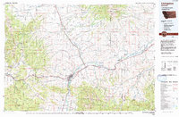
 2014 Bozeman2014 Print · USGSCovers Bozeman, including Matthews, Patterson, and other nearby areas
 - 2014 Map of Kelly Creek, 2014 Print
 2014 Kelly Creek2014 Print · USGSCovers Bozeman, including Chestnut, Gallatin County, and other nearby areas
 - 2017 Map of Kelly Creek, 2017 Print
 2017 Kelly Creek2017 Print · USGSCovers Bozeman, including Chestnut, Gallatin County, and other nearby areas
 - 2017 Map of Bozeman, 2017 Print
 2017 Bozeman2017 Print · USGSCovers Bozeman, including Matthews, Patterson, and other nearby areas
 - 2020 Map of Bozeman, 2020 Print
 2020 Bozeman2020 Print · USGSCovers Bozeman, including Matthews, Patterson, and other nearby areas
 - 2020 Map of Kelly Creek, 2020 Print
 2020 Kelly Creek2020 Print · USGSCovers Bozeman, including Chestnut, Gallatin County, and other nearby areas
Showing maps 1-25 of 27
Top cities near Bozeman
Top neighborhoods of Bozeman
- Story historical maps
- Alder Creek historical maps
- Apollo historical maps
- Baxter Meadows historical maps
- Bon Ton historical maps
- Bozeman Gateway historical maps
See more
Frequently asked questions
- What are the different types of historical maps available for Bozeman?
- What is the oldest map of Bozeman?
- Where can I purchase historical maps of Bozeman for my home or office?
- Where can I download high-res historical maps of Bozeman?
- Are there historical topographic maps available for Bozeman?
- Is there historical aerial imagery available for Bozeman?
- Where are historical maps of Bozeman sourced from?