Old Maps of Bozeman, Montana
Explore 17 old maps of Bozeman, spanning from 1888 to today. These high-resolution historic maps reveal how streets, neighborhoods, landmarks, and natural features evolved over time — perfect for genealogy, metal detecting, research, and local history exploration.
What you can do with these maps:
- See how Bozeman changed over time: Compare historical maps to modern-day views to trace roads, homesites, rail lines & more.
- View detailed metadata: Each map includes creators, publishers, year, scale, and archive source.
- Overlay maps with satellite & LiDAR: Visualize the past alongside modern tools to explore terrain & human change.
- Trusted historical sources: Maps sourced from the USGS, Library of Congress, and other archives.
- Access maps your way: View online, download high-res files, or order prints for personal or research use.
Start exploring old maps of Bozeman to uncover forgotten places, hidden landmarks, and the deep history beneath your feet.
Bozeman, MT maps
(17)- 1888 Map of Three Forks
 1888 Three Forks1888 Print · USGSCovers Bozeman, including Belgrade, Big Sky, and other nearby areas
 - 1891 Map of Livingston
 1891 Livingston1891 Print · USGSCovers Bozeman, including Livingston, Clyde Park, and other nearby areas
 - 1893 Map of Livingston
 1893 Livingston1893 Print · USGSCovers Bozeman, including Livingston, Clyde Park, and other nearby areas5 unique versions available
 - 1894 Map of Three Forks
 1894 Three Forks1894 Print · USGSCovers Bozeman, including Belgrade, Big Sky, and other nearby areas
 - 1895 Map of Three Forks
 1895 Three Forks1895 Print · USGSCovers Bozeman, including Belgrade, Big Sky, and other nearby areas5 unique versions available
 - 1947 Map of Bozeman, 1948 Print
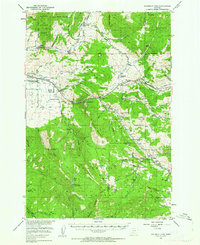
 1947 Bozeman1948 Print · USGSCovers Bozeman, including Belgrade, Livingston, and other nearby areas
 - 1948 Map of Bozeman, 1951 Print
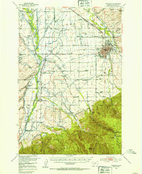
 1948 Bozeman1951 Print · USGSCovers Bozeman, including Belgrade, Livingston, and other nearby areas
 - 1951 Map of Bozeman Pass, 1952 Print
 1951 Bozeman Pass1952 Print · USGSCovers Bozeman, including Muir, West End, and other nearby areas5 unique versions available
 - 1953 Map of Bozeman
 1953 Bozeman1953 Print · USGSCovers Bozeman, including Kerns, Patterson, and other nearby areas5 unique versions available
 - 1955 Map of Bozeman
 1955 Bozeman1955 Print · USGSCovers Bozeman, including Belgrade, Livingston, and other nearby areas
 - 1958 Map of Bozeman, 1968 Print
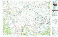
 1958 Bozeman1968 Print · USGSCovers Bozeman, including Belgrade, Livingston, and other nearby areas3 unique versions available
 - 1965 Map of Bozeman
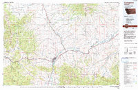
 1965 Bozeman1965 Print · USGSCovers Bozeman, including Belgrade, Livingston, and other nearby areas
 - 1987 Map of Kelly Creek
 1987 Kelly Creek1987 Print · USGSCovers Bozeman, including Chestnut, Gallatin County, and other nearby areas2 unique versions available
 - 1987 Map of Bozeman, 1988 Print
 1987 Bozeman1988 Print · USGSCovers Bozeman, including Patterson, Balmont, and other nearby areas2 unique versions available
 - 1992 Map of Bozeman
 1992 Bozeman1992 Print · USGSCovers Bozeman, including Belgrade, Three Forks, and other nearby areas
 - 1992 Map of Livingston
 1992 Livingston1992 Print · USGSCovers Bozeman, including Livingston, Clyde Park, and other nearby areas
 - 2000 Map of Kelly Creek, 2005 Print
 2000 Kelly Creek2005 Print · USGSCovers Bozeman, including Chestnut, Gallatin County, and other nearby areas
End of results
Showing maps 1-17 of 17
Top cities near Bozeman
Top neighborhoods of Bozeman
- Story historical maps
- Southwood historical maps
- Alder Creek historical maps
- Apollo historical maps
- Baxter Meadows historical maps
- Bon Ton historical maps
See more
Frequently asked questions
- What are the different types of historical maps available for Bozeman?
- What is the oldest map of Bozeman?
- Where can I purchase historical maps of Bozeman for my home or office?
- Where can I download high-res historical maps of Bozeman?
- Are there historical topographic maps available for Bozeman?
- Is there historical aerial imagery available for Bozeman?
- Where are historical maps of Bozeman sourced from?