Old Maps of Kirkwood, Montana for Hiking & Exploration
Hike through history with 12 historic maps of Kirkwood. Explore old trails, ghost towns, and forgotten backroads — perfect for outdoor adventurers and local explorers.
- Rediscover forgotten places: Map out old mining camps, roads, and footpaths that no longer exist on modern maps.
- Layer with modern tools: Combine with LiDAR or satellite views to plan hikes through historical terrain.
- Made for exploration: Popular among hikers, overlanders, and local history lovers.
Use these maps to find adventure and explore the hidden past of Kirkwood.
Kirkwood, MT maps
(12)- 1950 Map of Hebgen Dam, 1954 Print
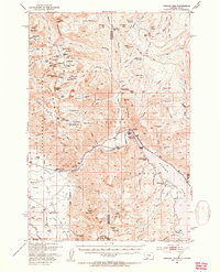 1950 Hebgen Dam1954 Print · USGSThe Madison Range and the high country of the Montana-Idaho border come alive in this mid-century survey. You can trace the ranching and early tourism of the era through sites like Olifee Ranch, Campfire Lodge, and the remote Watkins Creek Ranch airstrip.7 unique versions available
 - 1955 Map of Ashton, 1967 Print
 1955 Ashton1967 Print · USGSThe Greater Yellowstone ecosystem is captured here during the mid-1950s, showing the high plateaus and remote gateway towns of Idaho and Montana. Researchers can trace the Union Pacific line to Ashton or locate small settlements like Squirrel and Grainville.4 unique versions available
 - 1958 Map of Ashton
 1958 Ashton1958 Print · USGSGreater Yellowstone and the eastern Idaho borderlands appear here in the mid-1950s as rail and road networks connected remote mountain basins. Trace the Union Pacific route through Ashton or locate early outposts like Last Chance, Squirrel, and West Yellowstone.
 - 1960 Map of Ashton
 1960 Ashton1960 Print · USGSThe Idaho-Montana-Wyoming borderlands at the dawn of the sixties show a landscape defined by the Continental Divide and early wilderness tourism. Genealogists and historians can trace rail-stop settlements like Trude Siding, old outposts like Warm River, and early lodging at Snowball Inn.
 - 1988 Map of Hebgen Dam, 1989 Print
 1988 Hebgen Dam1989 Print · USGSThe upper Madison River valley near the Montana-Idaho border appears here in the late eighties, just decades after the massive 1959 quake. Researchers can trace the water levels of Earthquake Lake, locate the Hebgen Dam, and find family sites at the Trailer Park.
 - 1993 Map of Hebgen Lake
 1993 Hebgen Lake1993 Print · USGSThe high mountain passes and vast river basins of the Montana-Idaho border come into focus in the early nineties. Genealogists and historians can trace the remote settlement of Lakeview and the development of West Yellowstone near the Red Rock Lakes National Wildlife Refuge.2 unique versions available
 - 2000 Map of Hebgen Dam, 2005 Print
 2000 Hebgen Dam2005 Print · USGSGallatin County, Montana, was still reconciling its geology with its recreation at the start of the new millennium. Researchers can locate significant seismic landmarks like the Ghost Village and the Earthquake Scarp Exhibit alongside local landmarks like Watkins Creek Ranch.
 - 2011 Map of Hebgen Dam, 2011 Print
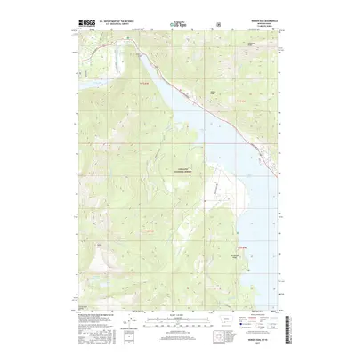
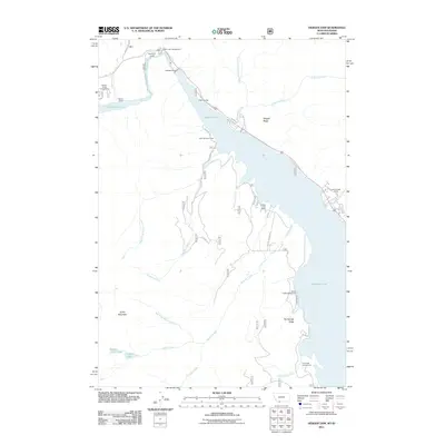 2011 Hebgen Dam2011 Print · USGSCovers Kirkwood, including Clark Springs, Gallatin County, and other nearby areas
 - 2014 Map of Hebgen Dam, 2014 Print
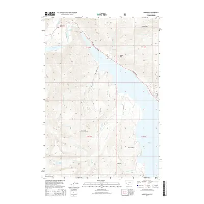 2014 Hebgen Dam2014 Print · USGSCovers Kirkwood, including Clark Springs, Gallatin County, and other nearby areas
 - 2017 Map of Hebgen Dam, 2017 Print
 2017 Hebgen Dam2017 Print · USGSCovers Kirkwood, including Clark Springs, Gallatin County, and other nearby areas
 - 2020 Map of Hebgen Dam, 2020 Print
 2020 Hebgen Dam2020 Print · USGSCovers Kirkwood, including Clark Springs, Gallatin County, and other nearby areas
 - 2024 Map of Hebgen Dam, 2024 Print
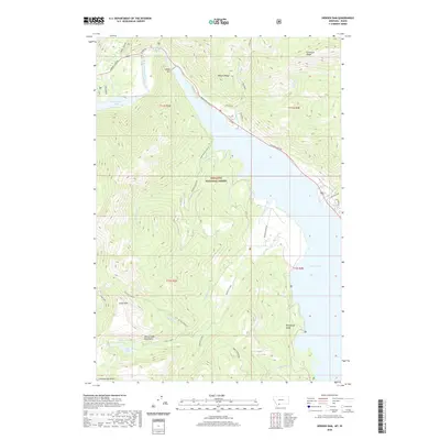
 2024 Hebgen Dam2024 Print · USGSGallatin, Montana is shown here as a landscape shaped by water and mountains in the modern era. Researchers can trace the shoreline of Hebgen Lake and locate alpine landmarks like Coffin Mtn and the evocatively named Ghost Village Rd.
End of results
Showing maps 1-12 of 12
Top cities near Kirkwood
Frequently asked questions
- What are the different types of historical maps available for Kirkwood?
- What is the oldest map of Kirkwood?
- Where can I purchase historical maps of Kirkwood for my home or office?
- Where can I download high-res historical maps of Kirkwood?
- Are there historical topographic maps available for Kirkwood?
- Is there historical aerial imagery available for Kirkwood?
- Where are historical maps of Kirkwood sourced from?