Old Maps of Helena Valley West Central, Lewis and Clark County for Hiking & Exploration
Hike through history with 12 historic maps of Helena Valley West Central. Explore old trails, ghost towns, and forgotten backroads — perfect for outdoor adventurers and local explorers.
- Rediscover forgotten places: Map out old mining camps, roads, and footpaths that no longer exist on modern maps.
- Layer with modern tools: Combine with LiDAR or satellite views to plan hikes through historical terrain.
- Made for exploration: Popular among hikers, overlanders, and local history lovers.
Use these maps to find adventure and explore the hidden past of Helena Valley West Central.
Helena Valley West Central, Lewis and Clark County maps
(12)- 1889 Map of Helena
 1889 Helena1889 Print · USGSCovers Helena Valley West Central, including Butte, Helena, and other nearby areas
 - 1893 Map of Helena
 1893 Helena1893 Print · USGSCovers Helena Valley West Central, including Butte, Helena, and other nearby areas2 unique versions available
 - 1899 Map of Helena
 1899 Helena1899 Print · USGSCovers Helena Valley West Central, including Helena, Montana City, and other nearby areas3 unique versions available
 - 1899 Map of Helena, 1956 Print
 1899 Helena1956 Print · USGSCovers Helena Valley West Central, including Butte, Helena, and other nearby areas
 - 1903 Map of Helena
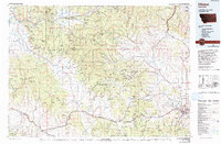
 1903 Helena1903 Print · USGSCovers Helena Valley West Central, including Butte, Helena, and other nearby areas4 unique versions available
 - 1947 Map of Butte, 1949 Print
 1947 Butte1949 Print · USGSCovers Helena Valley West Central, including Missoula, Butte, and other nearby areas2 unique versions available
 - 1950 Map of Helena, 1954 Print
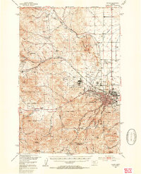 1950 Helena1954 Print · USGSCovers Helena Valley West Central, including Helena, Austin, and other nearby areas7 unique versions available
 - 1958 Map of Butte
 1958 Butte1958 Print · USGSCovers Helena Valley West Central, including Missoula, Butte, and other nearby areas5 unique versions available
 - 1960 Map of Butte
 1960 Butte1960 Print · USGSCovers Helena Valley West Central, including Missoula, Butte, and other nearby areas
 - 1962 Map of Butte
 1962 Butte1962 Print · USGSCovers Helena Valley West Central, including Missoula, Butte, and other nearby areas
 - 1975 Map of Elliston, 1993 Print
 1975 Elliston1993 Print · USGSCovers Helena Valley West Central, including Helena, McDonald, and other nearby areas
 - 1985 Map of Scratchgravel Hills
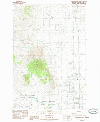 1985 Scratchgravel Hills1985 Print · USGSCovers Helena Valley West Central, including Helena, Iron, and other nearby areas
End of results
Showing maps 1-12 of 12
Frequently asked questions
- What are the different types of historical maps available for Helena Valley West Central?
- What is the oldest map of Helena Valley West Central?
- Where can I purchase historical maps of Helena Valley West Central for my home or office?
- Where can I download high-res historical maps of Helena Valley West Central?
- Are there historical topographic maps available for Helena Valley West Central?
- Is there historical aerial imagery available for Helena Valley West Central?
- Where are historical maps of Helena Valley West Central sourced from?