Old Maps of Jennings, Montana
Explore 14 old maps of Jennings, spanning from 1920 to today. These high-resolution historic maps reveal how streets, neighborhoods, landmarks, and natural features evolved over time — perfect for genealogy, metal detecting, research, and local history exploration.
What you can do with these maps:
- See how Jennings changed over time: Compare historical maps to modern-day views to trace roads, homesites, rail lines & more.
- View detailed metadata: Each map includes creators, publishers, year, scale, and archive source.
- Overlay maps with satellite & LiDAR: Visualize the past alongside modern tools to explore terrain & human change.
- Trusted historical sources: Maps sourced from the USGS, Library of Congress, and other archives.
- Access maps your way: View online, download high-res files, or order prints for personal or research use.
Start exploring old maps of Jennings to uncover forgotten places, hidden landmarks, and the deep history beneath your feet.
Jennings, MT maps
(14)- 1920 Map of Jennings
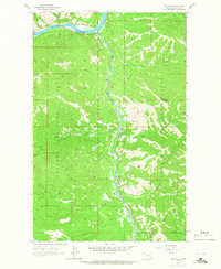
 1920 Jennings1920 Print · USGSNorthwest Montana in the early twenties is captured here as a landscape of timber, rail, and isolated homesteads. Genealogists can trace family-named locations such as Corries Ranch and Deegan Ranch, or locate the site of the Mamicke P.O. near the Fisher River.
 - 1935 Map of Thompson Lakes
 1935 Thompson Lakes1935 Print · USGSNorthwestern Montana in the mid-thirties was a rugged domain of timber management and rail-line outposts. Researchers can trace the Great Northern Ry through Jennings or locate remote schools like the Thompson River Sch and Manicke Sch.3 unique versions available
 - 1942 Map of Thompson Lakes
 1942 Thompson Lakes1942 Print · USGSNorthwest Montana during the early 1940s remained a landscape of timber and rail, where the Great Northern Railway hugged the banks of the Kootenai River. Researchers can trace the network of forest lookouts like Warland Pk Lookout and find early rural sites including Pleasant Valley Sch.2 unique versions available
 - 1957 Map of Kalispell, 1967 Print
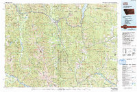
 1957 Kalispell1967 Print · USGSNorthwest Montana in the late fifties showcases a mountain landscape transitioning between wilderness and industry. Genealogists and researchers can trace the Great Northern rail corridor through Kalispell and Whitefish, or locate landmarks like the Montana Soldiers Home and Hungry Horse Reservoir.3 unique versions available
 - 1960 Map of Kalispell
 1960 Kalispell1960 Print · USGSNorthwest Montana in the late fifties is defined by the mountain corridors of the Great Northern Railway and the vast reaches of Glacier National Park. Researchers can trace the legacy of timber and mining towns like Libby, Rexford, and Whitefish, or locate landmarks such as the Snowshoe Mine.
 - 1961 Map of Kalispell
 1961 Kalispell1961 Print · USGSNorthwestern Montana at the start of the 1960s shows a landscape of timber-driven rail towns and the sprawling wild lands of Glacier National Park. Genealogists and historians can trace the route of the Great Northern through mountain passes or locate old settlements like Fortine, Trego, and Warland.
 - 1963 Map of Tony Peak, 1966 Print
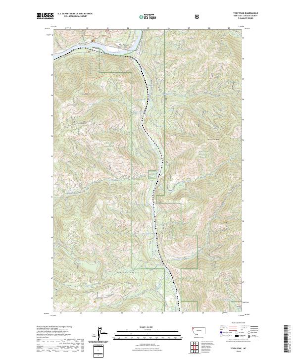
 1963 Tony Peak1966 Print · USGSThe Kootenai River and its confluence with the Fisher River dominate this Lincoln County landscape in the early sixties. Researchers can trace the Great Northern rail line and identify landmarks like the Lookout Tower on Tony Peak.2 unique versions available
 - 1978 Map of Libby, 1993 Print
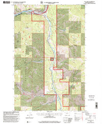
 1978 Libby1993 Print · USGSNorthwestern Montana in the late seventies and early eighties shows the impact of the newly formed Koocanusa Lake on the river economy. Genealogists and historians can trace local mining claims like the Snowstorm Mine or find smaller communities such as Happys Inn and White Haven.
 - 1997 Map of Tony Peak, 2000 Print
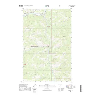
 1997 Tony Peak2000 Print · USGSThe Kootenai River and its junction with the Fisher River define this northwestern Montana landscape in the late nineties. Researchers can locate Tony Peak Lookout, identify a Mine site, and trace drainages from Canoe Gulch to Moonshine Island.
 - 2011 Map of Tony Peak, 2011 Print
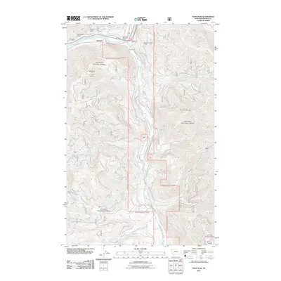 2011 Tony Peak2011 Print · USGSCovers Jennings, including Lincoln County, United States, and other nearby areas
 - 2014 Map of Tony Peak, 2014 Print
 2014 Tony Peak2014 Print · USGSCovers Jennings, including Lincoln County, United States, and other nearby areas
 - 2017 Map of Tony Peak, 2017 Print
 2017 Tony Peak2017 Print · USGSCovers Jennings, including Lincoln County, United States, and other nearby areas
 - 2020 Map of Tony Peak, 2020 Print
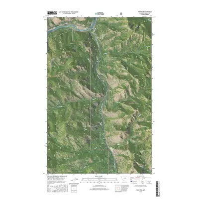
 2020 Tony Peak2020 Print · USGSCovers Jennings, including Lincoln County, United States, and other nearby areas
 - 2024 Map of Tony Peak, 2024 Print
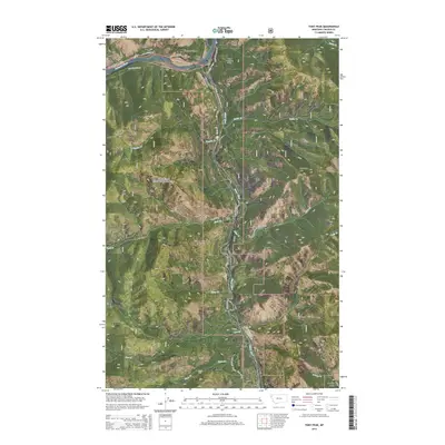
 2024 Tony Peak2024 Print · USGSLincoln County’s mountainous interior and the Kootenai River corridor are documented in this contemporary survey. Researchers can trace the timber and transit routes around the settlement of Jennings, Blackwell Flats, and the Champion Haul Rd.
End of results
Showing maps 1-14 of 14
Top cities near Jennings
Frequently asked questions
- What are the different types of historical maps available for Jennings?
- What is the oldest map of Jennings?
- Where can I purchase historical maps of Jennings for my home or office?
- Where can I download high-res historical maps of Jennings?
- Are there historical topographic maps available for Jennings?
- Is there historical aerial imagery available for Jennings?
- Where are historical maps of Jennings sourced from?