Old Maps of Grantsdale, Montana
Explore 13 old maps of Grantsdale, spanning from 1901 to today. These high-resolution historic maps reveal how streets, neighborhoods, landmarks, and natural features evolved over time — perfect for genealogy, metal detecting, research, and local history exploration.
What you can do with these maps:
- See how Grantsdale changed over time: Compare historical maps to modern-day views to trace roads, homesites, rail lines & more.
- View detailed metadata: Each map includes creators, publishers, year, scale, and archive source.
- Overlay maps with satellite & LiDAR: Visualize the past alongside modern tools to explore terrain & human change.
- Trusted historical sources: Maps sourced from the USGS, Library of Congress, and other archives.
- Access maps your way: View online, download high-res files, or order prints for personal or research use.
Start exploring old maps of Grantsdale to uncover forgotten places, hidden landmarks, and the deep history beneath your feet.
Grantsdale, MT maps
(13)- 1901 Map of Hamilton
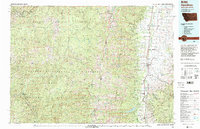
 1901 Hamilton1901 Print · USGSThe Bitterroot Valley in the late nineteenth century is a landscape of emerging rail towns and sophisticated irrigation. Trace the development of early Hamilton and Victor alongside the Northern Pacific Railway and historic canals like Republican Ditch.6 unique versions available
 - 1956 Map of Hamilton, 1970 Print
 1956 Hamilton1970 Print · USGSThe Bitterroot Valley and surrounding high country are captured here during the mid-fifties, showing the region's transition into a modern forest-and-rail hub. Genealogists and historians can trace family-named sites and early infrastructure from Fort Missoula to towns like Stevensville and Darby along the Northern Pacific line.2 unique versions available
 - 1959 Map of Hamilton
 1959 Hamilton1959 Print · USGSThe Bitterroot Valley and surrounding wilderness are captured in the late fifties, showing a landscape defined by forestry and river-based settlement. Researchers can trace the Lolo Trail or locate historical points like Fort Missoula and the Fred Burr Reservoir.
 - 1960 Map of Hamilton
 1960 Hamilton1960 Print · USGSThe Bitterroot Valley and surrounding high country are captured here during the late fifties, showing the region's transition into a modern forest and rail corridor. Researchers can trace the path of the Northern Pacific through Missoula or locate landmarks like Fort Missoula and Lake Como.
 - 1964 Map of Hamilton
 1964 Hamilton1964 Print · USGSThe Bitterroot Valley and its surrounding peaks are captured in detail during the mid-1960s, showing the early infrastructure of the Northern Rockies. Genealogists and historians can trace family roots in Hamilton and Stevensville or follow the historic Lolo Trail and Nez Perce Trail.
 - 1964 Map of Hamilton South, 1968 Print
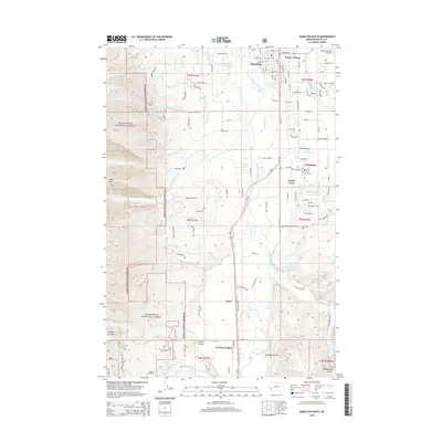
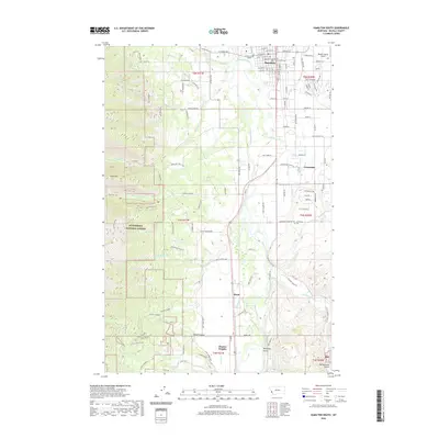
 1964 Hamilton South1968 Print · USGSThe Bitterroot Valley flourished in the mid-1960s through a sophisticated system of irrigation and rail transport. Genealogists and historians can trace family locations near Grantsdale, Charlas Heights, and several schools including Westview Sch.2 unique versions available
 - 1980 Map of Hamilton, 1997 Print
 1980 Hamilton1997 Print · USGSThe Bitterroot Valley in the 1980s was a landscape of river-fed towns and mountain wilderness along the Idaho-Montana border. Genealogists and historians can trace the developments of Hamilton, Woodside, and Grantsdale or locate high-altitude landmarks like Gash Point.2 unique versions available
 - 1998 Map of Hamilton South, 2002 Print
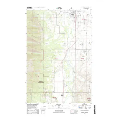
 1998 Hamilton South2002 Print · USGSThe Bitterroot River valley south of Hamilton shows a landscape shaped by irrigation and mountain timber near the millennium. Researchers can trace historical school sites like Jefferson Sch and the development of local water works such as the Republican Ditch and Grantsdale Canal.
 - 2011 Map of Hamilton South, 2011 Print
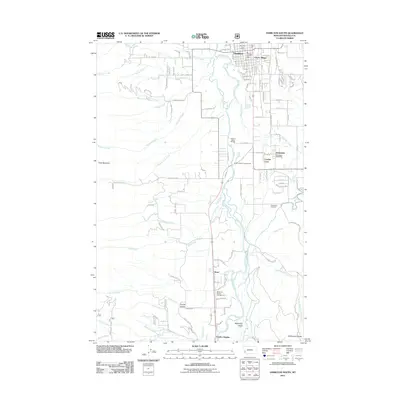 2011 Hamilton South2011 Print · USGSCovers Grantsdale, including Hamilton, Leisure Village, and other nearby areas
 - 2014 Map of Hamilton South, 2014 Print
 2014 Hamilton South2014 Print · USGSCovers Grantsdale, including Hamilton, Leisure Village, and other nearby areas
 - 2017 Map of Hamilton South, 2017 Print
 2017 Hamilton South2017 Print · USGSCovers Grantsdale, including Hamilton, Leisure Village, and other nearby areas
 - 2020 Map of Hamilton South, 2020 Print
 2020 Hamilton South2020 Print · USGSCovers Grantsdale, including Hamilton, Leisure Village, and other nearby areas
 - 2024 Map of Hamilton South, 2024 Print
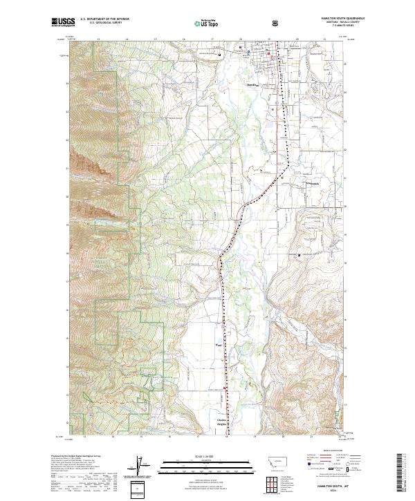 2024 Hamilton South2024 Print · USGSThe Bitterroot Valley comes alive in this survey of the region south of the Ravalli county seat. Local researchers can trace property lines near the Ravalli County Courthouse, locate family plots at Riverview Cem, and explore the canyon mouths of Roaring Lion Creek.
End of results
Showing maps 1-13 of 13
Top cities near Grantsdale
Frequently asked questions
- What are the different types of historical maps available for Grantsdale?
- What is the oldest map of Grantsdale?
- Where can I purchase historical maps of Grantsdale for my home or office?
- Where can I download high-res historical maps of Grantsdale?
- Are there historical topographic maps available for Grantsdale?
- Is there historical aerial imagery available for Grantsdale?
- Where are historical maps of Grantsdale sourced from?