Old Maps of Victor, Montana for Genealogy
Trace your family roots with 13 historic maps of Victor. These high-res maps reveal old neighborhoods, homesites, landmarks, and streets — helping you uncover where your ancestors lived and how the area evolved over time.
- Explore historic neighborhoods: Identify where your relatives may have lived in the 1800s or 1900s.
- Compare maps over time: Trace the changes in streets, buildings, and landmarks for multi-generational research.
- Perfect for genealogy & ancestry research: Used by family historians and researchers to map out lineage and migration.
These maps are an incredible resource for exploring your personal connection to Victor's past.
Victor, MT maps
(13)- 1901 Map of Hamilton
 1901 Hamilton1901 Print · USGSThe Bitterroot Valley in the late nineteenth century is a landscape of emerging rail towns and sophisticated irrigation. Trace the development of early Hamilton and Victor alongside the Northern Pacific Railway and historic canals like Republican Ditch.6 unique versions available
 - 1956 Map of Hamilton, 1970 Print
 1956 Hamilton1970 Print · USGSThe Bitterroot Valley and surrounding high country are captured here during the mid-fifties, showing the region's transition into a modern forest-and-rail hub. Genealogists and historians can trace family-named sites and early infrastructure from Fort Missoula to towns like Stevensville and Darby along the Northern Pacific line.2 unique versions available
 - 1959 Map of Hamilton
 1959 Hamilton1959 Print · USGSThe Bitterroot Valley and surrounding wilderness are captured in the late fifties, showing a landscape defined by forestry and river-based settlement. Researchers can trace the Lolo Trail or locate historical points like Fort Missoula and the Fred Burr Reservoir.
 - 1960 Map of Hamilton
 1960 Hamilton1960 Print · USGSThe Bitterroot Valley and surrounding high country are captured here during the late fifties, showing the region's transition into a modern forest and rail corridor. Researchers can trace the path of the Northern Pacific through Missoula or locate landmarks like Fort Missoula and Lake Como.
 - 1964 Map of Hamilton
 1964 Hamilton1964 Print · USGSThe Bitterroot Valley and its surrounding peaks are captured in detail during the mid-1960s, showing the early infrastructure of the Northern Rockies. Genealogists and historians can trace family roots in Hamilton and Stevensville or follow the historic Lolo Trail and Nez Perce Trail.
 - 1967 Map of Victor, 1972 Print
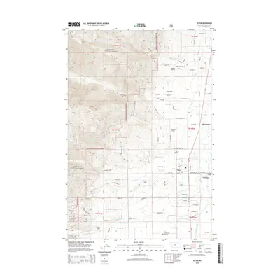
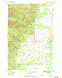 1967 Victor1972 Print · USGSIn the late sixties, the Bitterroot Valley near Victor maintained its rural character at the edge of the Bitterroot National Forest. Researchers can trace the historic Lewis and Clark Trail or locate the Curlew Mine and local Cem.
 - 1980 Map of Hamilton, 1997 Print
 1980 Hamilton1997 Print · USGSThe Bitterroot Valley in the 1980s was a landscape of river-fed towns and mountain wilderness along the Idaho-Montana border. Genealogists and historians can trace the developments of Hamilton, Woodside, and Grantsdale or locate high-altitude landmarks like Gash Point.2 unique versions available
 - 1998 Map of Victor, 2002 Print
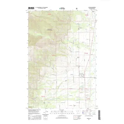
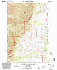 1998 Victor2002 Print · USGSThe Bitterroot Valley in the late nineties shows a landscape of mountain timber and river-bottom ranching. Genealogists and historians can trace the Bitterroot Branch rail line, locate the Curlew Mines, and find family landmarks like Curlew Sch.
 - 2011 Map of Victor, 2011 Print
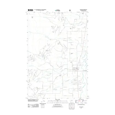 2011 Victor2011 Print · USGSCovers Victor, including Ravalli County, United States, and other nearby areas
 - 2014 Map of Victor, 2014 Print
 2014 Victor2014 Print · USGSCovers Victor, including Ravalli County, United States, and other nearby areas
 - 2017 Map of Victor, 2017 Print
 2017 Victor2017 Print · USGSCovers Victor, including Ravalli County, United States, and other nearby areas
 - 2020 Map of Victor, 2020 Print
 2020 Victor2020 Print · USGSCovers Victor, including Ravalli County, United States, and other nearby areas
 - 2024 Map of Victor, 2024 Print
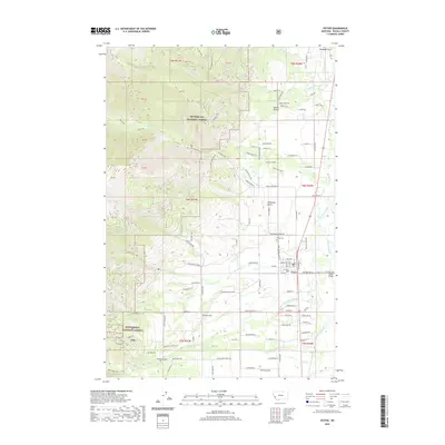
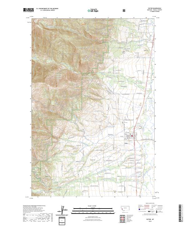 2024 Victor2024 Print · USGSThe Bitterroot Valley near Victor is shown here in its modern agricultural and wilderness context. Researchers can trace family history at the Victor Cem and explore landmarks like Dineen Hill, Indian Prairie, and the numerous creeks flowing from the Bitterroot Mountains.
End of results
Showing maps 1-13 of 13
Top cities near Victor
Frequently asked questions
- What are the different types of historical maps available for Victor?
- What is the oldest map of Victor?
- Where can I purchase historical maps of Victor for my home or office?
- Where can I download high-res historical maps of Victor?
- Are there historical topographic maps available for Victor?
- Is there historical aerial imagery available for Victor?
- Where are historical maps of Victor sourced from?