Old Maps of Boyd County, Nebraska
Explore 97 old maps of Boyd County, spanning from 1950 to today. These high-resolution historic maps reveal how streets, neighborhoods, landmarks, and natural features evolved over time — perfect for genealogy, metal detecting, research, and local history exploration.
What you can do with these maps:
- See how Boyd County changed over time: Compare historical maps to modern-day views to trace roads, homesites, rail lines & more.
- View detailed metadata: Each map includes creators, publishers, year, scale, and archive source.
- Overlay maps with satellite & LiDAR: Visualize the past alongside modern tools to explore terrain & human change.
- Trusted historical sources: Maps sourced from the USGS, Library of Congress, and other archives.
- Access maps your way: View online, download high-res files, or order prints for personal or research use.
Start exploring old maps of Boyd County to uncover forgotten places, hidden landmarks, and the deep history beneath your feet.
Boyd County, NE maps
(97)- 1950 Map of Mariaville
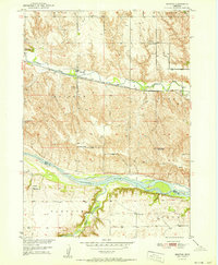
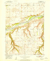
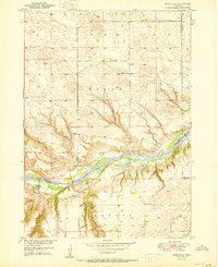 1950 Mariaville1950 Print · USGSThe Niobrara River breaks through the Nebraska sandhills at mid-century, revealing a landscape of remote ranching and rural education. Genealogists and researchers can locate the Mariaville settlement, Simpson Cem, and schools like School No 69.2 unique versions available
 - 1950 Map of Lynch, 1952 Print
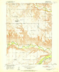
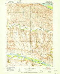
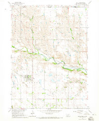
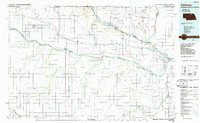
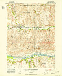 1950 Lynch1952 Print · USGSThe Boyd County panhandle was a landscape of remote farmsteads and rail-fed towns in the early 1950s. Genealogists can locate several rural schoolhouses like School No 63 and cemeteries such as Highland Cemetery along the Chicago and North Western line.3 unique versions available
 - 1950 Map of Monowi, 1973 Print
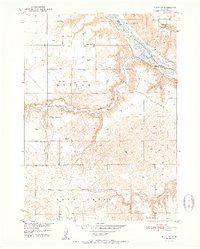
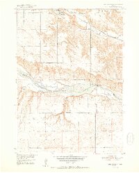
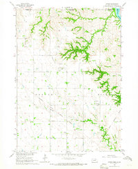
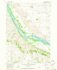
 1950 Monowi1973 Print · USGSNortheastern Nebraska is captured in the mid-1950s at the meeting of the Missouri River and Niobrara River. Genealogists and local historians can locate family sites among numerous rural landmarks like Alford Cem, Monowi, and Masdon Sch.
 - 1951 Map of Butte NW
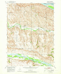
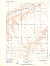
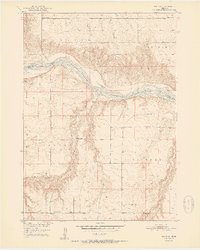
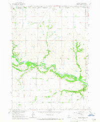
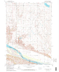
 1951 Butte NW1951 Print · USGSBoyd County agriculture and rural life are preserved here at the turn of the 1950s, showing the Nebraska-South Dakota borderlands. Researchers can trace the placement of historic country schoolhouses like School No 49 and School No 3 near the Niobrara River.2 unique versions available
 - 1951 Map of Bristow
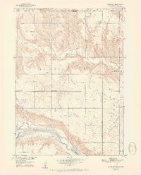
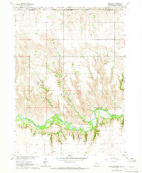
 1951 Bristow1951 Print · USGSBoyd and Holt counties meet at the Niobrara River in the early fifties, documenting a landscape of small townships and prairie schools. Genealogists can trace family roots through Bristow Cem, Mission Cem, and rural landmarks like School No 57 or the rail-side village of Bristow.3 unique versions available
 - 1951 Map of Naper
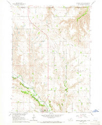
 1951 Naper1951 Print · USGSNaper and the Boyd County ranchlands are captured here in the early fifties, showing a rural landscape defined by river valleys and the state line. Researchers can locate several country schoolhouses, from Basin Sch to Point Sch, and the local Knoll Crest Cem.2 unique versions available
 - 1951 Map of Butte SW
 1951 Butte SW1951 Print · USGSHolt County's northern border along the Niobrara River is captured here in the early fifties, showing a rural landscape defined by its creek valleys. Genealogists can locate specific family landmarks like Adams Cem and rural school sites including Prairie Rose Sch and School No 68.2 unique versions available
 - 1951 Map of Dustin
 1951 Dustin1951 Print · USGSHolt County and Boyd County are documented here in the early 1950s, showing the rural communities along the Niobrara River. Local history researchers can trace family landmarks like the Cleveland Cem, White Horse Ranch, and several rural schoolhouses including Pleasant Hill Sch.2 unique versions available
 - 1951 Map of Naper SW
 1951 Naper SW1951 Print · USGSHolt County ranching and rural life are preserved here in the early fifties, centering on the canyon-cut lands along the Niobrara River. Genealogists and local historians can trace legacy landholdings like Tienken Ranch and several rural schoolhouses, including School No 51 and the Frost Valley Sch.2 unique versions available
 - 1952 Map of Monowi
 1952 Monowi1952 Print · USGSThe village of Monowi and the surrounding Nebraska-South Dakota borderlands are captured here in the early 1950s. Genealogists can trace family roots through numerous rural landmarks like Beulah Cem, Pleasant Hill Sch, and the Verdel Sch.2 unique versions available
 - 1952 Map of Spencer South
 1952 Spencer South1952 Print · USGSBoyd County and the Niobrara River are shown here in the early fifties during the peak of the region's agricultural and hydraulic development. Genealogists and local historians can locate rural schoolhouses and family burial grounds like the Bohemian Cemetery and School No 142 along the Chicago and North Western rail line.2 unique versions available
 - 1952 Map of Butte SE
 1952 Butte SE1952 Print · USGSHolt and Boyd counties are captured here in the early fifties, where the braided Niobrara River carves through the Nebraska plains. Genealogists can locate rural landmarks like Catalpa and several numbered schoolhouses, including School No 193 (Abandoned).2 unique versions available
 - 1955 Map of O'Neill, 1974 Print
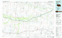
 1955 O'Neill1974 Print · USGSNorth-central Nebraska in the 1950s reveals a vast cattle-ranching landscape transitioning from the Missouri River breaks to the iconic Sand Hills. Researchers can trace the path of the Chicago and North Western rail line and locate rural landmarks like the Dustin Post Office and St Johns Lake Ch.2 unique versions available
 - 1959 Map of O'Neill
 1959 O'Neill1959 Print · USGSNorth-central Nebraska in the late fifties is defined by the vast Sand Hills and the vital Chicago and North Western rail line. Genealogists and researchers can trace family roots through settlements like Atkinson, Bassett, and Stuart or follow the waters of the Niobrara River.2 unique versions available
 - 1964 Map of Butte, 1965 Print
 1964 Butte1965 Print · USGSThe Nebraska and South Dakota borderlands come into focus in the mid-sixties, centered on the Boyd County seat. Researchers can trace the Chicago and North Western rail line through Anoka and locate historic burial sites like Old Settlers Cem.
 - 1964 Map of Gross, 1965 Print
 1964 Gross1965 Print · USGSBoyd County, Nebraska, and Gregory County, South Dakota, are captured in the mid-1960s as the rural landscape follows the Missouri River Basin. Genealogists and historians can trace the Old Fort Randall Military Road and locate the Rosedale Ch, Pleasant View Sch, and the settlement of Gross.
 - 1964 Map of Jamison, 1965 Print
 1964 Jamison1965 Print · USGSThe Nebraska-South Dakota borderlands come into focus in the mid-1960s, showing the intersection of the Rosebud Indian Reservation with the winding Keya Paha River. You can trace the rural communities of Jamison and Brocksburg alongside Spotted Tail Sch and Emmanuel Cem.
 - 1964 Map of Naper NW, 1966 Print
 1964 Naper NW1966 Print · USGSBoyd County, Nebraska, and the South Dakota borderlands are captured here in the mid-1960s. Researchers can locate family burial plots at the Naper Cem and German Cem or trace the winding course of the Keya Paha River through the valley.
 - 1964 Map of Lynch NE, 1966 Print
 1964 Lynch NE1966 Print · USGSThe Missouri River borderlands in the mid-1960s reveal a landscape of prairie schools and treaty boundaries. Genealogists can locate family landmarks like the Native American Ch or trace old rural districts such as School No 64 and School No 80.2 unique versions available
 - 1964 Map of Spencer North, 1966 Print
 1964 Spencer North1966 Print · USGSNorth of Spencer, the Nebraska-South Dakota border meets the old Fort Randall Military Reservation Boundary in the mid-1960s. Genealogists can trace local roots through landmarks like Messiah Ch, School No 52, and the Old Immanuel Cem.
 - 1964 Map of Marty, 1966 Print
 1964 Marty1966 Print · USGSThe Missouri River borderlands of South Dakota and Nebraska are captured here in the mid-sixties, showcasing a landscape shaped by tribal lands and military history. Genealogists can trace family footprints through the Old Yankton Indian Res Bdy, St Pauls Cem, and several rural schools like School No 83.2 unique versions available
 - 1969 Map of O'Neill
 1969 O'Neill1969 Print · USGSCentral Nebraska in the mid-fifties is defined here by the expansive Sand Hills and the winding Niobrara River. Trace the Chicago and North Western rail line through cattle towns like O'Neill and Ainsworth.
 - 1985 Map of Ainsworth
 1985 Ainsworth1985 Print · USGSThe Nebraska-South Dakota borderlands come into focus in the mid-1980s, documenting a landscape of river breaks and remote ranching hubs. Genealogists can trace the rural layout of Ainsworth, Bassett, and Springview or follow the Chicago and North Western rail line.2 unique versions available
 - 1986 Map of Atkinson
 1986 Atkinson1986 Print · USGSBoyd and Holt counties come into focus during the mid-eighties as they span the river valleys of the Nebraska and South Dakota border. Genealogists can locate family-named townships and remote outposts like Opportunity, Pishelville, and the Yankton Indian Reservation.2 unique versions available
 - 1989 Map of O'Neill
 1989 O'Neill1989 Print · USGSThe Nebraska-South Dakota borderlands are captured here in the late eighties, documenting the ranching and rail infrastructure of the High Plains. Genealogists and collectors can trace historic prairie towns like Monowi, Pishelville, and Santee along the Niobrara River.
Showing maps 1-25 of 97
Top cities of Boyd County
- Spencer historical maps
- Butte historical maps
- Lynch historical maps
- Naper historical maps
- Bristow historical maps
- Anoka historical maps
See more
Frequently asked questions
- What are the different types of historical maps available for Boyd County?
- What is the oldest map of Boyd County?
- Where can I purchase historical maps of Boyd County for my home or office?
- Where can I download high-res historical maps of Boyd County?
- Are there historical topographic maps available for Boyd County?
- Is there historical aerial imagery available for Boyd County?
- Where are historical maps of Boyd County sourced from?