1960s Maps of Harvard, Nebraska
Explore 2 historic maps of Harvard from the 1960s. These maps offer a rare glimpse into what life looked like during the 1960s — showing old roads, neighborhoods, homes, and landmarks that have changed or disappeared over time.
Whether you're researching your family's past, planning a metal detecting trip, or studying how Harvard's landscape evolved across the 1960s, these high-resolution maps are a powerful tool for exploring the history of this region.
- Focus on a specific era: All maps on this page are from the 1960s, giving you a focused view of this time period.
- See what’s changed: Compare century-old streets, trails, and buildings to today's modern landscape using overlays and satellite layers.
- Research with precision: Use these maps for genealogy, historical research, land use analysis, or educational projects.
- View, download, or print: Maps are fully viewable online in high resolution, and can be downloaded or printed for your own records.
Start exploring Harvard's history through authentic maps from the 1960s. This is your window into the past.
Harvard, NE maps
(2)- 1969 Map of Harvard NE, 1971 Print
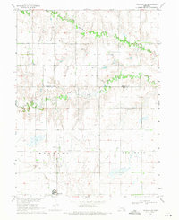 1969 Harvard NE1971 Print · USGSThe agricultural plains of Clay County are captured here in the late sixties, centered on the growing town of Harvard. Researchers can trace old family cemetery locations like Norwegian Cem or follow the path of a decommissioned Old Railroad Grade.2 unique versions available
 - 1969 Map of Harvard, 1971 Print
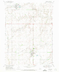 1969 Harvard1971 Print · USGSClay County at the end of the 1960s reveals a prairie landscape defined by the Burlington Northern rails and the legacy of the U S Naval Ammunition Depot (Abandoned). Trace family plots at Clay Center Cem or explore the grounds of the County Fairground.
End of results
Showing maps 1-2 of 2
Top cities near Harvard
- Aurora historical maps
- Sutton historical maps
- Clay Center historical maps
- Fairfield historical maps
- Giltner historical maps
- Glenvil historical maps
See more
Top neighborhoods of Harvard
Frequently asked questions
- What are the different types of historical maps available for Harvard?
- What is the oldest map of Harvard?
- Where can I purchase historical maps of Harvard for my home or office?
- Where can I download high-res historical maps of Harvard?
- Are there historical topographic maps available for Harvard?
- Is there historical aerial imagery available for Harvard?
- Where are historical maps of Harvard sourced from?