Old Maps of Mumper, Nebraska for Genealogy
Trace your family roots with 9 historic maps of Mumper. These high-res maps reveal old neighborhoods, homesites, landmarks, and streets — helping you uncover where your ancestors lived and how the area evolved over time.
- Explore historic neighborhoods: Identify where your relatives may have lived in the 1800s or 1900s.
- Compare maps over time: Trace the changes in streets, buildings, and landmarks for multi-generational research.
- Perfect for genealogy & ancestry research: Used by family historians and researchers to map out lineage and migration.
These maps are an incredible resource for exploring your personal connection to Mumper's past.
Mumper, NE maps
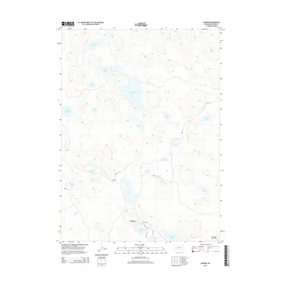
(9)- 1949 Map of Mumper
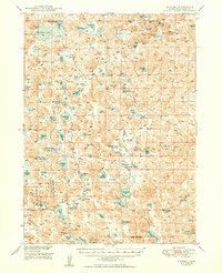 1949 Mumper1949 Print · USGSGarden County ranching and the Sandhills wetlands are on full display in this mid-century survey of the Nebraska Panhandle. Researchers can trace family-held lands like the Hills Ranch and Eldred Ranch or locate the historic School No 60.
 - 1954 Map of Scottsbluff, 1958 Print
 1954 Scottsbluff1958 Print · USGSThe Nebraska Panhandle's iconic landmarks and rail corridors are captured here during the mid-1950s. Researchers can trace the path of the North Platte River past Chimney Rock or locate the sprawling Sioux Ordnance Depot and the historic streets of Sidney.3 unique versions available
 - 1958 Map of Scottsbluff
 1958 Scottsbluff1958 Print · USGSThe Nebraska panhandle in the late fifties was a vital corridor of rail-and-river transport defined by the North Platte River and the Union Pacific. Genealogists and historians can trace rail stops like Reddus Station, explore the grounds of the Sioux Ordnance Depot, or locate landmarks like Chimney Rock.2 unique versions available
 - 1985 Map of Crescent Lake, 1986 Print
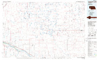 1985 Crescent Lake1986 Print · USGSThe Nebraska Sandhills come into sharp focus in the mid-1980s, centered on the wetlands of Garden County and the North Platte River valley. Researchers can trace the Union Pacific rail line through Broadwater and Lisco, or explore the many named basins within the Crescent Lake National Wildlife Refuge.2 unique versions available
 - 1986 Map of Mumper
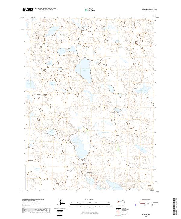
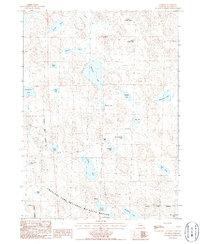 1986 Mumper1986 Print · USGSGarden County ranchlands and protected wetlands are shown in great detail during the mid-eighties. Researchers can trace the layout of the Crescent Lake National Wildlife Refuge and locate remote sites like the Four D Ranch and Mumper.
 - 2011 Map of Mumper, 2011 Print
 2011 Mumper2011 Print · USGSCovers Mumper, including Garden County, United States, and other nearby areas
 - 2014 Map of Mumper, 2014 Print
 2014 Mumper2014 Print · USGSCovers Mumper, including Garden County, United States, and other nearby areas
 - 2017 Map of Mumper, 2017 Print
 2017 Mumper2017 Print · USGSCovers Mumper, including Garden County, United States, and other nearby areas
 - 2021 Map of Mumper, 2021 Print
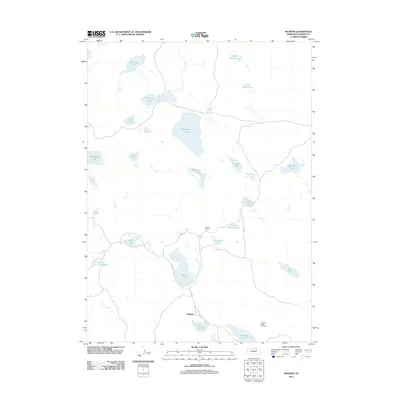
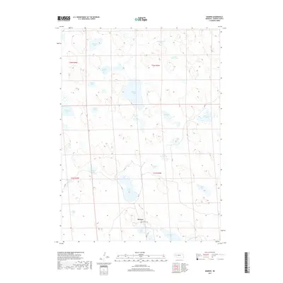
 2021 Mumper2021 Print · USGSGarden County ranching country is shown here in the early twenty-first century, centered on the community of Mumper. Researchers can trace old routes like RD 110 and find numerous named water bodies such as School Section Lake and the historic Tree Claim Lake.
End of results
Showing maps 1-9 of 9
Frequently asked questions
- What are the different types of historical maps available for Mumper?
- What is the oldest map of Mumper?
- Where can I purchase historical maps of Mumper for my home or office?
- Where can I download high-res historical maps of Mumper?
- Are there historical topographic maps available for Mumper?
- Is there historical aerial imagery available for Mumper?
- Where are historical maps of Mumper sourced from?